
 Simpson County, Mississippi
A Proud Part of the Mississippi GenWeb!
Contact Us:
State Coordinator: Jeff Kemp
County Coordinator: Gerry Westmoreland
If you have genealogy or history information to share, send it to Simpson County MSGenWeb.
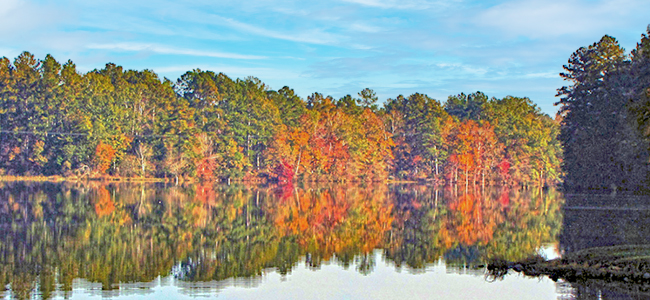
In the menu on the left there is a list of featured Simpson County rivers, lakes & streams that have photos and/or more information.
Below is a list of all rivers, lakes & streams in Simpson County.
Allen Creek
GPS: 31.901111, -89.962222
Banks Creek
GPS: 31.849444, -90.067500
Barron Creek
GPS: 31.987222, -90.205000
Beaver Branch
GPS: 31.868611, -89.846944
Big Creek
GPS: 31.851944, -90.071111
Big Creek
GPS: 31.971389, -90.201111
Big Creek
GPS: 31.874167, -89.693333
Boggan Branch
GPS: 31.877222, -89.899167
Boston Branch
GPS: 31.895556, -90.151389
Boston Branch
GPS: 31.922778, -90.148333
Buck Branch
GPS: 31.872778, -89.907500
Calhoun Branch
GPS: 31.983333, -90.105833
Campbell Creek
GPS: 31.999167, -89.870000
Cat Branch
GPS: 31.999444, -89.785278
Copper Branch
GPS: 31.874444, -90.007778
Cottonseed Branch
GPS: 31.851667, -90.115278
Crooked Creek
GPS: 31.641667, -90.057500
Crooked Creek
GPS: 32.021944, -89.801944
Crumps Creek
GPS: 31.745556, -90.118333
Dabbs Creek
GPS: 31.965556, -89.910278
Davis Branch
GPS: 31.956667, -90.167500
Dickerson Lake
GPS: 31.766389, -90.106944
Dry Creek
GPS: 31.790278, -90.120278
Dry Creek
GPS: 31.918611, -89.710278
Durden Branch
GPS: 31.860000, -90.066111
East Prong Silver Creek
GPS: 31.668333, -89.986667
Fletcher Branch
GPS: 32.040556, -89.785278
Garner Mill Creek
GPS: 31.960556, -89.655833
Goodwater Creek
GPS: 31.838333, -89.691667
Gowan Branch
GPS: 31.946389, -89.914722
Gwinville Branch
GPS: 31.738611, -89.916389
Hale Branch
GPS: 31.872778, -89.917778
Haley Creek
GPS: 32.030278, -90.247500
Harper Creek
GPS: 31.934722, -90.045278
Harrigan Branch
GPS: 31.915278, -89.903056
Hatchapaloo Creek
GPS: 31.905278, -89.576111
Haw Branch
GPS: 31.945833, -89.728333
Hunter Creek
GPS: 31.968333, -90.098889
Indian Creek
GPS: 31.994722, -89.876667
Jones Branch
GPS: 31.934722, -89.916389
Lee Branch
GPS: 31.864722, -90.033056
Lick Creek
GPS: 31.829167, -90.129167
Limestone Creek
GPS: 31.877222, -90.138333
Little Creek
GPS: 31.970833, -90.058333
Little Creek
GPS: 31.921389, -89.815556
Little Hatchapaloo Creek
GPS: 31.943333, -89.644722
Little Limestone Creek
GPS: 31.908611, -90.111944
Little Rocky Creek
GPS: 32.031389, -89.727500
Martin Lake
GPS: 31.758333, -90.116667
Massey Branch
GPS: 31.822500, -90.129444
McLauren Creek
GPS: 31.801389, -89.674167
Middle Prong Silver Creek
GPS: 31.753333, -89.970278
Mill Creek
GPS: 31.874444, -90.003611
Mill Creek
GPS: 32.026389, -89.977778
Moore Branch
GPS: 31.871111, -89.923611
Needham Creek
GPS: 31.956667, -89.941944
Okatoma Creek
GPS: 31.430556, -89.403333
Partman Branch
GPS: 31.744722, -89.895833
Peacock Lake
GPS: 31.918056, -89.864722
Pearl River
GPS: 30.179444, -89.526111
Phillips Lake
GPS: 32.035000, -89.901667
Pole Branch
GPS: 31.857500, -90.028056
Quinn Creek
GPS: 31.878889, -90.019722
Ready Branch
GPS: 31.928056, -90.106667
Rials Creek
GPS: 31.931667, -89.919444
Rocky Creek
GPS: 32.022500, -90.218333
Rocky Creek
GPS: 32.060278, -89.751389
Russell Branch
GPS: 31.923056, -89.720000
Sanders Creek
GPS: 31.911667, -89.944167
Sellers Creek
GPS: 31.976944, -89.893611
Shorter Creek
GPS: 31.947500, -90.031111
Simmons Branch
GPS: 31.910833, -89.868333
Simpson Legion Lake
GPS: 31.913611, -89.794444
Sinkler Branch
GPS: 31.809722, -90.086111
Skiffer Creek
GPS: 31.751667, -89.783333
Smith Branch
GPS: 31.902222, -89.942222
South Branch Vaughns Creek
GPS: 31.790000, -90.070000
Strong River
GPS: 31.849722, -90.135833
Tanyard Creek
GPS: 31.876667, -89.945278
Terrapin Creek
GPS: 31.957222, -89.860000
Thompson Branch
GPS: 31.938056, -89.636389
Uspoha Creek
GPS: 31.800000, -89.675556
Vaughns Creek
GPS: 31.780833, -90.108333
Walker Taylor Branch
GPS: 31.792500, -90.120556
Weeks Mill Creek
GPS: 31.955833, -90.190000
West Prong Silver Creek
GPS: 31.668056, -89.986667
Westville Creek
GPS: 31.895556, -89.972222
White Oak Creek
GPS: 32.083889, -89.720000
Wildcat Creek
GPS: 32.016944, -89.813611
Williams Creek
GPS: 31.871389, -90.028611
![]()
![]()