
 Lawrence County, Mississippi
A Proud Part of the Mississippi GenWeb!
Contact Us:
State Coordinator: Jeff Kemp
County Coordinator: Gerry Westmoreland
If you have church information to share, send it to Lawrence County MSGenWeb.
In the menu on the left there is a list of featured Lawrence County churches that have photos and/or more information.
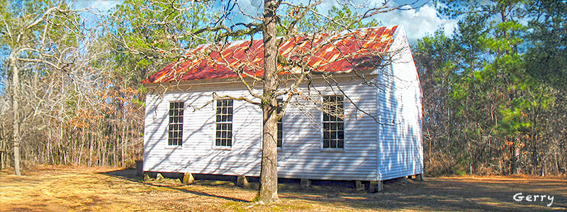
List of all Lawrence County Churches
A - M Churches
Antioch Church
GPS: 31.488333, -90.242500
Bahala Chapel
GPS: 31.697222, -90.197500
Ballards Chapel
GPS: 31.410833, -90.204444
Bethany Church
GPS: 31.422500, -90.194444
Bethel Church
GPS: 31.513056, -90.115833
Bethel Church
GPS: 31.690278, -89.977778
Calvary Baptist Church
GPS: 31.602367, -90.001311
Canaan Church
GPS: 31.600000, -90.013611
Carmel Church
GPS: 31.521667, -90.161111
Chinalee Church
GPS: 31.494722, -90.037222
Church of Christ
(now Monticello First Baptist Church)
Church of God
GPS: 31.525556, -90.039444
Church of God
GPS: 31.633611, -90.049167
Cole Church
GPS: 31.655000, -89.997500
Crooked Creek Church
GPS: 31.664444, -90.055556
Fair Hill Church
GPS: 31.690833, -90.185000
First Assembly of God Church
(now New Life Fellowship Full Gospel Church)
Forest Grove Church
GPS: 31.472500, -90.156111
Friendship Church
GPS: 31.620556, -90.123611
Hepzibah Church
GPS: 31.479444, -89.964444
Jayess Baptist Church
GPS: 31.362500, -90.205278
Lucas Tabernacle Church of Christ Holiness
GPS: 31.587308, -89.959038
Monticello Baptist Church
GPS: 31.553167, -90.103306
Monticello First Baptist Church
GPS: 31.560342, -90.121886
Monticello Methodist Protestant Church
GPS: 31.544818, -90.108002
Monticello United Methodist Church
GPS: 31.553438, -90.107863
Mount Pleasant Church
GPS: 31.607222, -90.192222
Mount Zion Church
GPS: 31.459167, -89.965278
Mount Zion Church
GPS: 31.693889, -90.239722
N - Z Churches
New Hope Baptist Church
GPS: 31.487778, -90.177778
New Life Fellowship Full Gospel Church
GPS: 31.603945, -90.008064
New Zion Church
GPS: 31.555278, -90.203056
North Pleasant Hill Church
GPS: 31.737222, -90.057222
Oak Grove Church
GPS: 31.470833, -90.207222
Oak Grove Missionary Baptist Church
GPS: 31.525278, -90.104167
Old Silver Creek Church
GPS: 31.551389, -90.010000
Pearl River Valley Church
GPS: 31.566667, -90.076944
Pin Oak Church
GPS: 31.582778, -90.035556
Pine Grove Church
GPS: 31.341389, -90.040833
Pleasant Grove Baptist Church
GPS: 31.640278, -90.073333
Powells Grove Church
GPS: 31.386944, -90.196944
Providence Church
GPS: 31.386111, -90.237778
Riverside Baptist Church
GPS: 31.564167, -90.112500
Rock Hill Church
GPS: 31.561111, -90.139444
Rocky Branch Baptist Church
GPS: 31.560000, -90.114722
Rose Hill Church
GPS: 31.526111, -89.988889
Saint James Church
GPS: 31.696944, -90.119722
Saint Paul Church
GPS: 31.615556, -90.000000
Salem Church
GPS: 31.371667, -90.097778
Sauls Valley Church
GPS: 31.385278, -90.056667
Shiloh Baptist Church
GPS: 31.637500, -90.215000
Silver Creek Methodist Church
GPS: 31.602297, -90.002144
Southgate Baptist Church
GPS: 31.540556, -90.115278
Spring Hill Church
GPS: 31.411667, -90.022778
Unity Church
GPS: 31.387222, -90.141111
unknown church
GPS: 31.552499, -90.107272
![]()
![]()