
 Jefferson County, Mississippi
A Proud Part of the Mississippi GenWeb!
Contact Us:
State Coordinator: Jeff Kemp
County Coordinator: Gerry Westmoreland
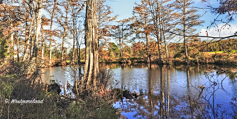
Bayou Pierre is one of the most historic and influential waterways in southwestern Mississippi. Flowing through Copiah, Hinds, Claiborne, and Jefferson counties before emptying into the Mississippi River near Port Gibson, the bayou has served as a natural highway, a settlement corridor, and a strategic military landmark for more than a thousand years. Even today, its winding course reflects the deep imprint of Native American, colonial, antebellum, and Civil War eras on the Mississippi landscape.
Indigenous Roots
Long before European arrival, the valley of Bayou Pierre was home to Indigenous peoples—most notably the Natchez, Choctaw, and other mound-building cultures of the Lower Mississippi. Archaeological evidence around Port Gibson and the lower bayou demonstrates:
Geography and Course
Bayou Pierre is a major tributary of the Mississippi River, stretching more than 60 miles from its headwaters in Copiah County through:
Early European Exploration and Settlement
The importance of Bayou Pierre in Mississippi history becomes particularly visible in the early 1700s.
In 1700, French explorers led by Pierre Le Moyne d’Iberville and his brother Bienville traveled up the Mississippi River and documented the mouth of Bayou Pierre. This was one of the earliest detailed European records of a waterway in the region.
Colonial Settlement
By the mid-1700s and early 1800s, the bayou valley became a popular route for settlers traveling inland from:
Antebellum and Agricultural Significance
Throughout the 1800s, Bayou Pierre provided:
Civil War Significance: The Battle of Port Gibson
Bayou Pierre played a major strategic role in the Vicksburg Campaign.
Battle of Port Gibson — May 1, 1863
After crossing the Mississippi River at Bruinsburg, Union General Ulysses S. Grant advanced northeast. Confederate forces made defensive stands along the natural chokepoints created by:
Result
Environmental and Natural Features
Today, Bayou Pierre remains largely rural and scenic. Its watershed provides habitat for:
Modern Bayou Pierre
While no longer used for major navigation or industry, Bayou Pierre continues to be important for:
Final Thoughts
Bayou Pierre is more than a stream—it is one of the oldest geographic and cultural corridors in Mississippi. From Indigenous settlements to French exploration, from antebellum agriculture to Civil War strategy, the bayou has been central to the history of the Natchez District and surrounding counties. Today, it remains one of Mississippi’s most scenic and historically rich waterways.
![]()
![]()