
 Jefferson County, Mississippi
A Proud Part of the Mississippi GenWeb!
Contact Us:
State Coordinator: Jeff Kemp
County Coordinator: Gerry Westmoreland
If you have church information to share, send it to Jefferson County MSGenWeb.
In the menu on the left there is a list of featured Jefferson County churches that have photos and/or more information.
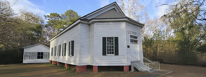
List of all Jefferson County Churches
Antioch Church
GPS: 31.764722, -90.774722
Bell Hill Church
GPS: 31.661667, -90.861667
Bethel Baptist Church
GPS: 31.433611, -89.699722
Bethesda Baptist Church
GPS: 31.675378, -90.930833
Bethlehem Church
GPS: 31.668889, -91.189444
Blue Hill Church
GPS: 31.763333, -90.868056
Brick Church
GPS: 31.808333, -90.998333
Buena Vista Church (historical)
GPS: 31.819444, -91.317500
Cane Ridge Methodist Church
GPS: 31.821368, -91.052171
Church Hill Church
GPS: 31.736389, -91.223611
Church of God
GPS: 31.786111, -90.971667
Clifton Church
GPS: 31.656944, -91.137222
Coles Creek Church
GPS: 31.651944, -91.170556
Coles Creek Church
GPS: 31.652222, -91.170833
Community Church
GPS: 31.690000, -91.101944
Crown Point Church
GPS: 31.649722, -90.964722
East Mount Olive Baptist Church
GPS: 31.782778, -90.968056
Ebenezer Church
GPS: 31.663611, -90.959444
Elmo Baptist Church
GPS: 31.620556, -90.938889
Ephesus Primitive Baptist Church
GPS: 31.731389, -90.945278
Fayette Baptist Church
GPS: 31.714217, -91.059332
Fellowship Church
GPS: 31.837778, -91.110833
Forest Grove Church
GPS: 31.736944, -91.101111
Fountain Chapel
GPS: 31.668056, -91.011111
Golden Mount Church
GPS: 31.786667, -91.209722
Gospel Church
GPS: 31.633889, -91.235556
Gravel Hill Church
GPS: 31.676111, -91.048333
Greenleaf Church
GPS: 31.717778, -91.028611
Greenleaf Church
GPS: 31.717222, -91.028333
Hickory Block Church
GPS: 31.674444, -90.815000
Jefferson Chapel
GPS: 31.679444, -91.234167
Jessamine Ridge Church
GPS: 31.787778, -91.047500
Laurel Hill Church
GPS: 31.849167, -91.164167
Linwood Church
GPS: 31.683611, -91.265833
Locust Grove Church
GPS: 31.741944, -91.062222
McNair Methodist Church
GPS: 31.727222, -91.230278
Mercy Seat Baptist Church
GPS: 31.727222, -91.230278
Mizpah Church
GPS: 31.752222, -90.969444
Morning Star Church
GPS: 31.847778, -91.022222
Mount Israel Church
GPS: 31.779167, -91.170278
Mount Moriah Church
GPS: 31.671667, -90.758333
Mount Zion Church
GPS: 31.703056, -91.175833
Mount Zion Church of God in Christ
GPS: 31.705556, -91.060556
Nebo Church
GPS: 31.640278, -90.847778
New Zion Church (historical)
GPS: 31.777222, -91.331111
Noland Hill ME Church (historical)
GPS: 31.802222, -91.133056
Old Mount Zion Church (historical)
GPS: 31.863333, -91.200556
Old Rodney Presbyterian Church
GPS: 31.862778, -91.199167
Piedmont Church
GPS: 31.638889, -90.778056
Pine Grove Church
GPS: 31.652222, -91.075833
Pine Grove Church
GPS: 31.709444, -91.001111
Poplar Hill AME Church
GPS: 31.763977, -91.092886
Providence Church
GPS: 31.833056, -90.901944
Red Lick Church
GPS: 31.808333, -90.998056
Richland Church
GPS: 31.757778, -91.209722
Rodney Baptist Church
GPS: 31.861389, -91.201111
Rodney Sacred Heart Catholic Church
GPS: 31.857778, -91.199167
Rose Hill Church
GPS: 31.830833, -90.970833
Rose Hill Church
GPS: 31.618056, -91.057222
Rose Hill Number 1 Church
GPS: 31.627500, -91.053333
Rose Hill Number 1 Church
GPS: 31.627222, -91.053333
Rose Hill Number 2 Church
GPS: 31.718611, -91.114444
Saint Anne's Catholic Church
GPS: 31.715071, -91.058280
Saint Anthonys Church
GPS: 31.741667, -91.021389
Saint James Church
GPS: 31.613889, -90.903333
Saint Johns Church
GPS: 31.814444, -90.868056
Saint Marks Church
GPS: 31.765278, -90.853056
Saint Peter Church
GPS: 31.773056, -91.218333
Salem Baptist Church (historical)
GPS: 31.628611, -91.124444
Salem Church
GPS: 31.628611, -91.130000
Salem Methodist Church (historical)
GPS: 31.763953, -90.784875
Second Union Church
GPS: 31.724167, -91.312500
Shady Grove Church
GPS: 31.719722, -90.942222
Smithland Church
GPS: 31.739722, -91.268611
Spring Hill Meetinghouse (historical)
GPS: 31.666944, -91.094722
Taylor Chapel Baptist Church
GPS: 31.745000, -91.146944
Travelers Rest Church
GPS: 31.832778, -91.193889
Union Church Baptist Church
GPS: 31.684073, -90.786883
Union Church Presbyterian Church
GPS: 31.683383, -90.790172
Unity Church
GPS: 31.799167, -90.873333
Wall Hill Church
GPS: 31.791667, -90.920278
Waterloo Church
GPS: 31.847222, -91.062500
Zion Church
GPS: 31.784444, -90.889167
![]()
![]()