|
Cemetery Name |
Known Location |
|
Airport Road
Cemetery |
|
|
Aldridge Graves |
|
|
Allen Cemetery |
Driving
Directions: (1) Travel Highway 25 South to Dennis,
Mississippi. Turn off Highway 4 West on County Road 1 and
travel 3 miles. The cemetery is located on the left side of
the road, 0.25 of a mile off of main road. (2) From Belmont,
Mississippi, travel south to Red Bud Road and turn right. At
the end of this road, turn right onto County Road 1. The
church and cemetery are located on the first road to the
right. Section 11, Range 9E, and Township 7S The tombstone
inscriptions were transcribed from the Society’s book,
Tishomingo County, Mississippi Cemeteries on October 2,
2005, by Helah Wilson and Janice Switcher. The cemetery was
re-surveyed and photographed by Bob and Cindy Whirley
Nelson, on May 31, 2006. |
|
Antioch Baptist Church & Cemetery |
The Antioch Church Cemetery was
surveyed by Mildred Aday, Shorty Bonds & Judy Walker on
January 2, 1996, for the Tishomingo County Historical &
Genealogical Society. This burial information was
transcribed from TCHGS’ book entitled Tishomingo County
Mississippi Cemeteries by Helah Wilson and Janice Switcher
on November 14, 2005. Location: From Burnsville travel
Highway 365 North to CR. 294. Turn right onto CR. 294.
Church and Cemetery are approximately 0.5 of a mile on the
right side of the road. |
|
Apostolic Church of Jesus Christ |
|
|
Archey's Graves |
Located near the Iuka Country
Club. There is no evidence of this cemetery today.
Information was received from older area residents during
our 1996-1997 cemetery survey. Transcribed by Helah Wilson &
Janice Switcher, October 3, 2005 |
|
Assembly of Christ Church & Cemetery |
Located in Dennis, Mississippi,
on Highway 4 near the Church. The Cemetery is located on the
left side of the road and is inside a fence. Transcribed by
Helah Wilson & Janice Switcher, October 3, 2005. |
|
Bailey Slave Cemetery |
From Iuka take Highway 25 South
to CR 957 (Rock Crusher Road). Take left on County Road 957
to County Road 163 (beside Magnolia Church). Turn right on
to County Road 163 (Gravel Road). Turn left at next road,
continue to gate. Walk 0.25 of a mile past gate (along top
of ridge). Cemetery is located near two large cedar trees
standing alone in a field on Gene Jourdan’s property.
Section 28, Range 11 and Township 4. Surveyed by Vickie
Durham, Austin Rast and Judy Walker, Date: 09-10-1996.
Transcribed by: Helah Wilson & Janice Switcher 10-10-2005
from Tishomingo County Cemetery Book published by Tishomingo
County Historical & Genealogical Society in 1996. |
|
Barnes/Johnson Cemetery |
Travel South on 365 about 5 miles to County Road 317. Turn
to the right on County Road 317 for a about 0.25 of a mile.
The cemetery is on the right hand side of the road in a Pine
Grove. Section 23, Range 9 & Township 2. Surveyed by: Shorty
Bonds, Date: 10-09-1996. Transcribed from Tishomingo County
Cemetery Book by: Helah Wilson and Janice Switcher on
October 20, 2005. |
|
Barnes/Lingelback Graves |
From Iuka travel 72 West
approximately 3 miles, trun left on CR 169. Hold to right at
Mt. Gilead Church. Continue this road approximately 2 miles
to Cr 177 to Left, travel this road approximately 1.5 miles.
Cemetery is about 0.5 of a mile into woods on right side of
road. Surveyed by: Shorty Bonds & Judy Walker Date:
11-20-1996. Transcribed from by: Helah Wilson & Janice
Switcher, 10-10-2005 |
|
Barnett/Bullard Cemetery |
From Highway 25, turn onto
Highway 30 West to County Road (Prentiss) 2229. Cemetery is
located just past an old home on the right, approximately ¼
miles into woods on right side of road. Surveyed by: Shorty
Bonds, Betty Marlar, Judy Walker & Mr. Arvid Wroten (Age 90)
Date: 02-18-1997. Transcribed from Tishomingo County
Cemetery Book by: Helah Wilson & Janice, Switcher on October
10, 2005. |
|
Beall Cemetery |
The Beall Cemetery in Tishomingo County, Mississippi, was
surveyed by Shorty Bonds on November 12, 1996, for the
Tishomingo County Historical & Genealogical Society. This
burial information was transcribed from TCHGS’ book entitled
Tishomingo County Mississippi Cemeteries by Helah Wilson and
Janice Switcher on October 3, 2005. Location: Travel Highway
25 South from Iuka, Mississippi. Turn onto Highway 30 West,
continue driving to County Road 2229 in Prentiss County. The
cemetery is located just past an old home on the right,
approximately 1/4 mile into the woods. |
|
Belmont Cemetery |
Directions: Travel Highway 25
south to the 4-way stop at Main Street in Belmont,
Mississippi. Turn right and drive ¼ of a mile to County Road
14. Turn right and drive 0.2 miles. The cemetery is located
on the left. The Belmont Cemetery was surveyed on September
28, 1996, by Ron Cooper, Vickie Durham, Marquita Greenaway,
and Wayne Provins for the Tishomingo County Historical &
Genealogical Society. Helah Wilson and Janice Switcher
transcribed the survey from the Society’s cemetery book on
October 28, 2005. |
|
Belmont Memorial Gardens |
The Belmont Memorial Garden was
surveyed on September 28, 1996, by Ron Cooper, Vickie
Durham, Marquita Greenaway, and Wayon P. Provins. The
finished survey was transcribed from the Tishomingo County
Historical & Genealogical Society’s cemetery book by Helah
Wilson and Janice Switcher on October 29, 2005. Location:
Take Highway 25 to Main Street in Belmont, Mississippi. Main
Street is at the 4-way-stop. Turn right and go 0.4 of a mile
to County Road 14. Turn right and go 0.2 of a mile. The
cemetery is on the left. |
|
Belmont Slave Cemetery |
Located on private property on
the old Mayhall Homeplace in Belmont. Sandstones marked
these graves. No names are known. Information from Alberta
Thomas, Jack Searcy and John Thomas Alexander. The number of
burials are also unknown. Transcribed by Cindy Whirley
Nelson. |
|
Belue Cemetery County |
The Belue Cemetery was surveyed
by Bob and Cindy Nelson first on June 6, 1996, and then a
second time on October 27, 2005. Driving Directions: The
Belue Cemetery is located on County Road 131 in Tishomingo
County, Mississippi. From Tishomingo, Mississippi, take
Highway 30 and drive 1.5 miles to Paden, Mississippi. Cross
the waterway bridge and turn on the first road to the left.
The cemetery is 1 mile ahead on the right. |
|
Bethany Presbyterian Church & Cemetery |
The Bethany
Presbyterian Church Cemetery was last surveyed on September
26 & 27, 2007 by Sara Carr Gresham, Martha Carr Bostick,
Jeanette Carr, and James Lawrence Carr. Driving Directions:
Traveling on Highway 25 South from Tishomingo, Mississippi,
turn right on County Road 112 (just before reaching the
Tishomingo State Park Road). Go about 1 mile and turn right
onto County Road 105. Travel 0.3 mile further. The paved
road ends at Bethany Presbyterian Church and its cemetery. |
|
Bethlehem Baptist Church & Cemetery
|
The following information was transcribed from Tishomingo
County, Mississippi Cemeteries by Helah Wilson and Janice
Switcher. The cemetery was then re-surveyed, updated, and
photographed on May 8, 2006, by Cindy Whirley Nelson and
Paulette Parker Whirley. There are many unmarked graves in
this cemetery, and due to a fallen tree, it was impossible
to photograph approximately eight stones. LOCATION: Travel
approximately 8.5 miles on Highway 25 South from Iuka,
Mississippi. Turn left on County Road 55, and travel 1.9
miles. The church and cemetery are located on the left side
of the road. |
|
Bishop Cemetery |
Driving Directions: Travel Highway 172 West (which is old
Highway 72) from Iuka, Mississippi, just past the entrance
to the Tishomingo County High School. This will be about 3.3
miles west from the 4-way stop at the Highway 172 and
Highway 25 bypass in Iuka, Mississippi. This family cemetery
is located on the left side of the road. |
|
Blackard
Cemetery |
|
|
Bloody Springs Road Graves |
The following burial
information was transcribed from TCHGS’ book entitled
Tishomingo County Mississippi Cemeteries by Helah Wilson and
Janice Switcher on November 3, 2005. Driving Directions:
These graves are located off of County Road 85 in Tishomingo
County, Mississippi, approximately 1 ½ miles south of the
Mingo community. |
Boggs Chapel Church & Cemetery
Large Cemetery large file |
Driving Directions: Travel Highway 25 South from Iuka,
Mississippi. After passing through the Midway Community,
turn right on County Road 55 and travel one mile to church
and cemetery. |
|
Bonds Cemetery |
The Bonds Cemetery information
was transcribed from TCHGS’ book entitled Tishomingo County
Mississippi Cemeteries by Helah Wilson and Janice Switcher
on November 3, 2005. |
|
Booker Graves |
These Booker gravesites were surveyed by Shorty Bonds,
Auston Rast, and Judy Walker on November 20, 1996. The
following burial information was transcribed from TCHGS’
book entitled Tishomingo County Mississippi Cemeteries by
Helah Wilson and Janice Switcher on November 3, 2005.
Driving Directions: From Tishomingo, Mississippi, travel
Highway 25 South to the Tishomingo State Park Road. Turn
left and keep traveling to the right at the next two
intersections. Just before driving under the Natchez Trace
Bridge, park your vehicle at an old, abandoned home place on
the left side of the road. The graves are located at the
edge of a wooded area in a field, approximately 300 yards
northeast of the old home place. |
|
Boothe Cemetery |
The Boothe Cemetery was
surveyed by Hassell Holder on September 30, 1996, for the
Tishomingo County Historical & Genealogical Society (TCHGS).
The following burial information was transcribed from TCHGS’
book entitled Tishomingo County Mississippi Cemeteries by
Helah Wilson and Janice Switcher on November 3, 2005.
Driving Directions: From Burnsville, Mississippi, travel on
Highway 365 south to County Road 345. The cemetery is
located on private property; it about 0.3 of a mile off the
highway. A chain link fence is erected around the graves. |
|
Broadwick Cemetery |
The information on the Broaddick Cemetery was transcribed
from TCHGS’ book entitled Tishomingo County Mississippi
Cemeteries by Helah Wilson and Janice Switcher on November
3, 2005. Location: This cemetery is located two miles south
of Jackson Camp, near Bay Springs. |
|
Brumley Cemetery |
The Brumley Cemetery was
originally located near Highway 4 on Gin Branch near
Mackey’s Creek in Prentiss County, Mississippi. It was
relocated to Tishomingo County to the Dennis Memorial
Gardens (adjoining Lindsey Cemetery) by U.S. Army Corps of
Engineers during the construction of the Tennessee–Tombigbee
Waterway. (Tract No. 100C). |
|
Burcham Cemetery |
The Burcham gravesite was
surveyed by Hassell Holder on August 5, 1996, for the
Tishomingo County Historical & Genealogical Society (TCHGS).
The following burial information was transcribed from TCHGS’
book entitled Tishomingo County Mississippi Cemeteries by
Helah Wilson and Janice Switcher on November 3, 2005.
Driving Directions: Travel Highway 365 South from
Burnsville, Mississippi, to the Holts Spur community. Turn
west onto the first road north of the railroad bridge on
Highway 365. Drive past the brick house and continue on to
the wooden framed house. Walk behind this house to a pond
levee in the hollow. The graves are at the far end of the
pond levee. The property is owned by Ray Davis’s daughter. |
|
Burgess Cemetery |
|
|
Burgess Cemetery (Black)
|
Tishomingo County’s Burgess
Cemetery for African American individuals is located on
County Road 78 at the Itawamba County, Mississippi, line.
From Belmont, Mississippi, travel 2.9 miles to County Road
78 at the Itawamba County line. Turn left; the cemetery is
on the left inside a private fence. It is located
immediately past the first Burgess Cemetery. African
American Burgess Cemetery 1 Tishomingo County, Mississippi.
The survey of this African American cemetery was transcribed
from TCHGS’ book entitled Tishomingo County, Mississippi
Cemeteries by Helah Wilson and Janice Switcher on November
3, 2005. The cemetery was re-surveyed and photographed by
Bob and Cindy Nelson on March 5, 2006, and May 31, 2006. |
|
Burgess Cemetery (White) |
Tishomingo County’s Burgess
Cemetery is located on County Road 78 at the Itawamba
County, Mississippi, line. From Belmont, Mississippi, travel
2.9 miles to County Road 78 at the Itawamba County line.
Turn left; the cemetery is on the left. According to the
1996 surveyors, there were 23 marked but unreadable graves.
There may possibly be more graves. The survey was
transcribed from TCHGS’ book entitled Tishomingo County,
Mississippi Cemeteries by Helah Wilson and Janice Switcher
on November 3, 2005. The cemetery Burgess Cemetery 1
Tishomingo County, Mississippi was re-surveyed and
photographed by Bob and Cindy Nelson on March 5, 2006, and
May 31, 2006. |
|
Burgess Creek Church & Cemetery
|
Driving Directions: The Burgess
Creek Cemetery is located on County Road 126 in Tishomingo
County, Mississippi. Drive Highway 25 South from Iuka,
Mississippi, to the Midway Community. At Midway, turn right
on County Road 364 at the Spring Hill Methodist Church.
Drive three miles to County Road 961, and turn left. Drive
two miles to County Road 126, and turn right. The Burgess
Creek Baptist Church and its adjacent cemetery are located
on the right side of the road between the Holcut and Paden
communities. |
|
Burns Cemetery |
The Burns Cemetery was surveyed
on May 21, 1996, by Opal Crabb, Marquita Greenaway, and
Cindy Nelson. The information was later transcribed from
TCHGS’ book entitled Tishomingo County Mississippi
Cemeteries by Helah Wilson and Janice Switcher on November
3, 2005. Location: Travel Highway 30 East to County Road 85
to the Mingo Community. The cemetery is located on the left
side of the road in a field. Township 5 Range 11 and Section
21. |
|
Burnsville Cemetery (Black & White)
|
Surveyed and photographed in
1996 by Tammy Cohn. This burial information was transcribed
from TCHGS’ book entitled Tishomingo County Mississippi
Cemeteries by Helah Wilson and Janice Switcher.
Driving Directions: Turn right by Joe’s Mini Mart on Highway
365. |
Burnsville Cemetery
(Black) |
The Burnsville Black Cemetery
was surveyed by Tammy Cohn on May 19, 1996, for the
Tishomingo County Historical & Genealogical Society. This
burial information was transcribed from TCHGS’ book entitled
Tishomingo County Mississippi Cemeteries by Helah Wilson and
Janice Switcher on October 15, 2005. Location: Turn right by
Joe`s Mini Mart on Highway 365. |
|
Burnsville Isolated Cemetery |
The Burnsville Isolated
Cemetery was surveyed by Shorty Bonds January 10, 1997, for
the Tishomingo County Historical & Genealogical Society.
This burial information was transcribed from TCHGS’ book
entitled Tishomingo County Mississippi Cemeteries by Helah
Wilson and Janice Switcher on November 27, 2005. |
|
Burnt Mills Confederate Soldier Grave |
The information concerning the
Burnt Mills Confederate Soldiers’ graves was transcribed
from TCHGS’ book entitled Tishomingo County Mississippi
Cemeteries by Helah Wilson and Janice Switcher on November
3, 2005. Location: These graves are located in the Paden
area near old Highway 30. |
|
Byram Cemetery |
The Byram Cemetery was surveyed
by Ron Cooper and Waylon Provins for the Tishomingo County
Historical & Genealogical Society. Helah Wilson and Janice
Switcher transcribed their survey from the Society’s
cemetery book on November 4, 2005. Location: Travel Highway
25 south to Belmont, Mississippi. Turn left at old Highway
25 across from the Belmont City Park. Drive 0.9 of a mile to
County Road 16. Turn right on County Road 16 and drive to
County Road 57. Turn left onto County Road 57 and drive 0.2
of a mile. Turn onto the dirt road on the right; the
cemetery is approximately 500 yards down the dirt road. |
|
Callicott Cemetery |
The Callicot Cemetery was
surveyed by Cindy (Whirley) Nelson on May 22, 1996 and
October 1, 2005, for the Tishomingo County Historical &
Genealogical Society. This burial information was
transcribed from TCHGS’ book entitled Tishomingo County
Mississippi Cemeteries by Cindy Nelson in 2005. |
|
Camp Ground Cemetery |
The Camp Ground Cemetery was
surveyed by Eddie & Valerie Carson & Blake Dawson in August
1996, for the Tishomingo County Historical & Genealogical
Society. This burial information was transcribed from TCHGS’
book entitled Tishomingo County Mississippi Cemeteries by
Helah Wilson and Janice Switcher on November 4, 2005.
Location: Highway 25 north; right on Coleman Park Road
County Road 989. Turn right on County Road 256; Cemetery is
0.25 of a mile on right. |
|
Carpenter Cemetery
|
Information on the burials in
the Carpenter Cemetery was transcribed from TCHGS’ book
entitled Tishomingo County, Mississippi Cemeteries and
re-surveyed by Helah Wilson and Janice Switcher on November
13, 2005. Cindy Whirley Nelson photographed the tombstones
on May 29, 2006, and updated the information below.
Location: Travel Highway 72 West from Iuka, Mississippi, to
County Road 961. Turn left before crossing the waterway. The
cemetery is located on the left side of the road. |
|
Carpenter-Nunley Cemetery |
Driving Directions: The
Carpenter/Nunley Cemetery, according to some folks, is also
known as the Selman Cemetery. From Highway 25 at the Midway
Community, take County Road 957 (Rock Crusher Road) for 5.6
miles to County Road 201. Turn left and go 0.8 of a mile to
the cemetery which is located on the left side of the road.
This cemetery can also be accessed from Highway 72 via
Airport Road. The Carpenter/Nunley Cemetery was re-surveyed
and photographed on July 9, 2006, by Bob Nelson and Cindy
Whirley Nelson. According to notes from the previous survey
in 1996, there are other Carpenter burials in this cemetery.
Approximately 25 unreadable and/or unmarked graves were
noted during the 1996 survey. Overgrowth of weeds and
infestation of ticks did not allow the researchers to locate
all the unmarked graves during the 2006
survey. |
|
Carr Cemetery |
The Carr Cemetery information
was given byMrs. Flora Carr Walker & Mrs. Irene Barnes for
the Tishomingo County Historical & Genealogical Society.
This burial information was transcribed from TCHGS’ book
entitled Tishomingo County Mississippi Cemeteries by Helah
Wilson and Janice Switcher on November 3, 2005. |
|
Carter’s Branch Cemetery |
This burial information was
transcribed from TCHGS’ book entitled Tishomingo County
Mississippi Cemeteries by Helah Wilson and Janice Switcher.
The cemetery was surveyed and photographed on May 30, 2006,
by Bob and Cindy Whirley Nelson. Onnie and Viola Alexander
assisted with information from a previous survey. LOCATION:
Carter’s Branch Cemetery is located in the northeast section
of Tishomingo County near the Alabama State line. Travel
Highway 30 east 2.3 miles; then turn left on County Road
958. Travel 3.1 miles; turn right on County Road 110, go 1.1
miles, then turn left on County Road 95. The cemetery is
located 0.7 of a mile. |
|
Chapel Hill Church & Cemetery
|
Location: From Burnsville,
Mississippi, travel Highway 72 West to County Road 944. Turn
right on County Road 944. Immediately past the Chapel Hill
Methodist Church, turn right on County Road 294. The
cemetery is located on the left side of the road. Helah
Wilson and Janice Switcher re-surveyed the Chapel Hill
Cemetery on November 5, 2005, and prepared the following
transcription. The tombstones were photographed by Cindy
Whirley Nelson on April 27, 2006. |
|
Clausel Hill (2)
Prentiss |
See .pdf file by clicking cemetery name |
|
Clement Cemetery |
Directions: From new River Trace subdivision
in the Eastport Community, access road at River Trace
(currently not paved), park on side of road 100 feet past
access road. Walk on right side into woods about 100 feet to
broken tombstones. Only one grave is partially visible and
the others are face down and he didn't want to disturb them. |
|
Cochran/Moser Cemetery |
Once known as the Moser
Cemetery, the Cochran-Moser Cemetery was surveyed by Shorty
Bonds on November 4, 1996, for the Tishomingo County
Historical & Genealogical Society (TCHGS). The following
burial information was transcribed from TCHGS’ book entitled
Tishomingo County Mississippi Cemeteries by Helah Wilson and
Janice Switcher on November 3, 2005. Driving Directions:
From the four-way intersection at Iuka, Mississippi, travel
approximately 6 miles on Highway 25 North to County Road
982. Turn left, drive 0.1 of a mile to County Road 274, and
drive 1 mile to County Road 283. Turn left on County Road
283; drive approximately 0.4 of mile. The cemetery is on the
left side of the road, approximately 200 yards into a cow
pasture. Section 28, Range 10 and Township 2. |
|
Coman Cemetery |
The Coman Cemetery was for the
Tishomingo County Historical & Genealogical Society (TCHGS).
The following burial information was transcribed from TCHGS’
book entitled Tishomingo County Mississippi Cemeteries by
Helah Wilson and Janice Switcher on November 3, 2005.
Driving Directions: From Iuka, Mississippi, travel Highway
25 South to a motel located near the Highway 72 and 25
overpass. The motel was originally the Days Inn, but now it
is currently called the Sunset Motel. Turn right and drive
past the motel for about 0.1 of a mile. Turn left onto an
old drive on the left, and the cemetery is located down the
hill on the south side. This is an African American
cemetery. Unfortunately, there are no markers at this
gravesite. |
|
Condra Cemetery |
This site is west of Midway on
county road 364 approximately ¼ mile off road behind R.M.
Barnett, 253 Highway 364. The site is actually owned by
Braxton Hester, 243 CR 364. Drive up in R.M. Barnett
driveway to side of carport and tell him you are related to
him, who you are and where you want to go. The Old Sunken
Road to Jourdan Spring will be visible on your right. Go
north and cross fence, pass old log barn, bear right to
coordinates. |
|
Cotton Springs Cemetery |
Driving Directions: The Cotton
Springs Cemetery is located on Highway 4 in Dennis,
Mississippi, adjacent to the Cotton Springs Boating Ramp; SE
¼ , Section 25, Township 6 Range 9. This information was
transcribed from the Society’s book, Tishomingo County,
Mississippi Cemeteries, by Helah Wilson and Janice Switcher.
The cemetery was surveyed and photographed on February 26,
2006, by Bob and Cindy Nelson. |
|
Cripple Deer Cemetery |
The Cripple Deer Cemetery was
surveyed by Bobby and Cindy Nelson and Austin Rast in 2003,
for the Tishomingo County Historical & Genealogical Society.
This burial information was transcribed from TCHGS’ book
entitled Tishomingo County Mississippi Cemeteries by Cindy
Nelson in 2003.
Location: Travel Highway 25 north of Tishomingo to Highway
30 and turn right. Go approximately three miles to County
Road 958 and turn left at Carter’s Branch Baptist Church. Go
to the end of this road (approximately 0.50 of a mile). From
the gate, walk 0.25 of a mile toward the tree line at the
far end of the pasture. The cemetery is on the ridge on the
right side of the road in the edge of the woods. A four
wheel drive is needed and this is located on private
property. |
Curtis Cemetery
(aka Billings or Bullard) |
The Curtis Cemetery was
surveyed by Shorty Bonds in 1996, for the Tishomingo County
Historical & Genealogical Society. This burial information
was transcribed from TCHGS’ book entitled Tishomingo County
Mississippi Cemeteries by Helah Wilson and Janice Switcher
on November 3, 2005. |
|
Dean Cemetery
- Paden |
Location: There are no signs on the highway to indicate
where the Dean Cemetery is located. Travel to the Crows Neck
Environmental Education Park in Paden, Mississippi. Upon
reaching the curve at Crows Neck, travel straight ahead to
encounter the cemetery. The Dean Cemetery in Paden was
surveyed on October 30, 2005, by Helah Wilson, Janice
Switcher, and Kathie Keele. |
|
Dean Graves |
The Dean graves were surveyed by Chuck Dean, Bobby Walker,
and Judy Walker on September 29, 1996, for the Tishomingo
County Historical & Genealogical Society. This burial
information was transcribed from TCHGS’ book entitled
Tishomingo County Mississippi Cemeteries by Helah Wilson and
Janice Switcher on November 4, 2005. Driving Directions:
From Highway 25 north, take County Road 231 (Harmony Road),
and then take County Road 226 to the left. Drive 0.1 of a
mile past the County Road 22 sign and turn left onto a field
road. Walk past a gate 0.75 of a mile to Hazard Cemetery in
woods. These graves are approximately 250 feet west of
Hazard Cemetery on the next ridge. The cemetery is located
on private property. |
|
Dean Slave Cemetery |
This cemetery was surveyed on
November 17, 1996, for the Tishomingo County Historical &
Genealogical Society by Shorty Bonds and Judy Walker.
LOCATION: Drive Highway 25 north of Iuka, Mississippi, for
approximately 1.5 miles to the first railroad overpass. Turn
onto field road to left. The cemetery is just off the
highway on the right. |
|
Dennis Soldier Grave |
|
|
Eastport Baptist Cemetery |
This cemetery was surveyed by
Shorty Bonds and Judy Walker on December 15, 1996, for the
Tishomingo County Historical & Genealogical Society (TCHGS).
It was transcribed from TCHGS’ book entitled Tishomingo
County Mississippi Cemeteries by Helah Wilson and Janice
Switcher on November 15, 2005. Location: Travel Eastport
Road in Iuka, Mississippi. This cemetery is located 5.6
miles down Eastport Road. The cemetery is on the left side
of the road behind the church. |
|
Eastport (Black & White) Cemetery |
Driving Directions: From Iuka, Mississippi, take Eastport
Road (also known as County Road 956) and drive approximately
8.5 miles. Turn left onto County Road 256, drive
approximately 0.3 mile to an intersection at the top of a
hill. Turn left. A metal gate is located approximately 50
feet further on the right. Walk past gate approximately 400
yards on field road. The cemetery is in a wooded area on
both sides of the road. It is located on property owned by
the Ludlum family. |
|
Eastport: Soldier |
|
|
Eastport (Unnamed) Cemetery |
This unnamed cemetery was
surveyed in 1996 by Shorty Bonds, Leon Johnson, and Judy
Walker. It was transcribed from TCHGS’ book entitled
Tishomingo County Mississippi Cemeteries by Cindy Whirley
Nelson. Location: From Iuka, Mississippi, travel Eastport
Road (County Road 956) for approximately nine miles past
County Road 263. Go left approximately 0.1 of a mile. The
cemetery is on the left side of the road about 100 yards
into the woods, just past the Billy Murrah home. There are
approximately six unmarked graves. |
|
Epps - White Cemetery |
The Epps-White Cemetery was
surveyed by Ron Cooper and Waylon Provins in
1996, for the Tishomingo County Historical & Genealogical
Society. This burial information was transcribed from TCHGS’
book entitled Tishomingo County Mississippi Cemeteries by
Helah Wilson and Janice Switcher on November 4, 2005.
Location: Travel Highway 25 to MS 366 east, go 1.7 miles to
County Road 68 (Bear Creek Road). Turn left and go 0.5 of a
mile to cemetery on right, approximately 100 yards through
field into the woods. |
|
Fairview -
(Prentiss County) |
|
|
Fairview Community Cemetery |
The Fairview Community Church
Cemetery was surveyed by Bob and Cindy Nelson on April 30,
1996, for the Tishomingo County Historical & Genealogical
Society. This burial information was transcribed from TCHGS’
book entitled Tishomingo County Mississippi Cemeteries by
Helah Wilson and Janice Switcher in October 2005. Location:
Travel Highway 25 North from Iuka to Crossroads. Turn left
on County Road 356 and go 1.6 miles to cemetery. Cemetery is
on both sides of the road. |
|
Fairview Holy Church
Cemetery |
The cemetery was surveyed on
September 24, 1996, by Joe Credille and Bob and Cindy
Nelson. This burial information was transcribed from TCHGS’
book entitled Tishomingo County Mississippi Cemeteries by
Helah Wilson and Janice Switcher on November 4, 2005.
Location: From Belmont, Mississippi, turn right off of
Highway 25 South at the first four-way stop. This is
Washington Street (or Moore’s Mill Road). The church and
cemetery are located on the right side of the road. |
|
Family Cemetery |
This burial information was
transcribed from TCHGS’ book entitled Tishomingo County
Mississippi Cemeteries by Helah Wilson and Janice Switcher
on November 4, 2005. Location: This cemetery is located on
Highway 172 west of Iuka, Mississippi, behind the home of
Laura Frederick. Section 22, Township 3, Range 10. |
|
First United Pentecostal Church |
|
|
Fisher Clemmons Cemetery |
This African
American Cemetery was surveyed on November 9, 1996, for the
Tishomingo County Historical & Genealogical Society by Eddie
Carson, Dezzie Deck, and Cindy Nelson. Location: At Belmont,
Mississippi, turn right at the first four-way stop onto
Washington Street. Travel down Washington Street for 0.6
miles. The cemetery is located on the left side of the road
on the Old Trentham Estate. This cemetery contains African
American burials. |
|
Forked Oak -
(Prentiss County) |
The Forked Oak Baptist Church Cemetery was initially
surveyed and compiled by Alicia South (typist), Virginia
Felkner South, L. A. South, and William M. South in November
1996. In November 2005, the information was transcribed from
TCHGS’ book entitled Tishomingo County Mississippi
Cemeteries by Helah Wilson and Janice Switcher. Members of
the Prentiss County Cemetery Committee re-surveyed and
updated the cemetery in May 2006. The cemetery was then
re-surveyed and photographed on August 12, 2006, and August
17, 2006, by Cindy Whirley Nelson and RaNae Smith Vaughn.
Location: From Highway 30 at the Burton Community, travel
north on Highway 365. Turn right on County Road 2312 at the
sign displaying “Forked Oak Baptist Church.” The cemetery,
adjacent to the church, is about 0.25 of a mile from the
highway. Although the Forked Oak Cemetery is located in
Prentiss County, Mississippi, it is less than one mile from
the Tishomingo County line; many residents of Tishomingo
County are buried in the cemetery. |
|
Forrest Grove Church & Cemetery |
|
|
Friendship Church & Cemetery |
Driving Directions: Travel
Highway 25 North from the City of Tishomingo, Mississippi.
Turn onto Highway 30 and travel west to Paden, Mississippi.
At Paden, turn right, cross railroad tracks, take the second
road to the right, and travel approximately 1.5 miles to the
church and cemetery. The cemetery was surveyed and
photographed by Bob Nelson, Cindy Whirley Nelson, and
Paulette Whirley on May 9, 2006. |
|
Gardner Homeplace Graves |
The Gardner
Homeplace Cemetery was surveyed by Nelda McRae in 1996. The
information was later transcribed from TCHGS’ book entitled
Tishomingo County Mississippi Cemeteries by Helah Wilson and
Janice Switcher on November 4, 2005. Location: Located in
the Highland Community near Tishomingo State Park.
Sandstones once marked graves on property of Maudie Gardner. |
|
Goode Cemetery |
The Goode Cemetery was surveyed
by Shorty Bonds and Judy Walker on November 17, 1996, for
the Tishomingo County Historical & Genealogical Society.
This burial information was transcribed from TCHGS’ book
entitled Tishomingo County Mississippi Cemeteries by Helah
Wilson and Janice Switcher on November 4, 2005. Location:
Section 28, Township 3W and Range 11 No evidence of these
graves was found. Reportedly a house sits on the site. Our
source tells us it contained approximately 15 graves marked
with stones. Mr. Nathan Goode, some Goode family members and
members of the Mack Minor family are reportedly buried here. |
|
Golden Confederate Soldier |
This burial information was
transcribed from TCHGS’ book entitled Tishomingo County
Mississippi Cemeteries by Helah Wilson and Janice Switcher
on November 3, 2005. The Confederate Soldier grave is
located between Golden and Red Bay in the Franchertown area
on the old homeplace of Rev. Hardin Patterson. According to
Richard Patterson, he was shot and killed by Union Soldiers
trying to escape. The property was owned by Mr. Sparks in
1996. |
|
Gortney Cemetery |
The Gortney Cemetery was
surveyed by Bob & Cindy Nelson on June 9, 1996, for the
Tishomingo County Historical & Genealogical Society. This
burial information was transcribed from TCHGS’ book entitled
Tishomingo County Mississippi Cemeteries by Helah Wilson and
Janice Switcher on November 4, 2005. Location: From Highway
25 at Midway, take County Road 366 West to County Road 961.
Turn left and go 0.8 of a mile to waterway access road (on
right). Park and walk past two concrete drainage ditches on
the right. Continue on to a group of Willow Trees on left.
Cemetery is directly behind the trees and is surrounded by a
concrete fence. The distance from the gate to the cemetery
is about 0.25 of a mile. |
|
Goyer Cemetery |
The Goyer Cemetery was surveyed
by Cindy Whirley Nelson on March 7, 2007, for the Tishomingo
County Historical & Genealogical Society. All marked graves
in this cemetery are situated together in the same location.
The cemetery is large in size and other burials are believed
to be here. Dr. Thomas Goyer reported in past years that
there were in fact “many graves here.” Additional facts were
obtained from Laura Frederick, Mr. Barnett, Mary Sue Wright,
and the cemetery book published by Biggs and Barnes. Travel
Directions: From Iuka, Mississippi, travel west on County
Road 180. The cemetery is on the left side of the road in
Township 3, Range 10, Section 26. |
|
Grimes Cemetery |
The Grimes Graves were surveyed
by Shorty Bonds onMarch 23, 1997, for the Tishomingo County
Historical & Genealogical Society. This burial information
was transcribed from TCHGS’ book entitled Tishomingo County
Mississippi Cemeteries by Helah Wilson and Janice Switcher
on November 4, 2005. Location: South of Burnsville, MS. Go
Highway 365, turn left on County Road 205. Cemetery is off
the road 30 yards to the right of driveway of house #204,
owned by D. Calton. |
|
Grissham & Woodruff Graves |
The Grissham and Woodruff
Graves were surveyed byBob and Cindy Nelson on June 16,
1996, for the Tishomingo County Historical & Genealogical
Society. This burial information was transcribed from TCHGS’
book entitled Tishomingo County Mississippi Cemeteries by
Helah Wilson and Janice Switcher on November 4, 2005.
Location: From Paden, travel County Road 131 past the Wilson
home place. Go about 300 yards, turn right and continue by
foot toward the Tombigbee Waterway. Go to marker S6, turn
left and climb embankment. This cemetery is located on the
East of Berm Road. |
|
Grissom Chapel Church & Cemetery |
The Grissom Chapel Cemetery was
surveyed by Helah Wilson & Janice Switcher on November 13,
2005, for the Tishomingo County Historical & Genealogical
Society. Location: Travel Highway 365 north to Burnsville to
County Road 298 turn left. Cemetery is approximately 2 miles
on the right. |
|
Hale Cemetery |
The Hale Cemetery
was surveyed by Bonnie Johnson on November 7, 1996, for the
Tishomingo County Historical & Genealogical Society. This
burial information was transcribed from TCHGS’ book entitled
Tishomingo County Mississippi Cemeteries by Helah Wilson and
Janice Switcher on November 4, 2005. Location: This cemetery
is located across the road from the Claude Carr home place
near Belmont, Mississippi. |
|
Harmony
United Methodist Church Cemetery (Black & White) |
Driving Directions: From Iuka,
Mississippi, travel Highway 25 North to County Road 231
(Harmony Road), turn left and travel approximately 2.7
miles, turn left on County Road 229, and travel
approximately 0.1 miles to the cemetery. Surveyed by Betty
Marlar and Jan Anglin, December 1, 2005. Note: Both black
and white individuals are buried in this cemetery. |
|
Harmony Hill Church & Cemetery |
Survey information was
initially transcribed from TCHGS’ book entitled Tishomingo
County Mississippi Cemeteries by Helah Wilson and Janice
Switcher on November 5, 2005. The cemetery was re-surveyed
and photographed on August 12, 2006, by Cindy Whirley Nelson
and RaNae Vaughn. LOCATION: Travel Highway 72 west from
Iuka, Mississippi, to Highway 365 at Burnsville,
Mississippi. Travel north on Highway 365. After crossing the
first bridge, turn left and the church will be on the right
side of the road. The cemetery is surrounded by a chain link
fence. |
|
Harvey and Southward Graves |
The Harvey Grave
was surveyed by Betty Marlar and JudyWalker on September 23,
1996, for the Tishomingo County Historical & Genealogical
Society. This burial information was transcribed from TCHGS’
book entitled Tishomingo County Mississippi Cemeteries by
Helah Wilson and Janice Switcher on November 4, 2005.
Location: Go to Highway 25 north from Tishomingo to Highway
30 east, go approximately five miles. This grave is located
near Ed Wares’ home on the right side of the road. |
|
Hazard Cemetery |
The Hazard Cemetery was
surveyed by Chuck Dean, Bobby Walker and Judy Walker on
September 29, 1996, for the Tishomingo County Historical &
Genealogical Society. This burial information was
transcribed from TCHGS’ book entitled Tishomingo County
Mississippi Cemeteries by Helah Wilson and Janice Switcher
on November 4, 2005. Location: Go Highway 25 north to
Harmony Road (County Road 231), and then take County Road
226 to the left. Go 0.1 of a mile past the County Road 227
sign, then turn left at first field road. Walk 0.75 of a
mile past gate to southwest corner of Ellis Murrah’s
property. This cemetery is in the woods at the end of a
field. This is a black cemetery. |
|
Hebron Church & Cemetery |
The Hebron Cemetery was
surveyed by Helah Wilson and Janice Switcher on November 6,
2005. The survey was updated and photographed by Bob and
Cindy Nelson on May 29, 2006. Location: From Burnsville,
Mississippi, turn right off of Highway 72 onto County Road
169 (Sardis Church Road). The cemetery is located at the
intersection of County Road 1969 and County Road 1963. |
|
Helton & McCoy Cemetery |
Located on County Road 169, was surveyed by Helah Wilson and
Janice Switcher on November 6, 2005. It is located on James
Lester Adams’ property, west of the Mt. Gilead Community. |
|
Hendrix Family Cemetery |
The Hendrix Family Cemetery
information was provided by Mary Sue Wright in 1996, for the
Tishomingo County Historical & Genealogical Society. This
burial information was transcribed
from TCHGS’ book entitled Tishomingo County Mississippi
Cemeteries by Helah Wilson and
Janice Switcher on November 4, 2005.
Location: From Highway 30 travel Highway 365 north to
Fairview Church sign on right.
Cemetery is on small hill north of Fairview Cemetery on
property of Harold Hendrix.
Cemetery is enclosed by a fence. |
|
Higdon Cemetery |
|
|
Highland Cemetery |
The Highland Cemetery was
surveyed by Nelda McRae on May 14, 1996, for the Tishomingo
County Historical & Genealogical Society. This burial
information was transcribed from TCHGS’ book entitled
Tishomingo County Mississippi Cemeteries by Helah Wilson and
Janice Switcher on November 17, 2005.
Location: Traveling south from Iuka, on Highway 25, at the
intersection of Highway 25 and 30, turn left onto Highway 30
east. Travel for 1.6 miles; turn right on County Road 106.
At the next road, County Road 87, turn right and travel 1.9
miles. Cemetery is on the left. |
|
Hill Cemetery - Belmont |
|
|
Hill Cemetery - Burnsville |
|
|
Hodges Cemetery |
The Hodges Cemetery was
surveyed by Cindy Nelson & Bobby Wimbish on November 5,
1996, for the Tishomingo County Historical & Genealogical
Society. This burial information was transcribed from TCHGS’
book entitled Tishomingo County Mississippi Cemeteries by
Helah Wilson and Janice Switcher on November 27, 2005.
LOCATION: Travel Highway 25 south past CR 364 at Midway.
Turn right on CR 144; go to where the road forks
approximately (800 yards). The cemetery is located straight
ahead in the cow pasture on the old Blissit Farm which is
now owned by Paul Morris. This cemetery has a fence around
it. |
|
Holder Cemetery |
Driving Directions: From U.S.
Highway 72 at Burnsville, Mississippi, turn south on Highway
365. Travel approximately 2.5 miles to the cemetery. It is
located on the west side of the road. This cemetery was
surveyed by Helah Wilson and Janice Switcher on August 19,
2005. It was re/surveyed by Cindy Nelson on October 21,
2005. |
|
Holder and Whitfield Cemetery |
See .pdf file by clicking cemetery name |
|
Hopewell/Whiteside (Black) Cemetery |
The Hopewell/Whiteside Cemetery
was surveyed by Shorty Bonds & JudyWalker on November 17,
1996, for the Tishomingo County Historical & Genealogical
Society. This burial information was transcribed from TCHGS’
book entitled Tishomingo County Mississippi Cemeteries by
Helah Wilson and Janice Switcher on November 10, 2005.
Location: Travel County Road 241 north of Iuka approximately
2 miles to Pickens Branch Bridge. Cemetery is in a wooded
area on hill to right of road. |
|
Hubbard
Cemetery - Coleman |
The Hubbard Cemetery was
surveyed by Shorty Bonds in 1996, for the Tishomingo County
Historical & Genealogical Society. This burial information
was transcribed from TCHGS’ book entitled Tishomingo County
Mississippi Cemeteries by Helah Wilson and Janice Switcher
on November 10, 2005. Location: Turn left off Coleman Park
road onto County Road 329 go about one mile. |
|
Hubbard Cemetery - Midway |
The Hubbard Cemetery was
surveyed by Shorty Bonds, Austin Rast and Judy Walker in
1996, for the Tishomingo County Historical & Genealogical
Society. This burial information was transcribed from TCHGS’
book entitled Tishomingo County Mississippi Cemeteries by
Helah Wilson and Janice Switcher on November 10, 2005.
LOCATION: Once located in the Midway area. Several monuments
marked graves of Hubbard family. No evidence found of these
monuments or graves. |
Hubbard Salem Cemetery
Photographs |
The Hubbard Salem Cemetery was
surveyed by Shorty Bonds, Eddie & Valerie Carson and Drew
Dawson on May 20, 1996, for the Tishomingo County Historical
& Genealogical Society. This burial information was
transcribed from TCHGS’ book entitled Tishomingo County
Mississippi Cemeteries by Helah Wilson and Janice Switcher
on November 14, 2005. Location: Take Highway 25 north to
County Road 989 (Coleman Park Road) one mile past Coleman
park road intersection. Church and cemetery are on the left. |
|
Indian Creek/Peel Cemetery |
The Indian Creek–Peel Cemetery
was surveyed by Shorty Bonds, Leon Johnson, and Judy Walker
on October 31, 1996, for the Tishomingo County Historical &
Genealogical Society (TCHGS). It was transcribed from TCHGS’
cemetery book by Helah Wilson and Janice Switcher on
November 27, 2005. Driving Directions: Take Eastport Road
(County Road 956) and drive approximately 2.5 miles to
County Road 261. Take County Road 261 approximately 2.5
miles to the intersection of County Road 256. Turn right on
County Road 256; go approximately 200 yards up the hill. The
cemetery is just off the road on the left in the woods. |
|
Iuka Memorial Gardens |
The Iuka Memorial Gardens was
surveyed byMarquita Greenaway in 1996, for the Tishomingo
County Historical & Genealogical Society. This burial
information was transcribed from TCHGS’ book entitled
Tishomingo County Mississippi Cemeteries by Helah Wilson and
Janice Switcher on November 27, 2005. Location: Located on
Memorial Lane in Iuka, MS |
|
Jackson Camp Baptist Church & Cemetery |
Survey information was
initially transcribed from TCHGS’ book entitled Tishomingo
County Mississippi Cemeteries by Helah Wilson and Janice
Switcher on November 30, 2005. The cemetery was re-surveyed
and photographed on May 8, 2006, by Bob Nelson, Cindy
Whirley Nelson, and Paulette Whirley. Location: From Highway
25 at Tishomingo, Mississippi, take Highway 30 West. Cross
the waterway bridge at Paden, Mississippi, and take the
first paved road on the left (County Road 113). Travel to
the fork of the road, turn right, and stay on the paved
road. At the four-way junction, continue straight on County
Road 121. The church and cemetery are adjacent to the water
and about 3.3 miles from Highway 30. |
|
Jackson Ridge Cemetery |
The Jackson Ridge Cemetery was
surveyed by Shorty Bonds and JudyWalker on November 17,
1996, for the Tishomingo County Historical & Genealogical
Society. This burial information was transcribed from TCHGS’
book entitled Tishomingo County Mississippi Cemeteries by
Helah Wilson and Janice Switcher on November 27, 2005.
Location: Travel Snowdown Road (CR 246) approximately three
miles. Pickwick Lake will be visible from high hill, at the
foot of this hill take small gravel road on the right. Gate
is across gravel road. Walk past the gate approximately 400
yards, the cemetery is on the second ridge. Cemetery is
located on the right side of the road on top of ridge near
the lake. The front of the cemetery has a monument which is
cited below. |
|
Joel Cemetery |
|
|
Johnson Cemetery |
The Johnson Cemetery was
surveyed by Vicky Durham in September 1996 for the
Tishomingo County Historical & Genealogical Society (TCHGS).
It was transcribed from TCHGS’ cemetery book by Helah Wilson
and Janice Switcher on November 27, 2005. Driving
Directions: From Iuka, Mississippi, travel Highway 172 east.
Turn left by the National Guard Armory, cross the railroad
tracks, and turn right onto Eastport Street. Drive to County
Road 247, turn right, and travel another 0.1 miles. The
Unity Baptist Church is on the left side of the road.
Section 28, Range 11, Township 3. |
|
Johnson Cemetery |
The Johnson Cemetery was
surveyed by Billy Johnson in 1996 for the Tishomingo County
Historical & Genealogical Society (TCHGS). It was
transcribed from TCHGS’ cemetery book by Helah Wilson and
Janice Switcher on November 27, 2005. Driving Directions:
Turn right at Hubbard Salem Church and travel to old Walter
Jones’ home place (abandoned inside state buffer zone). Turn
right at the second road on the right and drive to the
river’s edge. Township 1S, Range 10E, Section 13. |
|
Jourdan Grave Holcut (destroyed by Tombigbee Waterway)
|
|
|
Jourdan Hill Cemetery |
This burial information was
transcribed from TCHGS’ book entitled Tishomingo County
Mississippi Cemeteries by Helah Wilson and Janice Switcher
on November 27, 2005. Location: Located on the left side of
Highway 4, west to Dennis, MS, 0.75 of a mile Sandstone
Markers |
|
Kirk/Scruggs Cemetery |
The Kirk–Scruggs Cemetery was
surveyed by Bobby and Marquita Greenaway on December 3,
1996, for the Tishomingo County Historical & Genealogical
Society (TCHGS). It was transcribed from TCHGS’ cemetery
book by Helah Wilson and Janice Switcher on November 27,
2005. Driving Directions: From Iuka, Mississippi, travel
Highway 72 west to County Road 180, also known as Mt. Gilead
Road. Turn left onto County Road 230. The cemetery is
located on the left approximately 25 yards from County Road
180. |
|
Lambs Chapel Cemetery |
The Lambs Chapel Cemetery was
surveyed by Helah Wilson and Janice Switcher on April 10,
2005, for the Tishomingo County Historical & Genealogical
Society. Location: Go Highway 365 north from Burnsville then
turn left onto County Road 298. Pass Shady Grove Church,
turn right onto County Road 369 (this road changes to
gravel). Go 2.5 miles to T-intersection, turn right onto
County Road 373. Go approximately 0.5 of a mile, take first
road on right. Go 0.3 of a mile, take right at intersection.
Cemetery is at the end of this road. |
|
Leander Grave Seeking Information |
|
|
Liberty (Black) Cemetery |
Location: Travel Highway 25
South from Iuka, Mississippi, to the Midway Community in
Tishomingo County. At Midway, turn left off of Highway 25
South onto County Road 957 (Rock Crusher Road) and travel
seven miles. Shortly after crossing the Alabama state line,
Liberty Road will be on the right side of the road. The
cemetery is directly across this junction on the left. This
African American cemetery was photographed and surveyed by
Bob and Cindy Whirley Nelson on April 5, 2006. |
|
Lindsey Cemetery |
The Lindsey
Cemetery was surveyed by Burnett Bryant, Eddie Carson, Sadie
Gist, Nelda McRae, Cindy Nelson & Brenda Whitfield on August
17, 1996, for the Tishomingo County Historical &
Genealogical Society. This burial information was
transcribed from TCHGS’ book entitled Tishomingo County
Mississippi Cemeteries by Helah Wilson and Janice Switcher
on November 27, 2005.
Location: Approximately 0.25 of a mile south of Dennis, on
the west side of the
Highway. |
|
Lindsey, Mary - Grave |
The Mary Lindsey Grave Site was
surveyed by J. T. Lindsey and Judy Walker in 1996 for the
Tishomingo County Historical & Genealogical Society (TCHGS).
It was transcribed from TCHGS’ cemetery book by Helah Wilson
and Janice Switcher on November 27, 2005. Driving
Directions: From Dennis, Mississippi, take County Road 17 to
County Road 29. Travel approximately 0.5 of a mile further. |
|
Little Flock Community Cemetery |
The Little Flock Community
Cemetery was surveyed by Hassell Holder in 1996 and
resurveyed by Helah Wilson and Janice Switcher on November
5, 2005, for the Tishomingo County Historical & Genealogical
Society. This burial information was transcribed from TCHGS’
book entitled Tishomingo County Mississippi Cemeteries by
Helah Wilson and Janice Switcher in November 2005. Location:
From Burnsville, travel Hwy. 365 South to CR 265; turn right
onto County Road 265 (at Berea Church of Christ). Go
approximately 0.2 miles. Church and Cemetery are on the
left. |
|
Long Cemetery |
|
|
Lynch Grave |
The Lynch Cemetery was surveyed
by Bob and Cindy Whirley Nelson on June 6, 1996, for the
Tishomingo County Historical & Genealogical Society (TCHGS).
Driving Directions: From Burnsville, Mississippi, take
Highway 365 South to Highway 364. Turn left, and then take
the second road to the left. Go 1.5 miles further. The
cemetery is located on the right side of the road on old Sid
Wade’s place. |
|
Mackeys Creek Cemetery |
The Mackey’s Creek
Cemetery was surveyed by Bobby and Marquita Greenaway on May
9, 1996, for the Tishomingo County Historical & Genealogical
Society. This burial information was transcribed from TCHGS’
book entitled Tishomingo County Mississippi Cemeteries by
Helah Wilson and Janice Switcher on November 27, 2005.
Location: From Highway 4 turn on Prentiss County Road 3501,
go to County Road 3571 and turn right (Mackey’s Creek sign).
Go to the fork in the road and stay to the right. Continue
on to the end of the road, and turn right. When this road
ends, cemetery will be on the left. This cemetery is about 6
miles from the Mackey’s creek sign. |
|
Magnolia Missionary Baptist Church & Cemetery |
The Magnolia
Missionary Baptist Church Cemetery was surveyed by Cindy
Whirly Nelson on May 14, 1996 and November 1, 2005, for the
Tishomingo County Historical & Genealogical Society. This
burial information was transcribed from TCHGS’ book entitled
Tishomingo County Mississippi Cemeteries by Cindy Nelson in
2005. Location: The Magnolia Cemetery is located on County
Road 957 in Tishomingo County, Mississippi. Traveling
Highway 25 from Iuka or Tishomingo, take County Road 957 at
Midway for approximately six miles. |
|
Mahan Graves |
|
|
Maness (or Manus) Cemetery |
The Maness Cemetery was
surveyed in 1996, for the Tishomingo County Historical &
Genealogical Society. This burial information was
transcribed from TCHGS’ book entitled Tishomingo County
Mississippi Cemeteries by Helah Wilson and Janice Switcher
on November 27, 2005. |
|
Mann Cemetery
|
|
|
Marlar-White aka White Cemetery
|
The Marlar-White Cemetery
information was provided by Mary Sue Wright in 1996, for the
Tishomingo County Historical & Genealogical Society. This
burial information was transcribed from TCHGS’ book entitled
Tishomingo County Mississippi Cemeteries by Cindy Nelson in
2005. Location: Follow directions to Harmony Hill Baptist
Church Cemetery in Burnsville. This grave is located on the
White Property. |
|
Martin Cemetery |
This cemetery was surveyed and
photographed by Bob and Cindy Whirley Nelson on March 5,
2006. Location: From Tishomingo, Mississippi, travel south
on Highway 25 South to County Road 112. Turn right and
travel to County Road 107. The cemetery is located at the
end of the road. |
Marton Graves
Relocated to Friendship
|
The Marton Graves was provided
by U.S. Corps. of Engineers in 1996, for the Tishomingo
County Historical & Genealogical Society. This burial
information was transcribed from TCHGS’ book entitled
Tishomingo County Mississippi Cemeteries by Helah Wilson and
Janice Switcher on November 27, 2005. Location: Relocated
from Divide Cut Portion of Tennessee - Tombigbee Waterway to
Friendship Cemetery in Paden, MS |
|
Massey Cemetery |
The Massey Cemetery was
surveyed by Shorty Bonds, Nell Graves & Judy Walker on
January 2, 1996, for the Tishomingo County Historical &
Genealogical Society. This burial information was
transcribed from TCHGS’ book entitled Tishomingo County
Mississippi Cemeteries by Helah Wilson and Janice Switcher
on November 27, 2005. Location: From Iuka take 172(Old
Highway 72) west to CR 982. Turn right on 982, go 3.4 miles
to CR. 236, turn right. Cemetery is approximately 0.6 of a
mile down the road near Gaines
Residence in the Turnpike area. |
|
McCulloch Grave |
The McCullough Grave was
surveyed by Marquita Greenaway in 1996, for the Tishomingo
County Historical & Genealogical Society. This burial
information was transcribed from TCHGS’ book entitled
Tishomingo County Mississippi Cemeteries by Helah Wilson and
Janice Switcher on November 27, 2005. Location: Located
north of Iuka on private property |
|
McMasters Grave |
The McMasters Grave information
was provided by Bertha P. Arnold on October 10, 1996, for
the Tishomingo County Historical & Genealogical Society.
This burial information was transcribed from TCHGS’ book
entitled Tishomingo County Mississippi Cemeteries by Helah
Wilson and Janice Switcher on November 27, 2005. Location:
Take Highway 25 north to Iuka to Highway 365 north. Go
approximately 0.4 of a mile, turn left onto CR306, go
straight through the intersection. The grave is located on
the property of Mrs. Bertha P. Arnold, formerly owned by Mr.
McMasters |
|
McNeil Graves |
The McNeil Graves were surveyed
by Bob and Cindy Nelson on September 22, 1996, for the
Tishomingo County Historical & Genealogical Society. This
burial information was transcribed from TCHGS’ book entitled
Tishomingo County Mississippi Cemeteries by Helah Wilson and
Janice Switcher on November 27, 2005. Location: At Highway
25 & 72 junction in Iuka travel west on Highway 72 for 1
mile. Turn left on CR 180(across from Victoria Inn). Go to
the forks of the road, turn left onto Cr 169. Go to the
end of this road. Park at the gate and walk about 300 yards
down a paved road to the end of the woods line. Walk north
about 250 yards; turn up bank to the east. Graves are
situated on a red clay bank on an old logging road. Signs of
an old home place are obviously nearby. |
|
McRae Cemetery |
The McRae Cemetery was surveyed
by Bob Nelson, Cindy Nelson and Sarah Hammett on May 25,
1996, for the Tishomingo County Historical & Genealogical
Society. This burial information was transcribed from TCHGS’
book entitled Tishomingo County Mississippi Cemeteries by
Helah Wilson and Janice Switcher on November 27, 2005.
Location: From Belmont go out Moore’s Mill road to CR 6,
turn left go 0.7 of a mile to Cr 17 turn left and go 0.4 of
a mile to CR 19, go 0.2 of a mile turn left on CR 961.
Cemetery is located off Rock Creek Road across from Haskell
Spark’s home |
|
Midway Community Cemetery |
Driving Directions: Travel
Highway 25 south past County Road 364 in the Midway
community. The cemetery is just ahead on the left in a
wooded area. Members of this community acknowledge that
there were numerous graves here many years ago. However, the
surveyors were unable to locate any visible graves at this
time. The cemetery was once recorded as Hodges Cemetery. SW
¼, Section 24, Township 4 and Range 10. |
|
Mitchell (Beachum) Cemetery
|
The Mitchell Cemetery was
surveyed by Joe Credille, Bob Nelson and Cindy Nelson on
September 25, 1996, for the Tishomingo County Historical &
Genealogical Society. This burial information was
transcribed from TCHGS’ book entitled Tishomingo County
Mississippi Cemeteries by Helah Wilson and Janice Switcher
on November 27, 2005. Location: Travel highway 4 west to CR
1, continue 2.5 to 3 miles to CR 864 and on another 200
yards to a gravel road on the left. Cemetery is about 1.5
miles on the right in a wooded area. |
|
Moody Hill Cemetery
|
|
|
Moore Cemetery - Pickwick |
This burial information was
transcribed from TCHGS’ book entitled Tishomingo County
Mississippi Cemeteries by Helah Wilson and Janice Switcher
on November 29, 2005. Location: Located on property of
Chicago/ St. Louis and N.O. Railroad in Tishomingo Co. There
are eight graves. Two graves from this cemetery were
relocated and the others to remain, at the request of the
relatives. |
|
Moore Cemetery -
Belmont |
See .pdf file by clicking cemetery name |
|
Moore's Chapel Cemetery |
The Moore’s Chapel
Cemetery was surveyed by Bobby and Marquita Greenaway on
April 23, 1996, for the Tishomingo County Historical &
Genealogical Society. This burial information was
transcribed from TCHGS’ book entitled Tishomingo County
Mississippi Cemeteries by Helah Wilson and Janice Switcher
on November 27, 2005. Location: Take Highway 25 north
approximately 0.6 of a mile from four way stop in Iuka to CR
232. Turn left on Cr 231 cemetery is on the right. |
|
Mosley Grave |
The Mosley Grave was surveyed
by Shorty Bonds and JudyWalker in 1996, for the Tishomingo
County Historical & Genealogical Society. This burial
information was transcribed from TCHGS’ book entitled
Tishomingo County Mississippi Cemeteries. Location: North of
Iuka on property once owned by W.B. Young. Current property
owner states grave is no longer to be found. |
Mt. Evergreen/Toe Nail Cemetery
(Old Mt. Pleasant)
|
The Mt. Evergreen Cemetery was
surveyed by Eddie Carson in 1996, for the Tishomingo County
Historical & Genealogical Society. This burial information
was transcribed from TCHGS’ book entitled Tishomingo County
Mississippi Cemeteries by Helah Wilson and Janice Switcher
on November 29, 2005. Location: From Iuka travel Eastport
Street (CR956) to intersection of Corner Store. Stay left on
CR956 to approximately 2.5 miles. Cemetery is on the right. |
|
Mount Gilead Cemetery |
The Mount Gilead Cemetery was
surveyed by Betty Marlar and JudyWalker on August 15, 1996
and by Helah Wilson and Janice Switcher on October 16, 2005,
for the Tishomingo County Historical & Genealogical Society.
This burial information was transcribed from TCHGS’ book
entitled Tishomingo County Mississippi Cemeteries by Helah
Wilson and Janice Switcher on October 16, 2005. Location:
Mount Gilead Cemetery is in three sections. The most
southwestern section was once known as Old Hebron Cemetery.
Travel Highway 72 west from Iuka to County Road 180 (Mount
Gilead Road).
Turn left onto County Road 180, go approximately 1.75 miles.
Church and Cemetery are on right. |
|
Mount Joy Cemetery |
The Mt. Joy Cemetery was
surveyed by Vicky Durham in 1996 and by Helah Wilson and
Janice Switcher on October 20, 2005, for the Tishomingo
County Historical & Genealogical Society. Location: Travel
Highway 72 east from Iuka to County Road 992 (Airport Road).
Turn right, go one mile, church and cemetery are on the left
side of the road. |
|
Mount Moriah Church & Cemetery |
Driving Directions: Travel
Highway 172 (old Highway 72) west from the 4-way stop sign
at the Highway 25 and Highway 172 intersection. Drive west
1.7 miles away from Iuka, Mississippi. The church and
cemetery are located on the right side of the road. The Mt.
Moriah Baptist Church Cemetery was surveyed by Sadie Gist
and Mary S. Wright. The following information was originally
transcribed on November 29, 2005, by Helah Wilson and Janice
Switcher from TCHGS’ book entitled, Tishomingo County,
Mississippi Cemeteries. The cemetery was re-surveyed and
photographed on May 22, 2006, by Meghan White and Betty
Marlar. |
|
Mount Pleasant Cemetery |
The Mt. Pleasant Cemetery was
surveyed by Eddie Carson, Sadie Gist, Nelda McRae and Cindy
Nelson on August 17, 1996, for the Tishomingo County
Historical & Genealogical Society. This burial information
was transcribed from TCHGS’ book entitled Tishomingo County
Mississippi Cemeteries by Helah Wilson and Janice Switcher
on November 29, 2005. Location: Take Highway 25 south of
Tishomingo CR 112. Turn right-cemetery and church are
approximately two miles down the road. |
|
Mulberry Cemetery |
|
|
Myrick
Cemetery |
|
|
New Bethel Cemetery |
Transcribed by W. D. Holcomb
and Lionel Stegall , September 2008
Directions: Travel Hwy 25 south from Belmont and turn right
on county road 864. Travel 864 for 1 mile and turn right
onto county road 8. Travel CR 8 for 2.2 miles and cemetery
is on left at intersection of CR 8 and CR 6. Cemetery is
located beside the New Bethel Missionary Baptist Church.
Photograph |
|
New Lebanon Church & Cemetery |
|
|
New Liberty Baptist Church & Cemetery
|
|
|
New Prospect Church & Cemetery |
The New
Prospect Cemetery was surveyed by Brenda Whitfield in 1996,
for the Tishomingo County Historical & Genealogical Society.
This burial information was transcribed from TCHGS’ book
entitled Tishomingo County Mississippi Cemeteries by Helah
Wilson and Janice Switcher on November 29, 2005.
Location: Approximately three miles south of Iuka,
Mississippi (Highway 25) directly behind New Prospect
Church. |
|
New Salem Cemetery |
The New Salem Baptist Church Cemetery was
surveyed byMary Sue Wright in 1996, for the Tishomingo
County Historical & Genealogical Society. This burial
information was transcribed from TCHGS’ book entitled
Tishomingo County Mississippi Cemeteries by Helah Wilson and
Janice Switcher on December 2, 2005. Location: Go
approximately five miles north on Highway 25 to CR 982, 0.1
of a mile to CR 274, about five miles to CR 283, turns left
about 0.3 of a mile. The Church & Cemetery are on the left. |
|
North Bethel Church Cemetery |
The North Bethel Methodist Cemetery was
surveyed by Bobby and Marquita Greenaway on April 23, 1996,
for the Tishomingo County Historical & Genealogical Society.
This burial information was transcribed from TCHGS’ book
entitled Tishomingo County Mississippi Cemeteries by
Helah Wilson and Janice Switcher on December 6, 2005.
Location: Travel Highway 25 north for approximately 4.5
miles, turn left at the Central School, Take second road to
right and follow road to church sign. |
|
North Crossroads Cemetery |
The North Crossroads Community
Church Cemetery was surveyed by Shorty Bonds on November 11,
1996, for the Tishomingo County Historical & Genealogical
Society. This burial information was transcribed from TCHGS’
book entitled Tishomingo County Mississippi Cemeteries by
Helah Wilson and Janice Switcher on December 6, 2005.
Location: Traveling north on Highway 25, take the first left
hand road (County Road 333) past the waterway bridge for 0.5
of a mile to the four way stop sign. Turn left at 0.2 of a
mile. Turn on the first road on the left. Church is at top
of hill. |
|
Nunley Cemetery |
The Nunley Cemetery was
surveyed byMarquita Greenaway and Cindy Nelson on April 1,
1997, for the Tishomingo County Historical & Genealogical
Society. This burial information was transcribed from TCHGS’
book entitled Tishomingo County Mississippi Cemeteries by
Helah Wilson and Janice Switcher on December 5, 2005.
Location: From Iuka, travel 72 East to Airport Road (County
Road 995). Turn right onto 995, then travel approximately
1.75 miles to County Road 201, turn left onto County Road
201 and travel approximately 0.5 of a mile. The cemetery is
on the left side of road at edge of field. It is enclosed by
a wire fence. |
|
Oak Grove Cemetery |
The Oak Grove Cemetery was surveyed by
Mildred Aday, Monica Aday, Shorty Bonds, Burnett Bryant,
Eddie Carson, Drew Dawson, Marquita Greenaway and Judy
Walker in February 1997, for the Tishomingo County
Historical & Genealogical Society. This burial information
was transcribed from TCHGS’ book entitled Tishomingo
County Mississippi Cemeteries by Helah Wilson and Janice
Switcher on November 14, 2005. Location: Highway 25 north
inside Iuka City Limits. |
|
Old Abandoned Cemetery– Pickwick |
|
|
Old Bethel Church & Cemetery |
The Old Bethel Cemetery was surveyed by
Sarah Hammett, Cindy Nelson, Louise Northcutt and Mary
Roberts on September 11, 1996, for the Tishomingo County
Historical & Genealogical Society. This burial information
was transcribed from TCHGS’ book entitled Tishomingo County
Mississippi Cemeteries by Helah Wilson and Janice Switcher
on January 1, 2006. Location: From Belmont city limits
travel Highway 25 south for 5.4 miles to Cr 864. Turn right;
go to the first paved road on the left (approximately 1.3
miles from first turn off). Turn left on CR 10, and travel
0.8 of a mile to church and cemetery. |
|
Old Eastport Cemetery |
Location: Take
Eastport Road (County Road 956) approximately 8.5 miles to
County Road 263. Turn left onto County Road 263, drive
approximately 0.6 of a mile, and turn right onto County Road
267; continue driving for approximately one mile. The woods
on the right were previously cut over. Walk through this
area and into deep woods. The cemetery is located
approximately 75 feet into the woods on the left side of an
old road. Township 2, Range 11, Section 22. |
|
Old Holder Cemetery |
Location: Travel east on Highway 72 from
Burnsville. Cross Tombigbee Waterway, take first road to
right which is County Road 961.Go south three miles to
cemetery which is on the left. |
|
Old Johnson Cemetery
|
The Old Johnson Cemetery was surveyed byMary
Sue Wright on August 30, 1996, for the Tishomingo County
Historical & Genealogical Society. This burial information
was transcribed from TCHGS’ book entitled Tishomingo
County Mississippi Cemeteries by Helah Wilson and Janice
Switcher on December 4, 2005. Location: From Burton on
Highway 30 east of Booneville, first paved left (not 365).
Go to first gravel road turn left, go about two miles, turn
on old logging road to left. Walk 1.75 miles to cemetery
road to the cemetery. |
|
Old Mackey's Creek Cemetery |
|
|
Old Old Bethel Cemetery |
Location: Go Red Bud Road three miles to
County Road 10, turn left, go 0.1 of a mile. Take old dirt
road on left to forks of road, brae right for about 300
yard. Cemetery is on an embankment on the right side of the
road. The cemetery is about one mile off the main road and
is located near the old A.C. Hammett family home. |
|
Old Pickwick Lake |
Location: Once located on property owned by
Ben Busby, No evidence found of this cemetery in 1937, when
lake was formed. Area residents confirmed its existence.
Cited from James L. Douthat`s book. |
|
Old Pleasant Hill Cemetery |
Location: Going north on Highway 25 take CR
324 in front of the old Four Star Building Supply Co., Go
about 1 mile. The Church & Cemetery are on the left. Section
3, Township 2, Range 10 |
|
Old Union Church & Cemetery |
|
|
Owens Cemetery |
Location: The
Owens Cemetery is located on Old Flag Tree Road southwest of
Paden. |
|
Pace Cemetery |
Location: The Pace Cemetery is located
between old Highway and new Highway 25, three miles north of
Tishomingo. Turn right onto County Road 125. Cemetery is 0.4
of a mile on the left past a locked gate on private
property. |
|
Paine Cemetery |
Location: From
Iuka, take County Road 956 (Eastport Road) approximately 8.5
miles to County Road 263. Turn left and go approximately 0.6
of a mile to intersection of County Road 401 and take a
left. Go to guard house, cemetery is approximately 500 yards
on right side of the road. |
|
Paden
Cemetery |
|
|
Palestine Baptist Community Church & Cemetery |
The original survey information
was transcribed from TCHGS’ book entitled Tishomingo County,
Mississippi Cemeteries by Helah Wilson and Janice Switcher.
The cemetery was photographed by Cindy Whirley Nelson and
Paulette Whirley in April 2006. |
|
Paradise Cemetery |
Location: Highway
30 East, CR 958, Church is 1.5 miles on the right. |
|
Parsons Cemetery |
The information below was
transcribed from TCHGS’ book entitled, Tishomingo County
Mississippi Cemeteries, by Helah Wilson and Janice Switcher
on December 1, 2005. The cemetery was surveyed and
photographed on May 29, 2006, by Cindy Whirley Nelson.
LOCATION: From Iuka, Mississippi, travel Highway 72 West to
County Road 180. Continue left at Mt. Gilead Church onto
County Road 169. Continue traveling on the same road which
changes into County Road 133. At the dead end of the road,
there will be a waterway gate. The cemetery is located in an
wooded area at the end of the road on the right. |
|
Patrick Cemetery |
Location: From Iuka travel Highway 25
north to .T.V.A. Access Road (CR 321) turn right, Church and
cemetery are approximately 0.2 of a mile down this road,
visible on right. |
|
Phifer Cemetery |
The Phifer
Cemetery was surveyed by Brenda Whitfield in 1996. The
information was later transcribed from TCHGS’ book entitled
Tishomingo County Mississippi Cemeteries by Helah Wilson &
Janice Switcher on December 1, 2005. Location: Located near
Seaborn Gentles on hill from Palestine Cemetery. |
|
Phillips also known as the Natchez Trace Cemetery |
|
|
Pickens Cemetery |
The Pickens Cemetery was
surveyed by Shorty Bonds on October 10, 1996. The
information was later transcribed from TCHGS’ book entitled
Tishomingo County Mississippi Cemeteries by Helah Wilson &
Janice Switcher on December 1, 2005. Location: From Iuka
four-way stop on Highway 25 & 172 go about 2 miles north on
Highway 25. At the crossing Pickens Branch take the second
driveway to the left where Mrs. Noel Kirk lives. Cemetery is
on the hill to the south behind the little white house. |
|
Piney Grove Cemetery - (or
Allen Line) |
Location: This cemetery is located about 3
miles north of Bay Springs near New Bethel Church of Christ.
Take Highway 30 W. (CR 864). Turn on 3501, and go
approximately 2.5 miles. Turn left on 3550, and go 2.4 miles |
|
Pittsburg Cemetery |
The Pittsburg Cemetery was
surveyed by Ronald Cooper and Waylon Provins in
September,1996. The information was later transcribed from
TCHGS’ book entitled Tishomingo County Mississippi
Cemeteries by Helah Wilson & Janice Switcher on December 1,
2005. Location: From Belmont, go left on Highway 25 (across
from Belmont City Park). Go 0.9 of a mile to CR 16. Turn
right on CR16 to the intersection of CR 16 & CR 57
(approximately 0.9 of a mile). Turn left on CR 57, travel
1.1 miles (rock house on left, and field road drive on
right). Cemetery is about 500 yards into the woods/pasture
isolated Section 24 Township 6 & Range 10 |
|
Pleasant Grove Church of Christ & Cemetery |
Location: Going South on Highway 365 take CR
304 for approximately 0.5 of a mile. The church & cemetery
are on the right. |
|
Pleasant Hill Church & Cemetery |
See .pdf file by clicking cemetery name |
|
Poplar Springs Cemetery |
The Popular Springs Church Cemetery was
surveyed by Bobby and Cindy Nelson on April 30, 1996, for
the Tishomingo County Historical & Genealogical Society.
This burial information was transcribed from TCHGS’ book
entitled Tishomingo County Mississippi Cemeteries by Helah
Wilson and Janice Switcher on December 2, 2005. Location:
Highway 25 north from Iuka to Goat Island travel one mile
farther, church & cemetery are on the left. |
|
O'Possum Trot (Old Lambert) Cemetery |
The Possum Trot Cemetery was
initially surveyed by Mildred Aday on June 12, 1996. The
survey information was later transcribed from TCHGS’ book
entitled Tishomingo County Mississippi Cemeteries by Helah
Wilson and Janice Switcher on November 12, 2005. The
cemetery was re-surveyed and photographed on August 12,
2006, by Cindy Whirley Nelson and RaNae Vaughn. LOCATION:
Take Highway 365 North of Burnsville to Harmony Hill Baptist
Church; then travel right on Harmony Hill Road. Take a left
on the first gravel road past the Harmony Hill Baptist
Church. The gravel road dead ends at the cemetery. |
|
Prospect - Mann Cemetery |
The Prospect-Mann Cemetery was
surveyed by Ron Cooper and Waylon Provins on October 2, 1996
and transcribed from Tishomingo County Mississippi
Cemeteries by Helah Wilson & Janice Switcher on December 2,
2005. Location: From Belmont, take Highway 25 to MS 366 east
1.7 miles to (CR 68) Bear Creek Road. Turn left and go 3.1
mile to stone house on left. Road to cemetery on right 0.2
of a mile up the hill on logging road. You should ask
permission at stone house. |
|
Providence Church & Cemetery |
The Providence Church Cemetery
is located on County Road 957. From Highway 25, at Midway,
take County Road 957 (Rock Crusher Road). Travel five miles
to the church and cemetery. The Providence Cemetery was
surveyed April 25, 1986, by Cindy Whirley Nelson. A second
survey was conducted on November 1, 2005, by Cindy Whirley
Nelson; and a third survey was conducted on May 8, 2006, by
Cindy Nelson and Paulette Parker Whirley. |
|
Rast Cemetery |
Location: From Iuka take Highway 25 south to
CR 957 (Rock Crusher Road). Go left onto Cr 163 (at Magnolia
Baptist Church). Turn right onto CR 163 (gravel road), keep
right. At top of hill, cross small branch. Approximately 100
yards past branch, cemetery will be on the left. |
|
Riddle Cemetery |
Location: Go Highway 365 north from
Burnsville, turn left onto CR 298.Just past Shady Grove
Church turn right onto CR 369(this road changes to gravel).
Go 2.5 miles to a T-intersection, go right onto Cr 373. Go
approximately 0.5 of a mile, take the first road on the
right, go about 0.3 of a mile, and take a left at the
intersection. Go 0.2 of a mile, graves are just off the road
on the left. The graves have had pine trees planted over
them, and are difficult to see. |
|
Ridge Cemetery County |
|
|
Robinson Cemetery |
The Robinson Cemetery was
surveyed October 10, 1996 by Shorty Bonds. The information
was later transcribed from TCHGS’ book entitled Tishomingo
County Mississippi Cemeteries by Helah Wilson & Janice
Switcher 12/29/2005 Location: Take highway 25 north to
county road 324. Turn left in front of the old Four Star
Building Supply Company, go 1.7 miles. The graves are on the
right hand side of the roadabout 0.5 of a mile in the woods. |
|
Rowland Mills Missionary
Baptist Church & Cemetery |
The Rowland Mills Missionary
Baptist Church Cemetery’s burial information was transcribed
from TCHGS’ book entitled Tishomingo County Mississippi
Cemeteries by Helah Wilson and Janice Switcher on October
23, 2005. |
|
Rowland Mills -
Isolated Grave |
|
|
Russell (Alabama) Cemetery |
Location: Go Highway 25 north of Tishomingo
to Highway 30 intersection. Take a right on Highway 30. go
to the end of Highway 30, it changes to CR 85 until you pass
the intersection of Cr 102- Take the first gravel road on
the left, past intersection of CR 102 and CR 85. The
cemetery is at the end of the gravel road. |
|
Rutledge Cemetery |
|
|
Rutledge Salem Baptist Church & Cemetery |
Location: Five
miles Southeast of Iuka. |
|
Sanders Graves |
Location: Travel Highway 25 north of
Tishomingo to Highway 30 east. At Mingo crossroads take a
right. Then take next two roads to the right. These graves
are located west of Forrest Grove Church, behind the old
Autrey Wade homeplace. |
|
Sardis Missionary Baptist Church & Cemetery |
This information was originally transcribed from TCHGS’ book
entitled Tishomingo County Mississippi Cemeteries by Helah
Wilson and Janice Switcher on November 4, 2005. The cemetery
was re-surveyed and photographed by Bob and Cindy Whirley
Nelson on May 30, 2006.
LOCATION: Travel Highway 72 West from Iuka, Mississippi, for
approximately three miles. Turn left and go to the end of
County Road 169. The church and cemetery are located on the
left side of the road. |
|
Scruggs Cemetery |
|
|
Shady Grove Baptist Church & Cemetery |
The Shady Grove Missionary Baptist Church Cemetery is a new
cemetery with only one burial. It was surveyed and
photographed in August 2006 by Cindy Whirley Nelson.
LOCATION: The Shady Grove Missionary Baptist Church Cemetery
is located on County Road 131 in Tishomingo County,
Mississippi, at the Alcorn County line. From Tishomingo,
Mississippi, take Highway 30 and drive 1.5 miles to Paden,
Mississippi. Cross the waterway bridge and take the first
road to the left. Pass the Belue Cemetery on the right side
of the road, and continue following directional signs to the
Shady Grove Missionary Baptist Church. |
|
Shady Grove Cemetery |
|
|
Sharps Bottom Cemetery |
The Sharps Bottom Cemetery was
surveyed by Shorty Bonds, Bobby Walker, and Judy Walker on
October 18, 1996. The information was later transcribed from
TCHGS’ book entitled Tishomingo County Mississippi
Cemeteries by Cindy Nelson. Location: From Iuka, take
Highway 25 North to Highway 365, go left. Turn right onto
County Road 304, go approximately one mile, then turn right
onto County Road 363 and go approximately seven miles to
intersection of 363 and 373. At intersection, go straight
onto a gravel road (County Road 373). Go 1.5 miles (cross 2
railroad tracts) to top of hill. Park at the dirt road on
the right, walk 250 feet down road. Part of a cedar fence
remains on the left side of the road. Cemetery is in the
woods just past the fence. |
|
Sharp Family Cemetery |
The Sharp Family Cemetery
information was surveyed on November 5, 1996 by Judy Walker
& Shorty Bonds. The information was later transcribed from
TCHGS’ book entitled Tishomingo County Mississippi
Cemeteries by Helah Wilson and Janice Switcher. Location:
Going south on 365 turn to the right on CR 363 for
approximately 9 miles. Then go approximately three miles on
Cr 373. The cemetery is located about 0.5 of a mile into
woods on top if the hill. TPW 1, Range 9, Section 25 & NE ¼. |
|
Short Creek (or Busby) Cemetery |
The Short Creek (aka Busby)
Cemetery was surveyed in 1996 by Shorty Bonds . The
information was later transcribed from TCHGS’ book entitled
Tishomingo County Mississippi Cemeteries by Helah Wilson &
Janice Switcher on December 23, 2005. Location: From Coleman
Park, take CR. 308 and then turn left on CR. 323. Take the
first left road for about .0.5 of a mile. |
|
Simmons Graves |
Information on the Simmons
Graves was given on October 10, 1996 by Blake Dawson.. The
information was later transcribed from TCHGS’ book entitled
Tishomingo County Mississippi Cemeteries by Cindy Nelson.
Location: Located on private property behind Phil Dawson's
house in Tishomingo County. |
|
Smith - Burnsville Cemetery |
The Smith Cemetery
was surveyed in 1996 by Shorty Bonds & Judy Walker. The
information was later transcribed from TCHGS’ book entitled
Tishomingo County Mississippi Cemeteries by Cindy Nelson.
Location: From Burnsville, traveling west on Highway 72
about 0.5 miles past Burnsville, take County
Road 944 about two miles and turn right just past Chapel
Hill Church onto County Road 294. Go about 1.75 miles, the
cemetery is located in the woods on Mr. Bobby Campbell's
property. |
|
Smith – Midway Cemetery |
|
|
Snowdown Cemetery |
The Snowdown Cemetery was
surveyed October 9, 1996 by Shorty Bonds . The information
was later transcribed from TCHGS’ book entitled Tishomingo
County Mississippi Cemeteries by Helah Wilson & Janice
Switcher on October 10, 2005. Location: From North
Crossroads, travel South on 365 about 5 miles to County Road
317. Turn to the right on County Road 317 for a about 0.25
of a mile. The cemetery is on the right hand side of the
road in a Pine Grove. |
|
South Crossroads Baptist Church & Cemetery |
Take Highway 25 South from Iuka
to County Road 364 at the Midway Community in Tishomingo
County, Mississippi. Turn right onto County Road 364, go
approximately 2.5 miles to County Road 175, and turn left.
The cemetery is located directly across the road from the
South Crossroads Baptist Church. The cemetery was surveyed
October 22, 2005, by Bob and Cindy Whirley Nelson. |
|
Spring Hill Methodist Church & Cemetery
|
Location: From Iuka, take Highway 25 South
approximately five miles to County Road 364 at Midway. The
church and cemetery are on the right side of the road. |
|
Stephens Cemetery |
The Stephens Cemetery
information was obtained from Joe Stephens. The information
was later transcribed from TCHGS’ book entitled Tishomingo
County Mississippi Cemeteries by Helah Wilson and Janice
Switcher. Location: From Paden, travel west to Jackson Camp
Road on left. Travel approximately two miles to site of Old
Stephens Arbor School. Graves are located near this site. NE
Section 25, Township 5 and Range 9E. Information from Joe
Stephens. |
|
Stricklen Cemetery |
The Stricklen Cemetery was
surveyed on June 6, 1996 by Bob & Cindy Nelson. The
information was later transcribed from TCHGS’ book entitled
Tishomingo County Mississippi Cemeteries by Helah Wilson and
Janice Switcher. Location: From Highway 72 at Burnsville,
take Highway 365 South to Highway 364. Turn left, then take
second road to the right (County Road 137). The cemetery is
on an embankment in the woods on the right side of the road.
There are possibly 5 to 10 graves which are unmarked. |
|
Tankersley Cemetery |
The Tankersley Cemetery was
surveyed on April 28, 1996 by Bob & Cindy Nelson and Bobby &
Marquita Greenaway. The information was later transcribed
from TCHGS’ book entitled Tishomingo County Mississippi
Cemeteries by Helah Wilson and Janice Switcher. Location:
From Iuka, take Highway 25 south to County Road 957 (Rock
Crusher Road) and turn left. Go to County Road 169 (at
Magnolia Baptist Church), and turn right. This is a gravel
road. At the forks of the next road, stay left to the end of
the road. Park at the gate and cross the pasture fence. This
cemetery is located on private property. |
|
Temple Baptist Church
Cemetery |
The Temple Baptist Church
Cemetery was surveyed on October 23, 2005, by Helah Wilson
and Janice Switcher. The information was later transcribed
from TCHGS’ book entitled Tishomingo County Mississippi
Cemeteries by Helah Wilson and Janice Switcher on November
3, 2005. Location: From Burnsville, Mississippi, travel
Highway 72 West to Highway 365 South. The cemetery is
approximately five miles from Burnsville. |
|
Tishomingo Cemetery |
The Tishomingo Cemetery was
surveyed by Nelda McRae, 1996. The information was later
transcribed from TCHGS’ book entitled Tishomingo County
Mississippi Cemeteries by Helah Wilson and Janice Switcher
on December 18, 2005. Location: Hwy 25 South at Tishomingo
County city limits. |
Tishomingo Cemetery
(African American) |
Driving Directions: From the
City of Tishomingo, Mississippi, travel Highway 25 South for
approximately one mile. Turn onto a dirt road. The cemetery
is located on the right on private property. The
transcription of this survey was obtained from TCHGS’ book
entitled Tishomingo County, Mississippi Cemeteries by Helah
Wilson and Janice Switcher. |
|
Tynes Cemetery |
Travel Highway 25 to Dennis.
Take Highway 4 to Bay Springs. Go under the Natchez Trace
Bridge, take first dirt road to the left. |
|
Thompson - Upton - Durham Cemetery |
See .pdf file by clicking cemetery name |
|
Vaughn Cemetery |
Driving Directions: From
Dennis, Mississippi, travel down Highway 4. Turn left on the
gravel road past the McDougal Landing sign. The Vaughn
Cemetery was surveyed by Sadie Gist and Mary Sue Wright on
July 21, 1996. This cemetery was marked by M. L. Sandy of
Corinth, Mississippi. The tombstones were transcribed from
TCHGS’ Tishomingo County, Mississippi Cemeteries by Cindy
Whirley Nelson. Bob and Cindy Nelson revisited the cemetery
and took photographs on February 26, 2006. |
|
Vinson Cemetery |
Follow directions to Bethlehem
Church Cemetery. This cemetery is located east of the there.
Transcribers Shorty Bonds, Austin Rast and Judy Walker noted
in 1996 that the cemetery was destroyed by timber cutters.
According to Wayne Martin following the publishing of the
Tishomingo County Cemetery History Book, he is going to
fence in the cemetery area and provide clean up. |
|
Watson Cemetery |
The Watson Grave was surveyed
on October 11, 1996 by Ron Cooper and Waylon Provins. The
information was later transcribed from TCHGS’ book entitled
Tishomingo County Mississippi Cemeteries by Cindy Nelson.
Location: From Iuka, take Highway 25 South to County Road
186, turn left and travel 1.2 miles to County Road 144. Turn
right for 2.2 miles to County Road 992. Turn left for 0.7 of
a mile to entrance of Cripple Deer Tree Farm. Grave is
approximately 0.5 of a mile through the woods on private
property owned by
James Cox. |
|
Welch Graves |
The Welch Grave was surveyed on
November 5, 1996 by Judy Walker & Shorty Bonds. The
information was later transcribed from TCHGS’ book entitled
Tishomingo County Mississippi Cemeteries by Cindy Nelson.
Location: Going south on 365 turn to the right on CR 363 for
approximately 9 miles. Then go
approximately three miles on Cr 373. The cemetery is located
about 0.5 of a mile into woods on top if the hill. TPW 1,
Range 9, Section 25 & NE ¼. |
|
Whitfield Cemetery |
The information for the
Whitfield Cemetery is from Mr. Crane as cited from Barnes &
Biggs Cemetery Book. Transcribed from TCHGS’ book entitled
Tishomingo County Mississippi Cemeteries by Cindy Whirley
Nelson.
Location: From Burnsville, take Highway 365 South to County
Road 133; turn left. Cemetery is located behind the home of
Mr. Clovis Crane located at 132 CR 133. One grave is
unmarked, other graves are believed to be buried here. |
|
Whitehurst/Hall Cemetery |
The Whitehurst-Hall Cemetery
was surveyed in 1996 by Bob & Cindy Nelson . The information
was later transcribed from TCHGS’ book entitled Tishomingo
County Mississippi Cemeteries by Cindy Nelson. Location:
From Burnsville, take County Road 292 north of Highway 72 to
the Alcorn County Line. This cemetery is located on private
property. There appears to be at least seven graves
unmarked, except some with a large rock or a tree in the
Whitehurst part of the cemetery. |
|
Woodley Cemetery |
The Woodley
Cemetery was surveyed on January 3, 1996 by Shorty Bonds and
Judy Walker. The information was later transcribed from
TCHGS’ book entitled Tishomingo County Mississippi
Cemeteries by Cindy Nelson. Location: From Burnsville,
travel Highway 72 east, turn right onto County Road 171.
Cemetery is 0.1 of a mile on the right side of the road,
approximately 100 yards northwest of old homeplace. A fence
surrounds the cemetery. Township 3, Range 10, Section 18. |
|
Wynns Grave |
The Wynns Cemetery was surveyed
in 1996 by Vicky Durham, Auston Rast and Judy Walker. The
information was later transcribed from TCHGS’ book entitled
Tishomingo County Mississippi Cemeteries by Cindy Nelson.
Location: From Tishomingo, travel Highway 25 north to County
Road 186. Turn right, then left onto County Road 155. Go
approximately 200 feet until road begins left curve.
Cemetery is on right side of road approximately 50 feet into
woods under large oak tree. Surveyed by Vicky Durham, Auston
Rast and Judy Walker, 1996. |


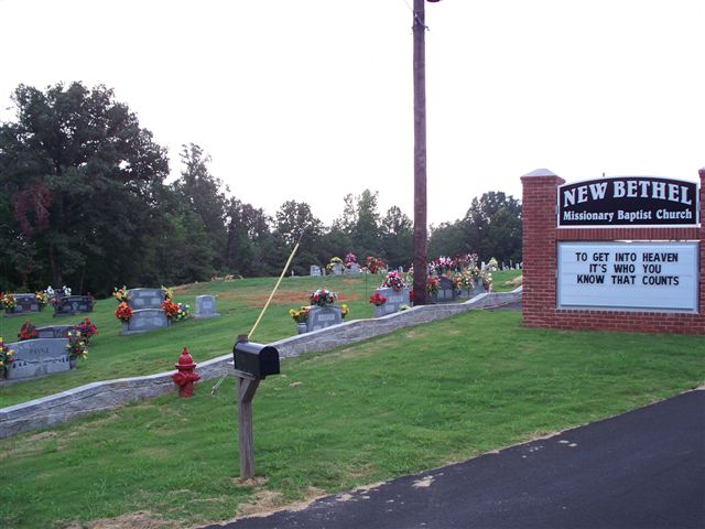