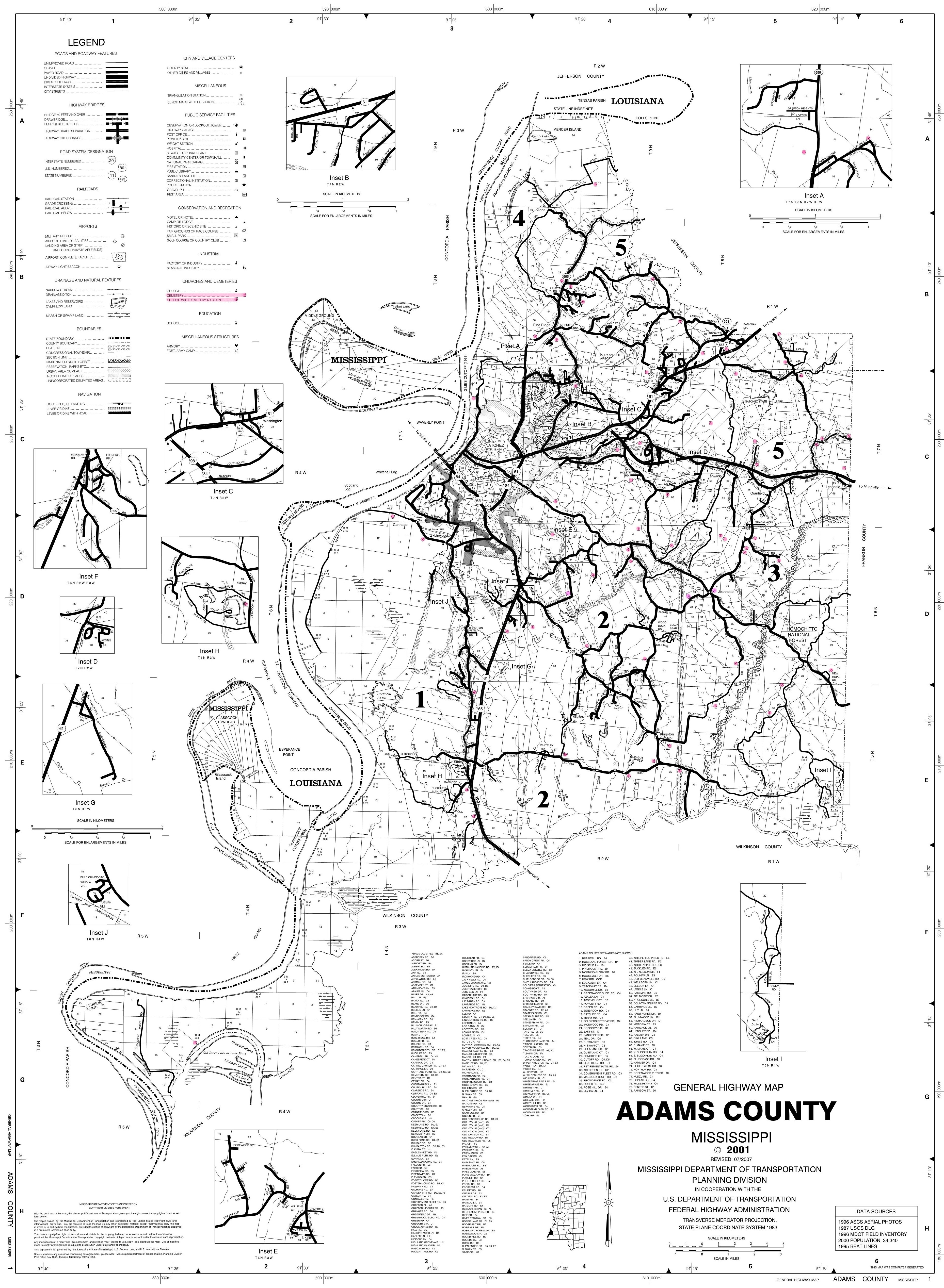
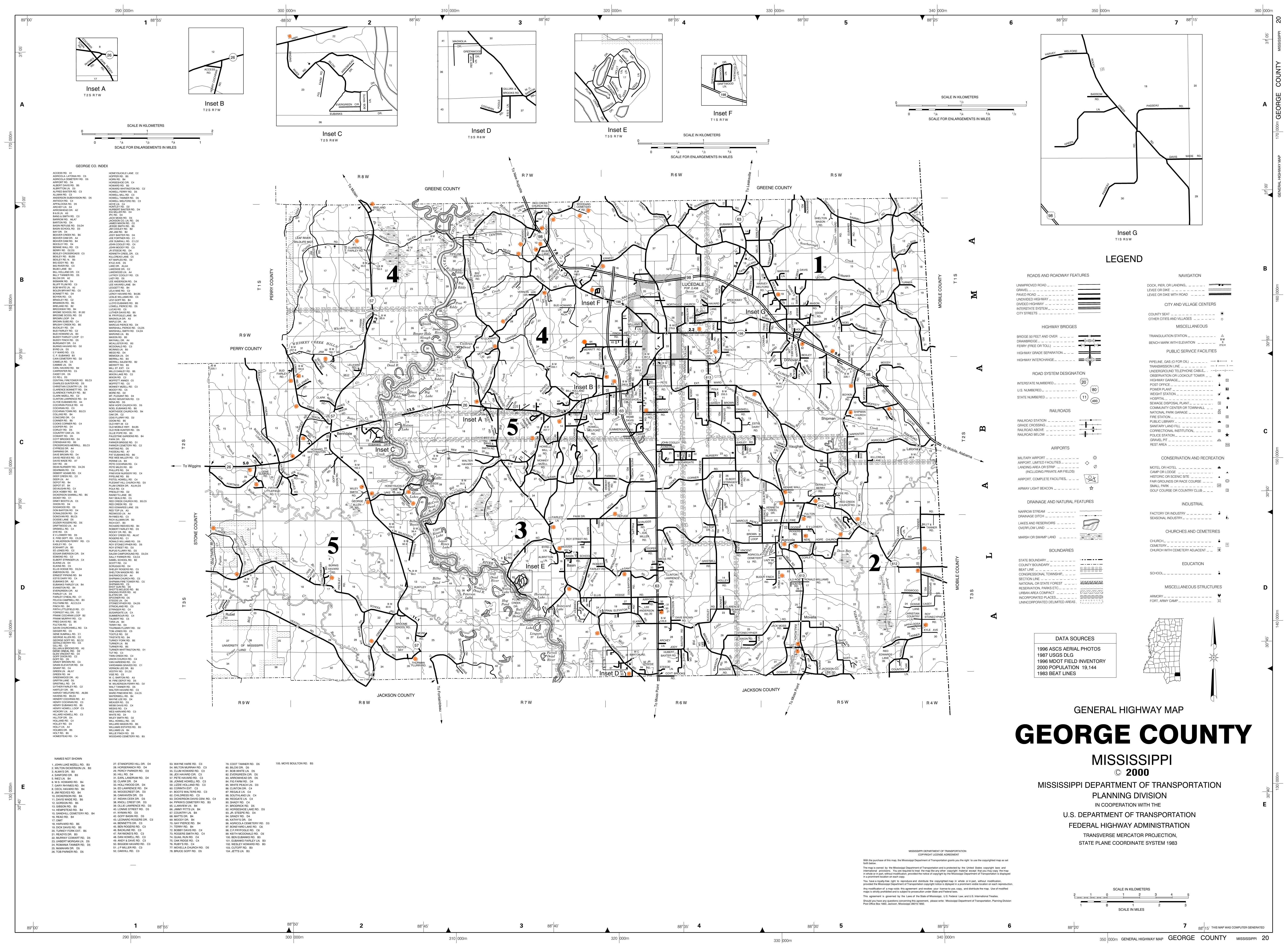
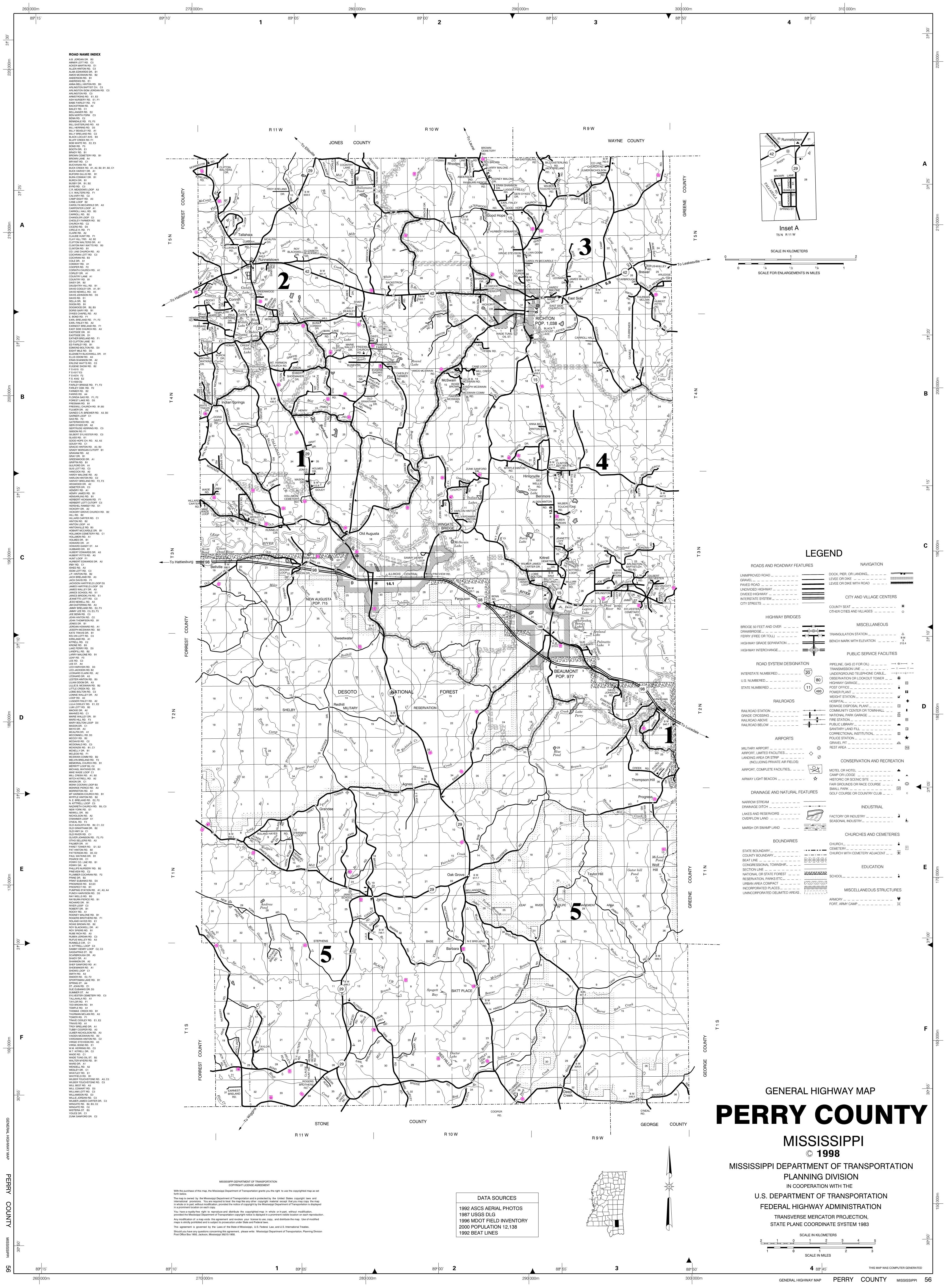
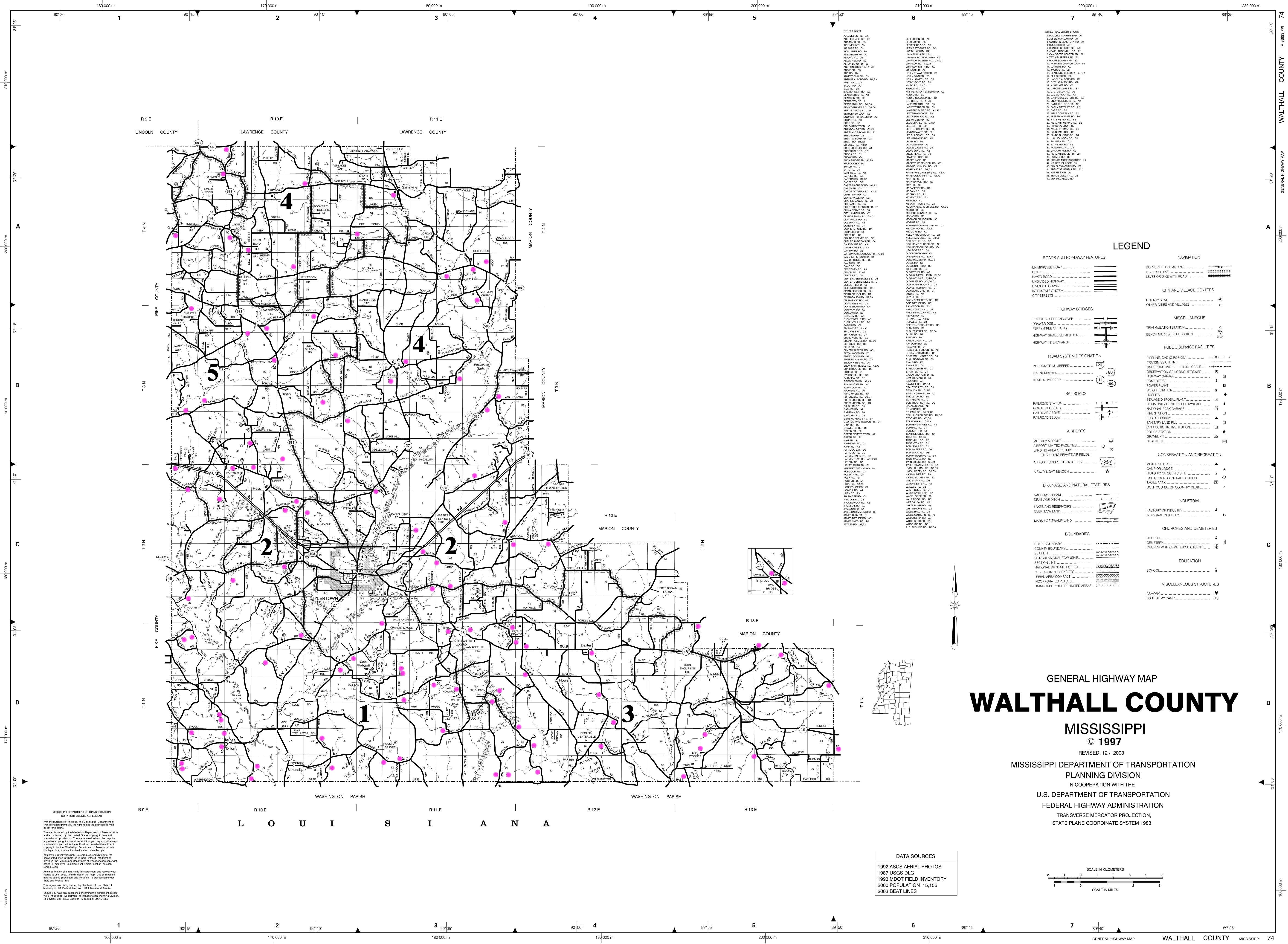
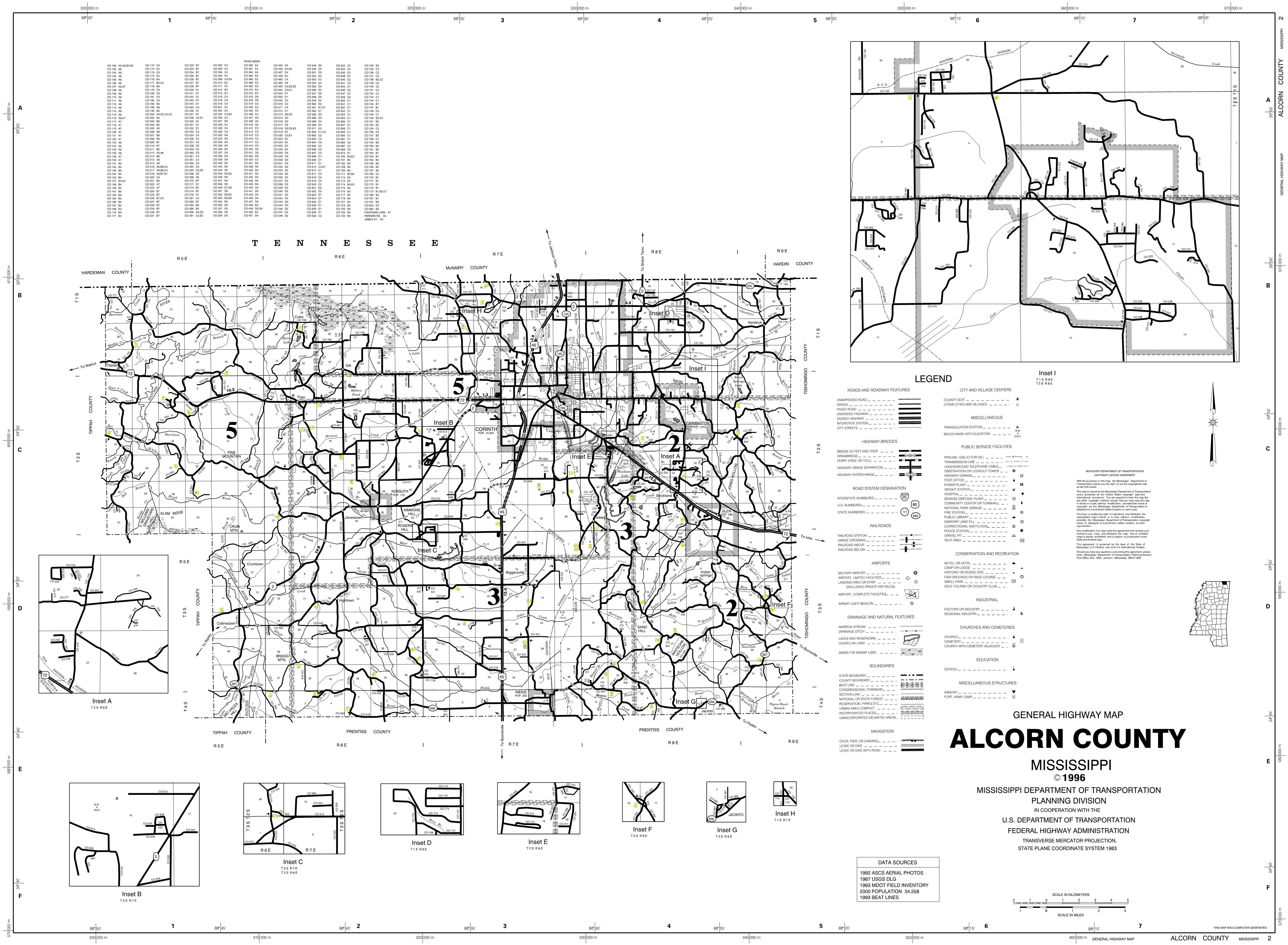
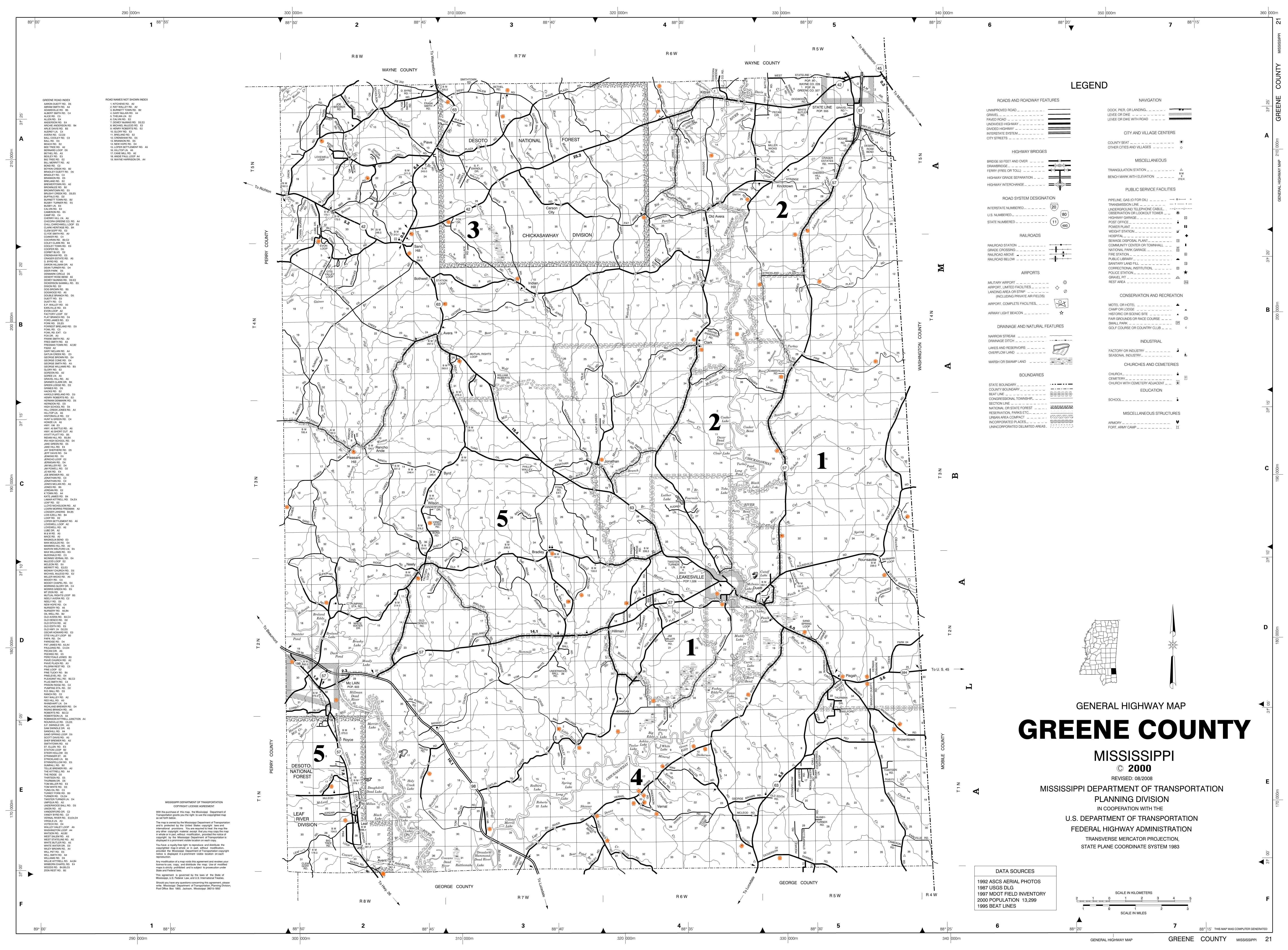
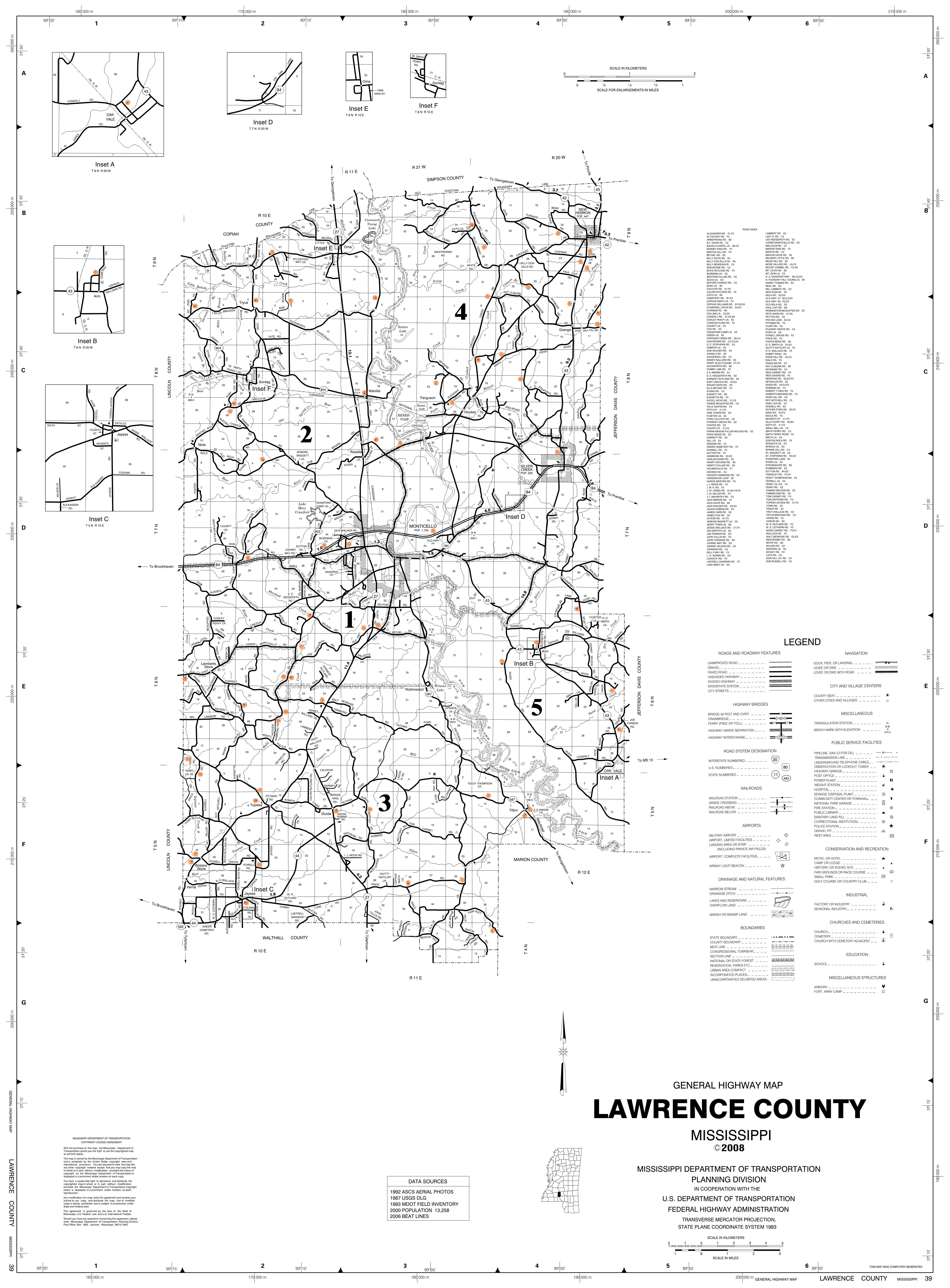
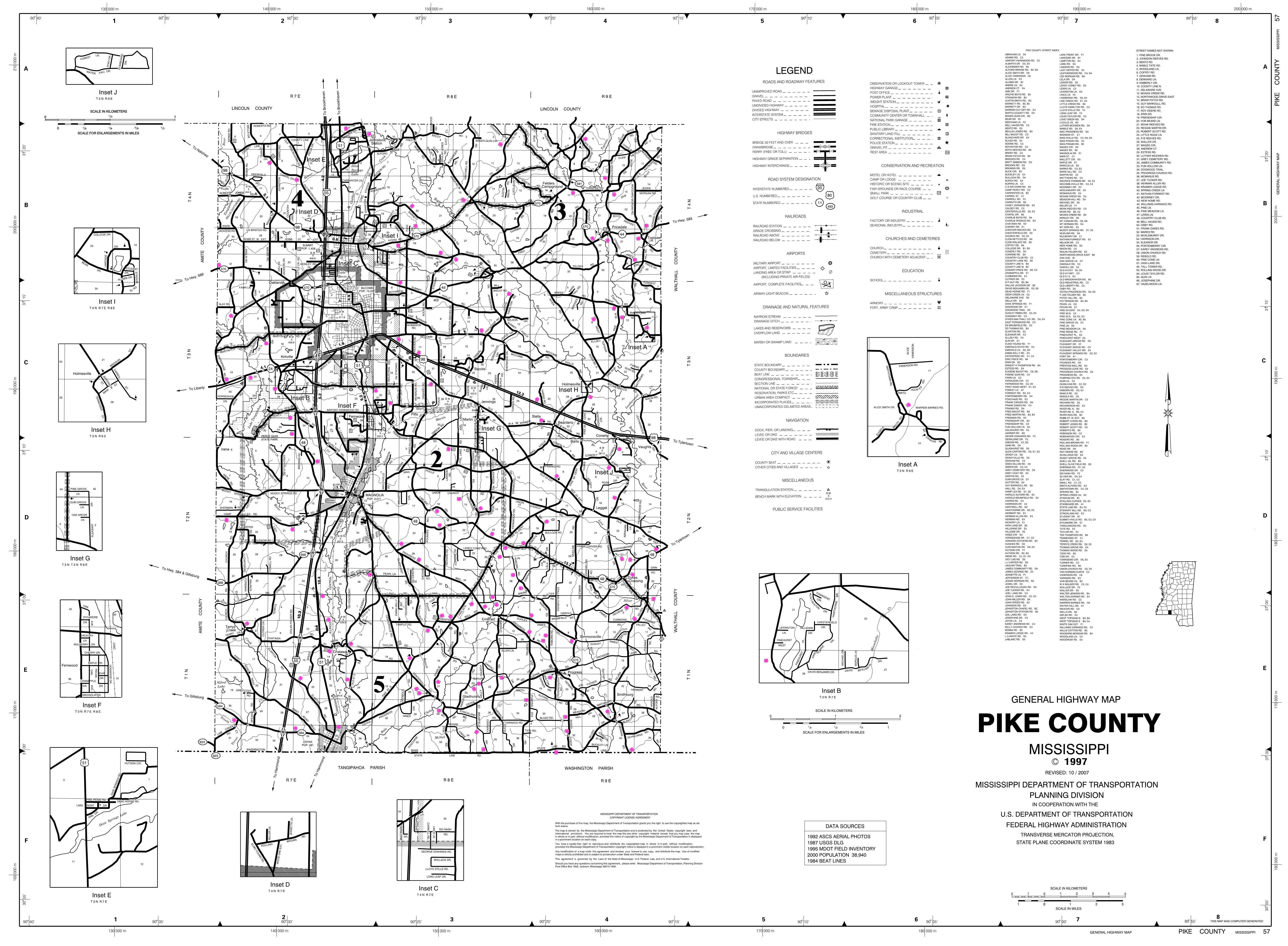
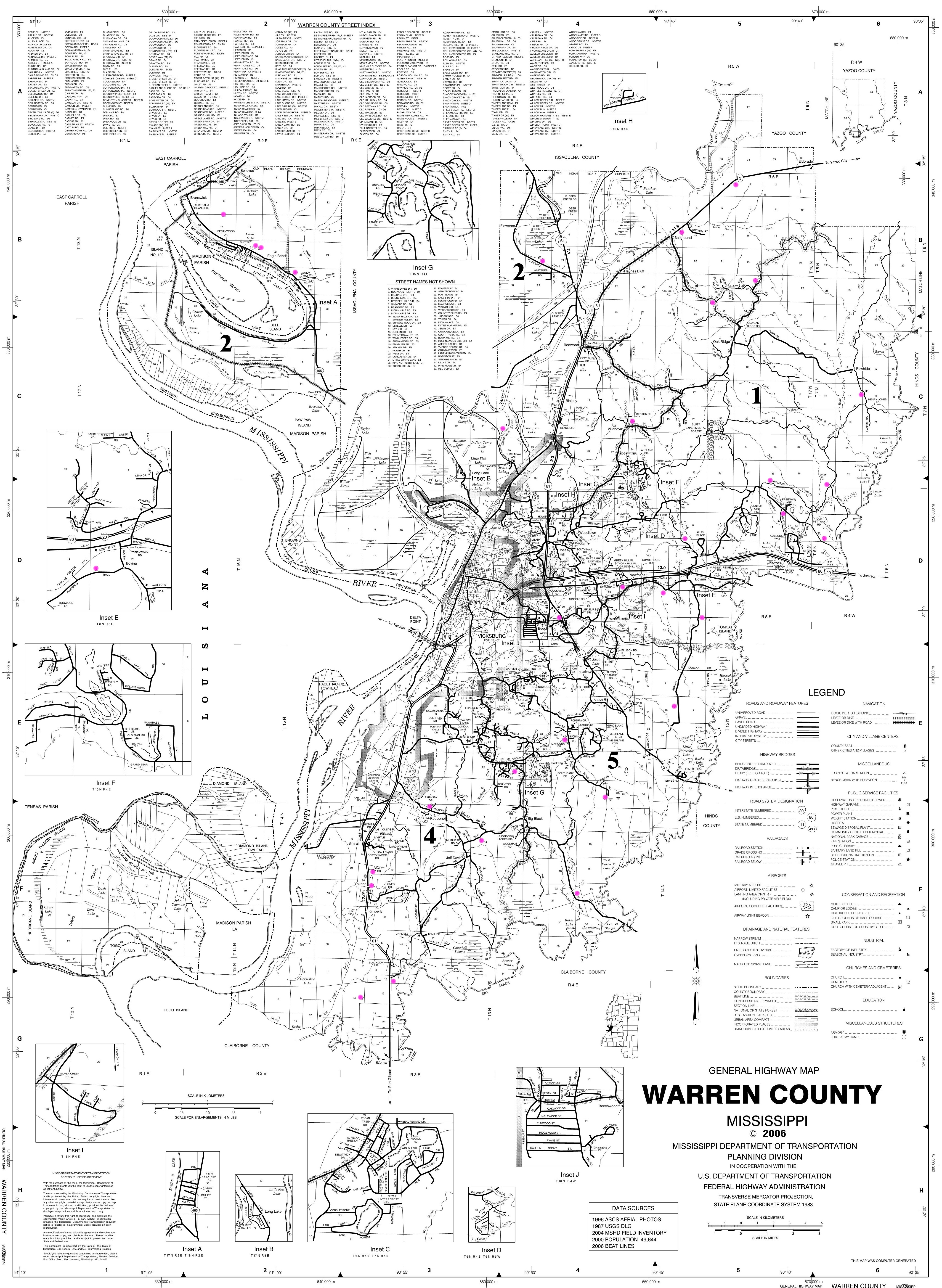
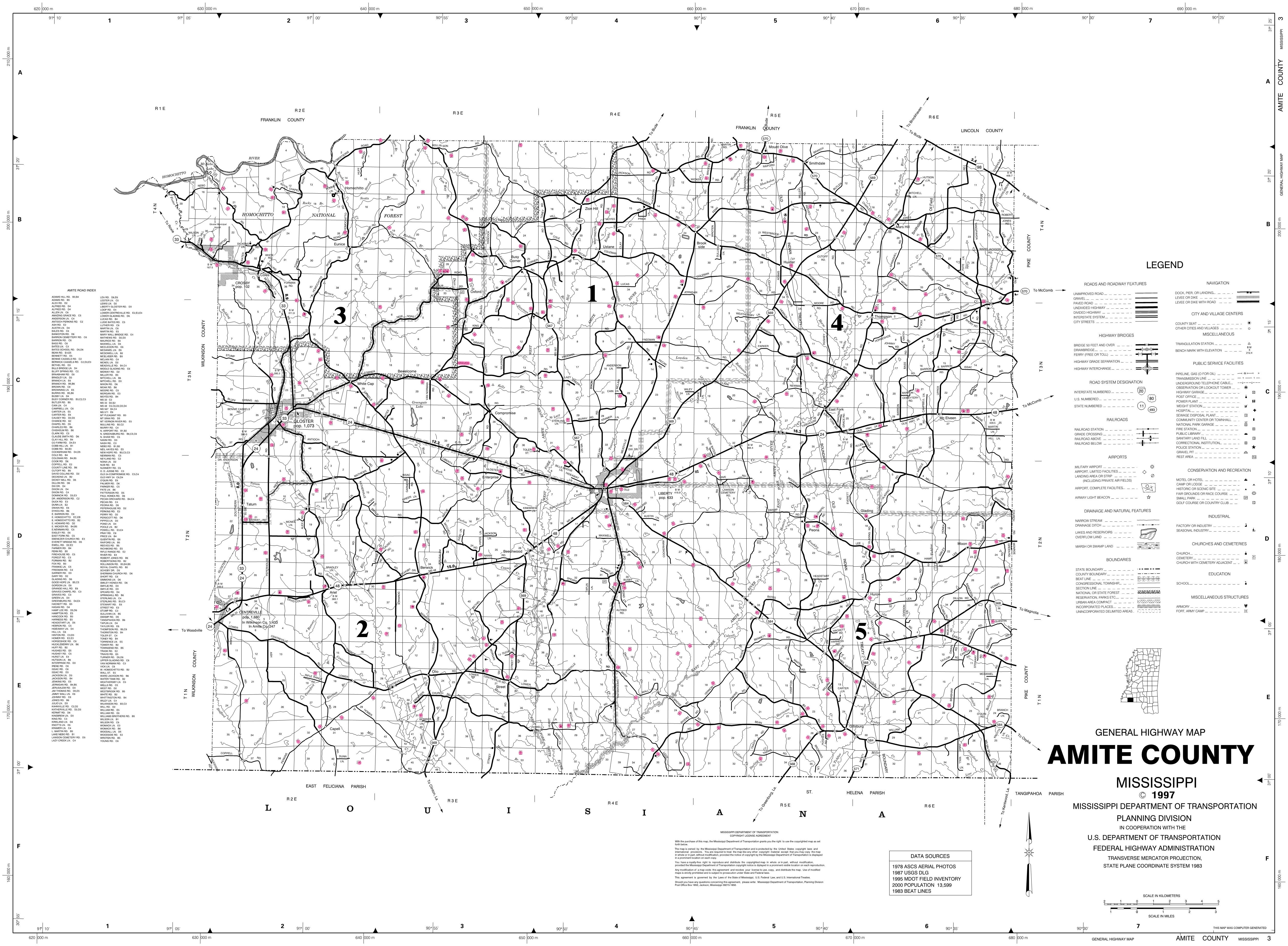
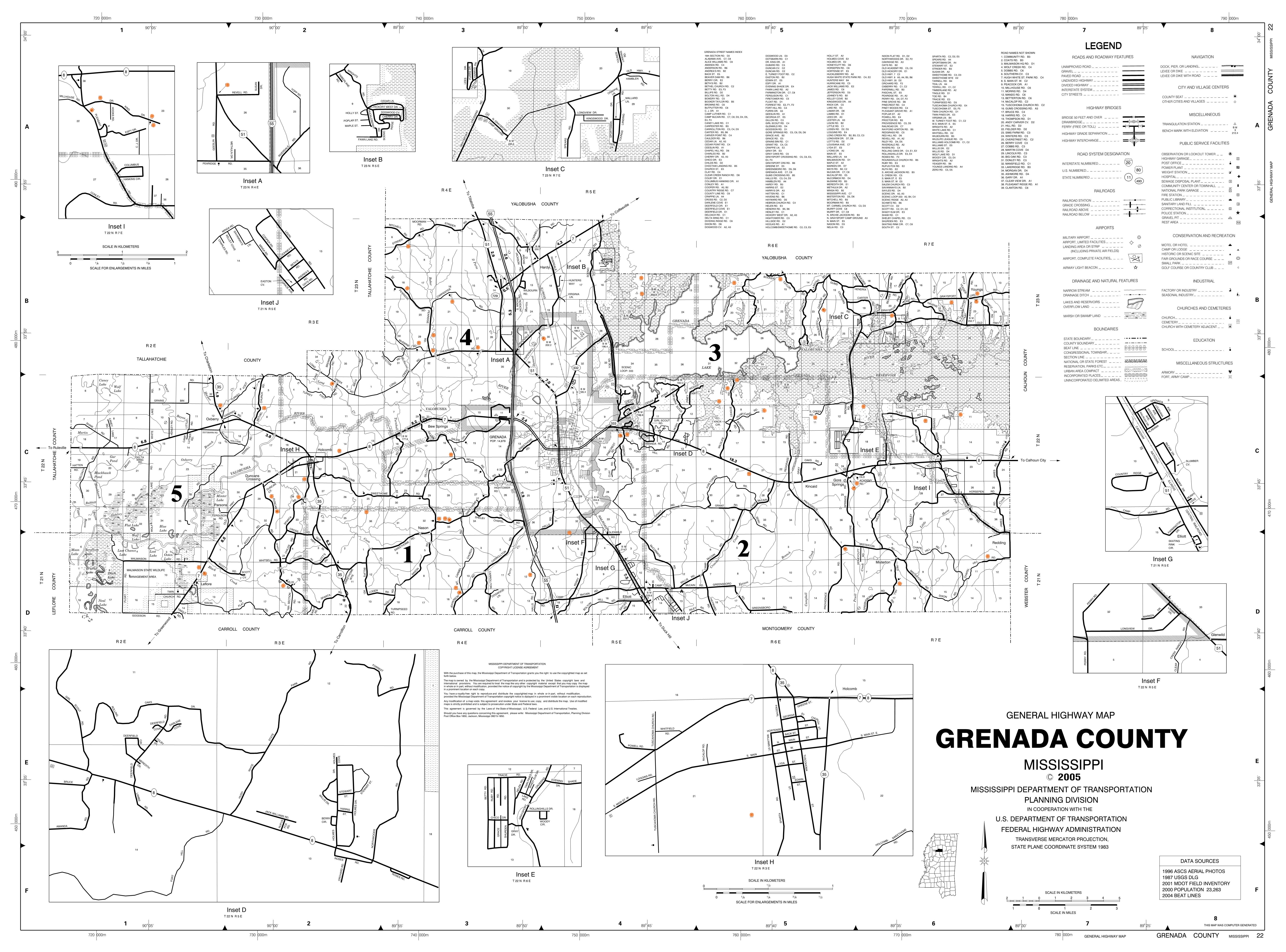
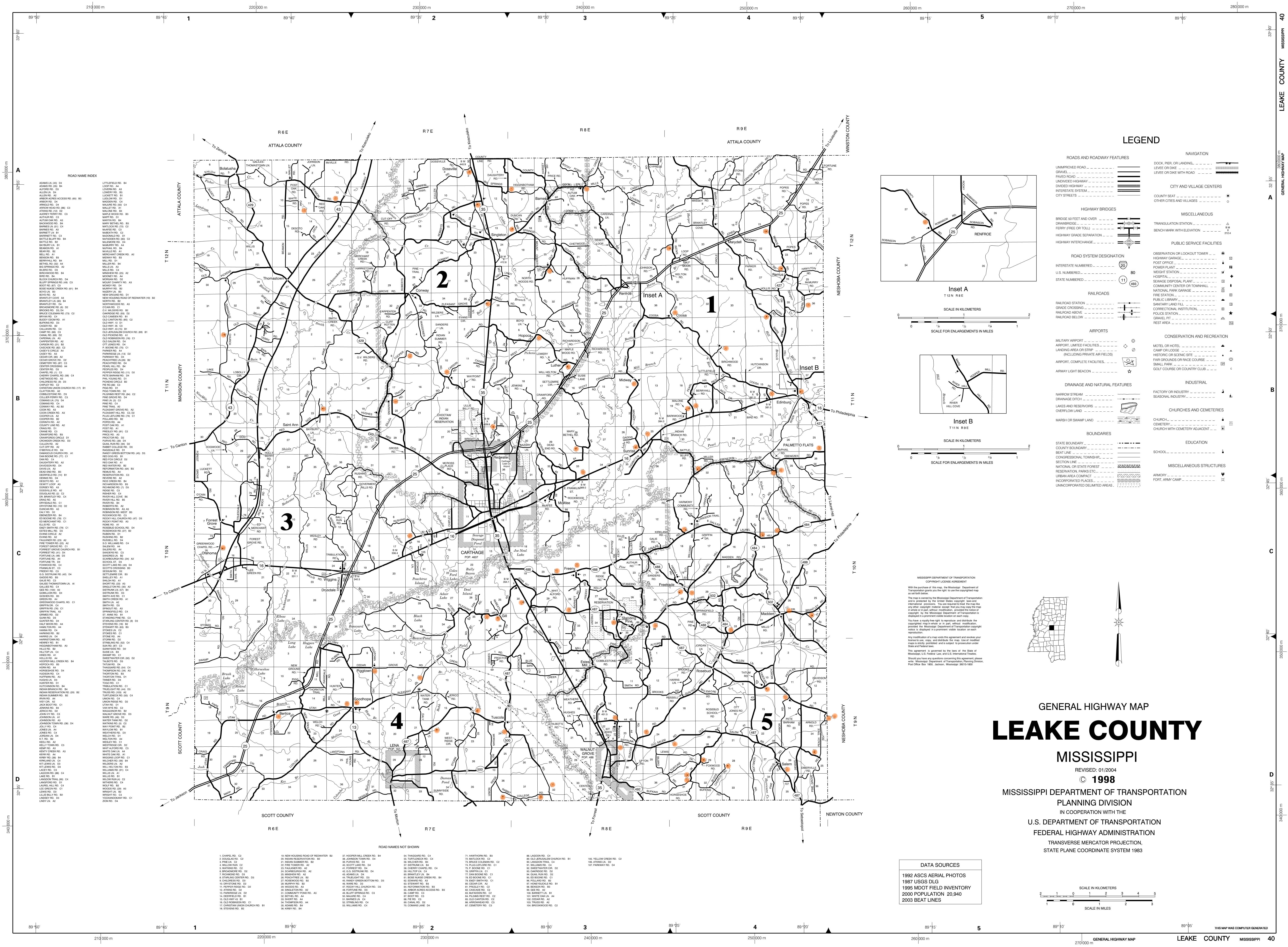
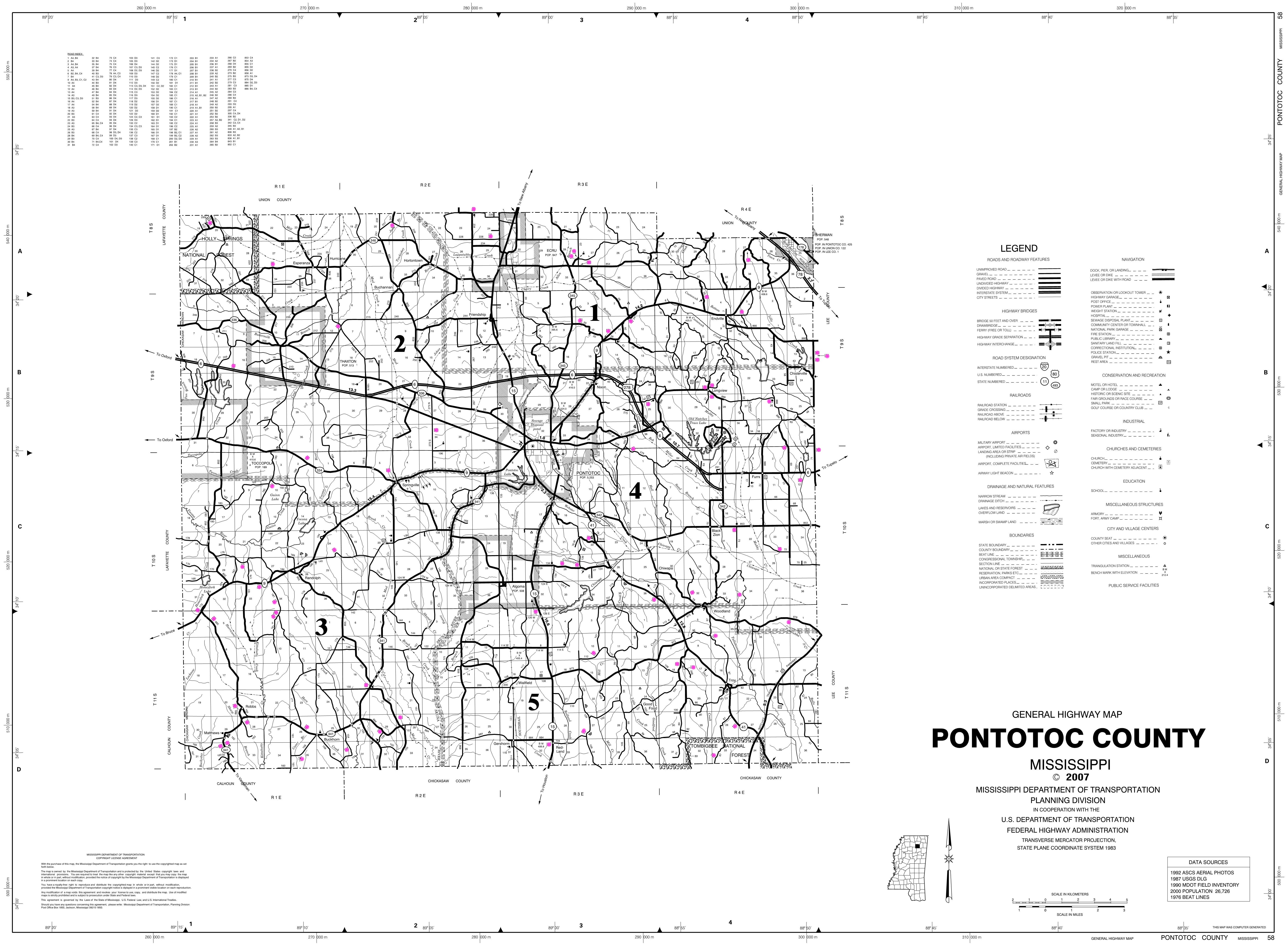
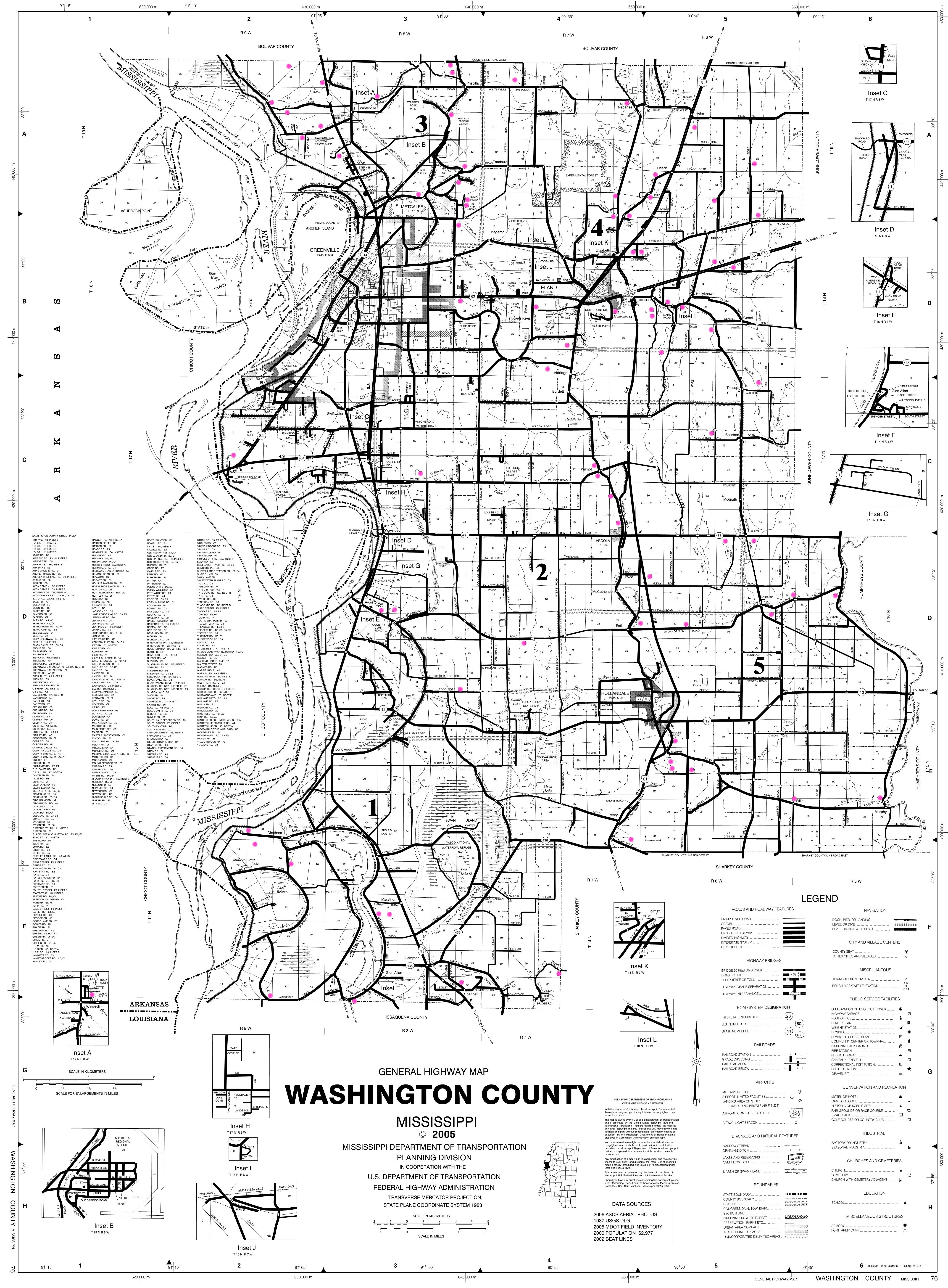
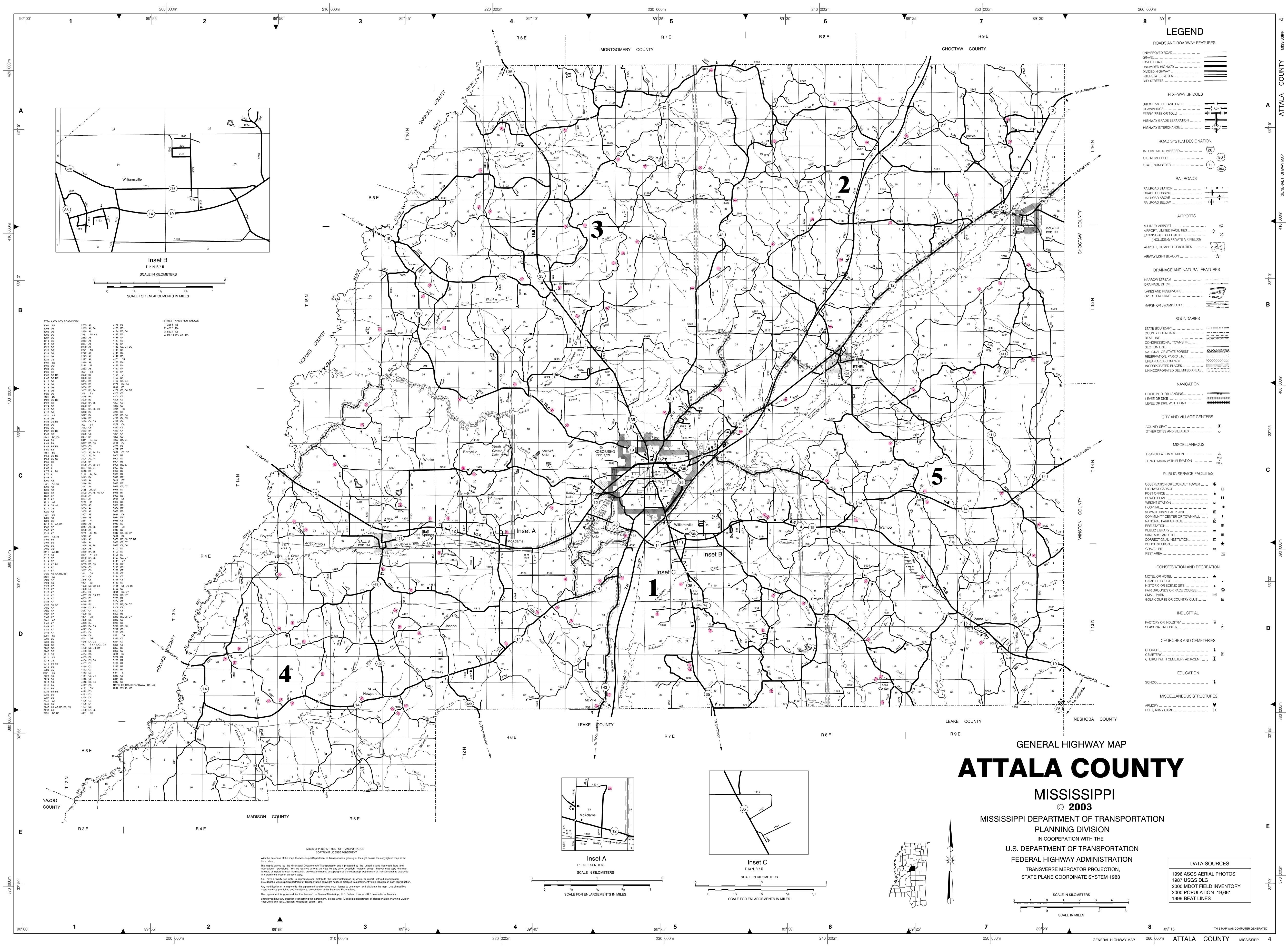
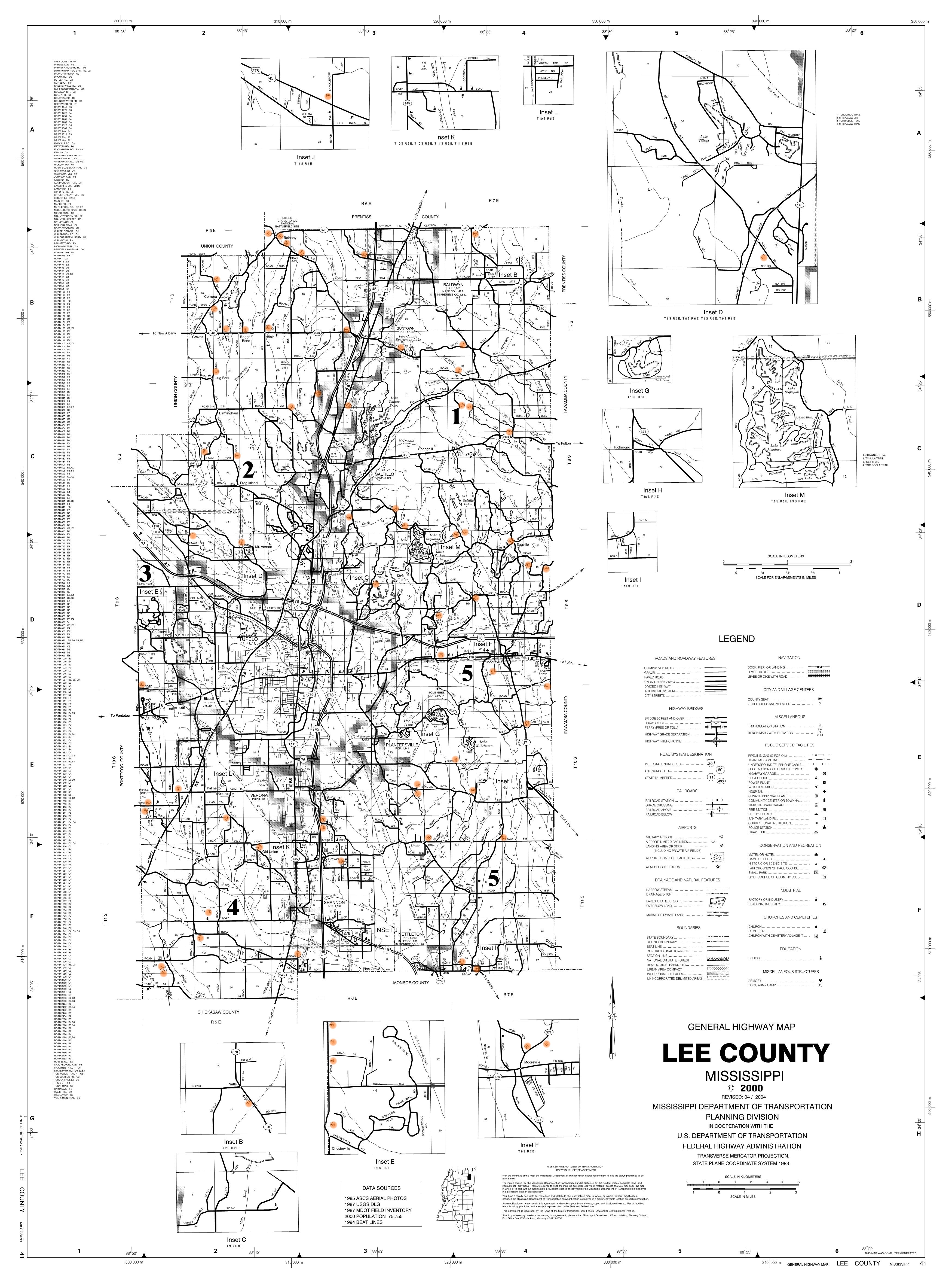
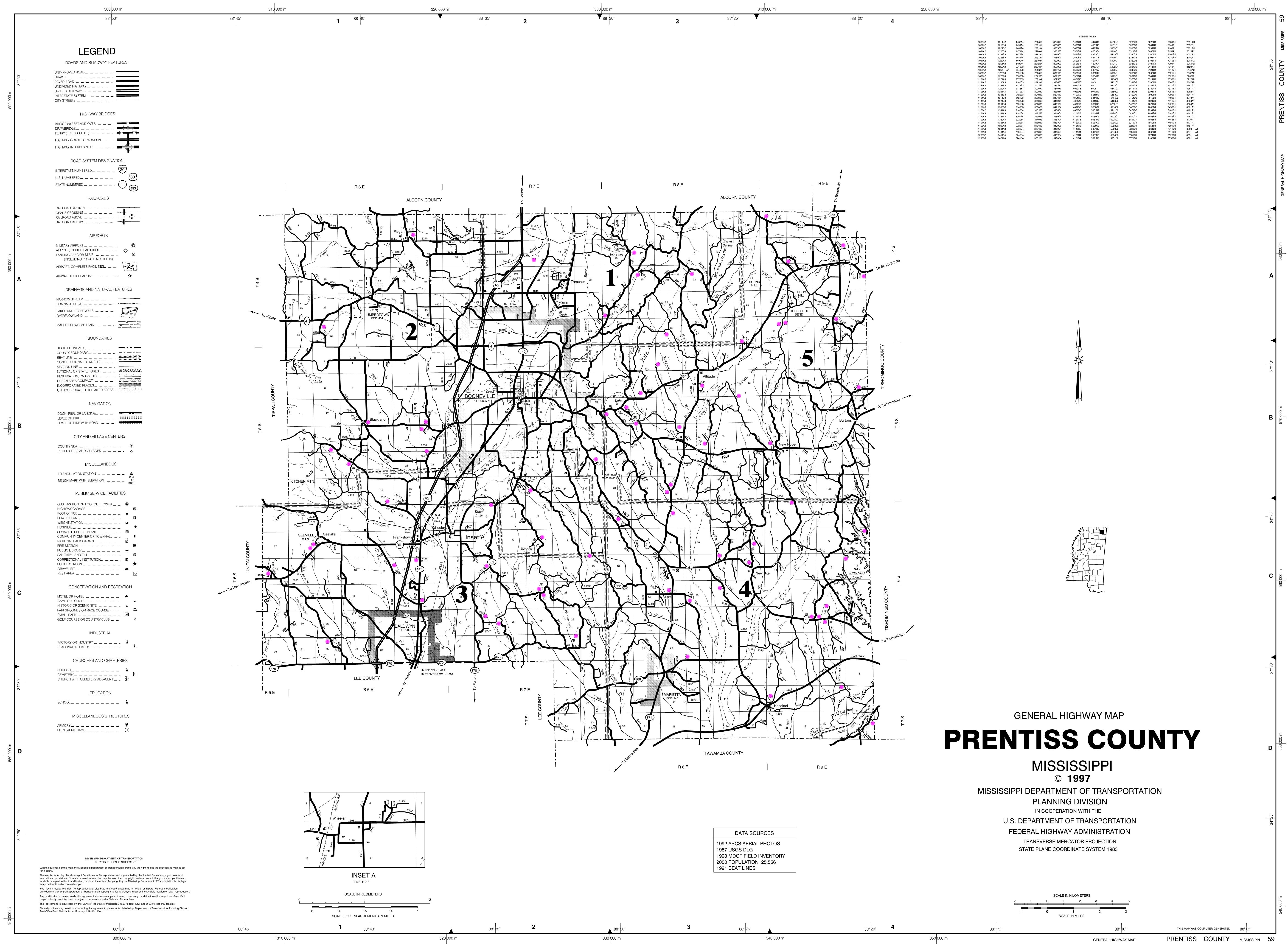
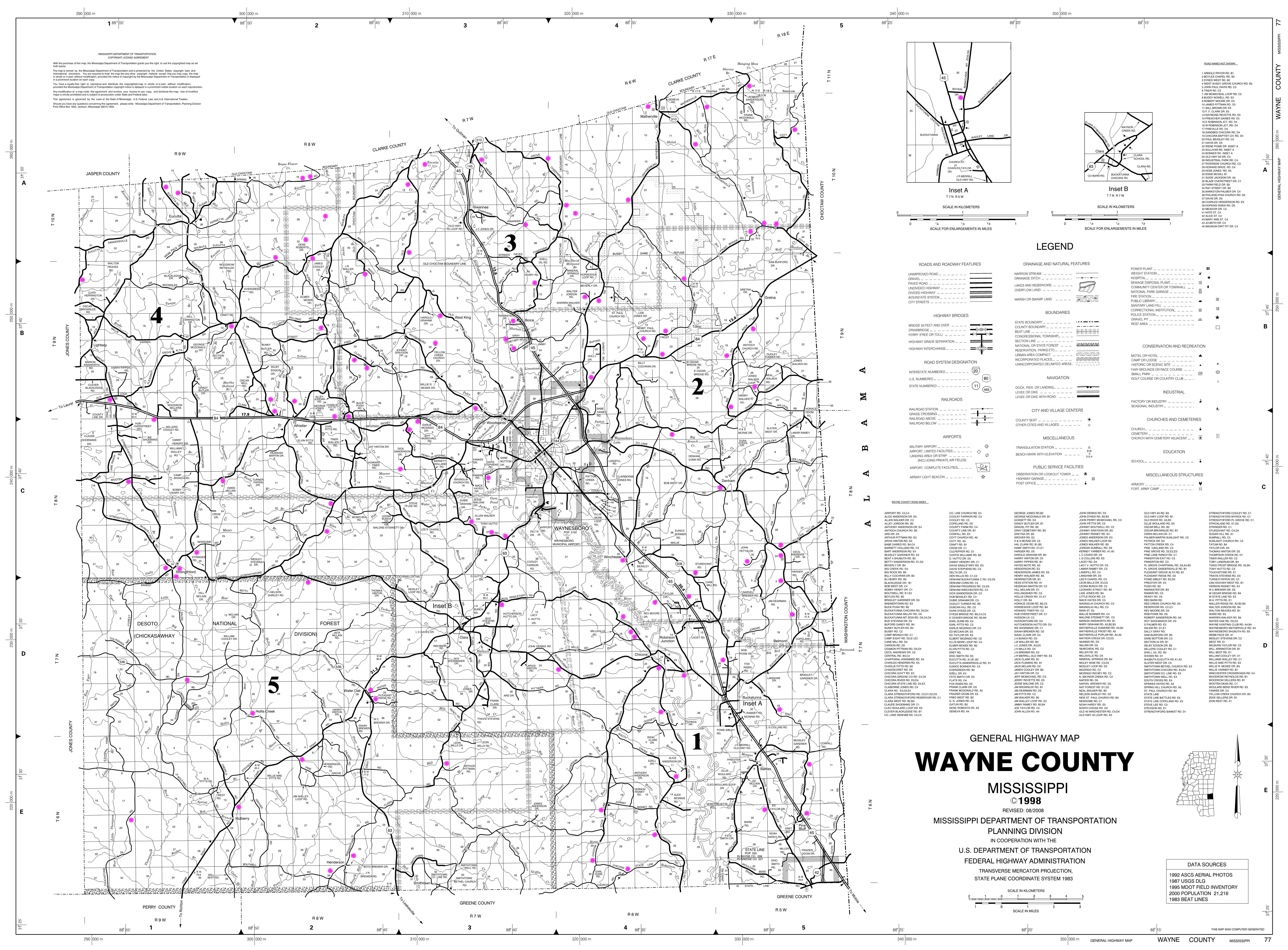
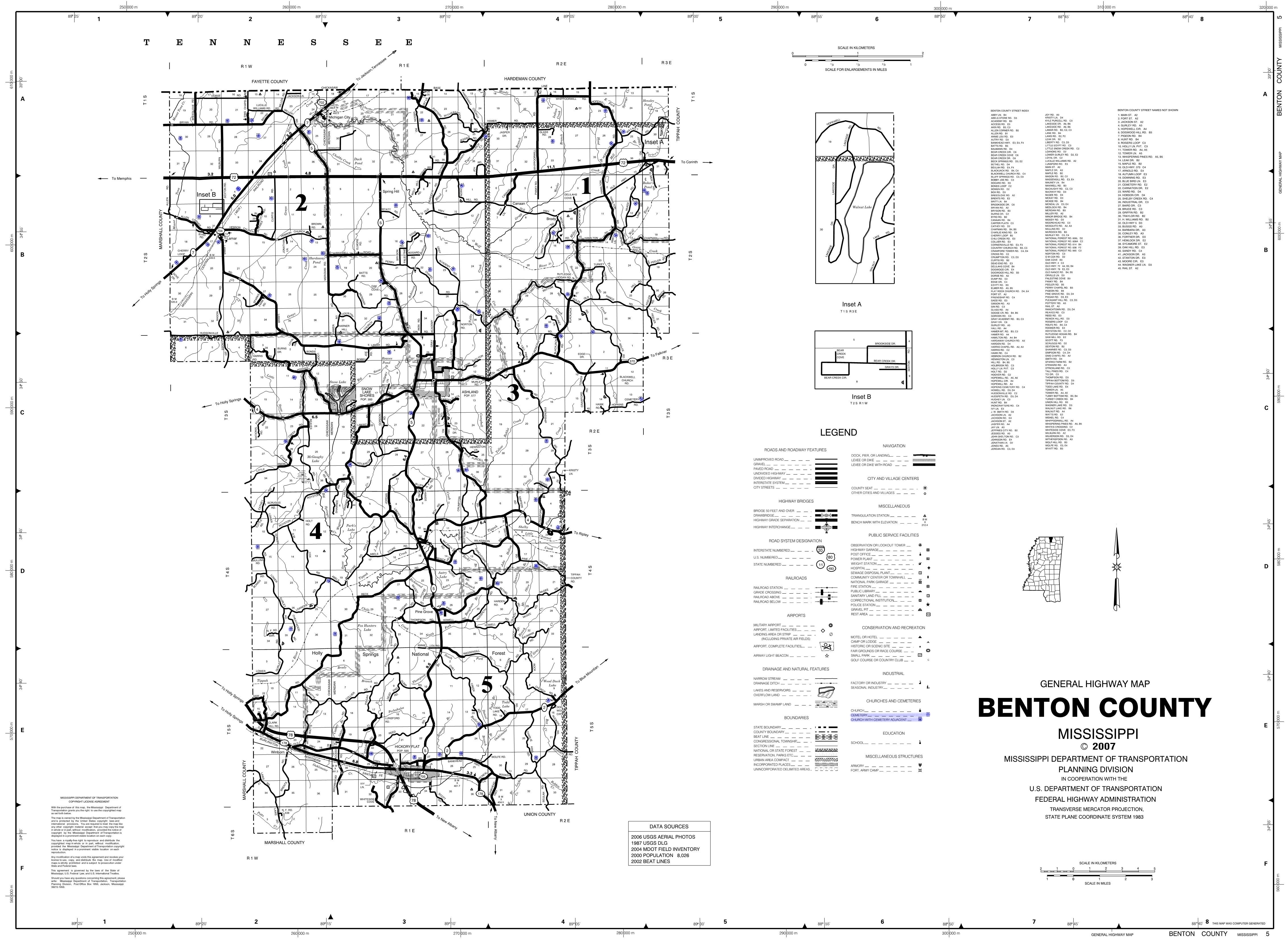
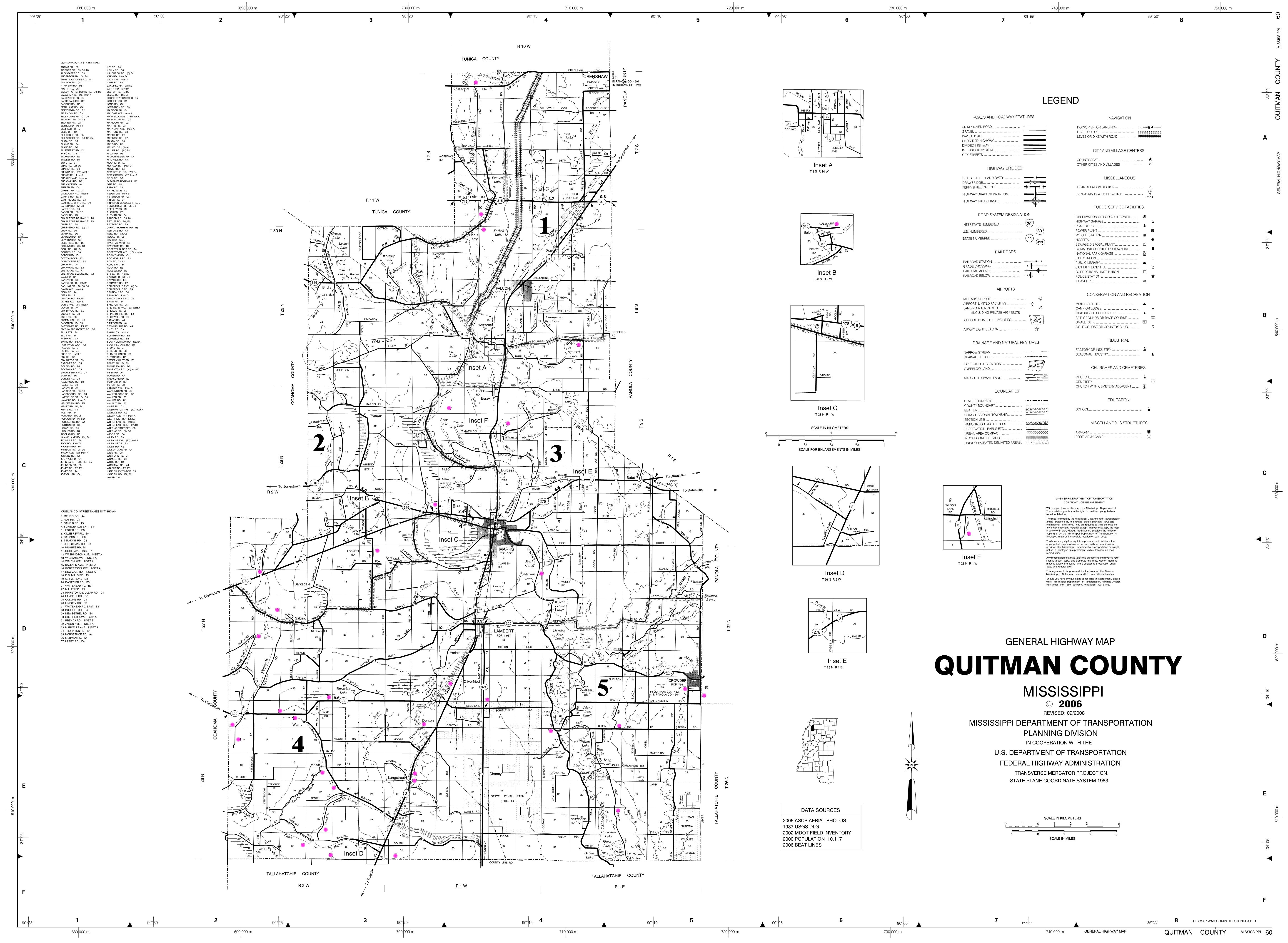
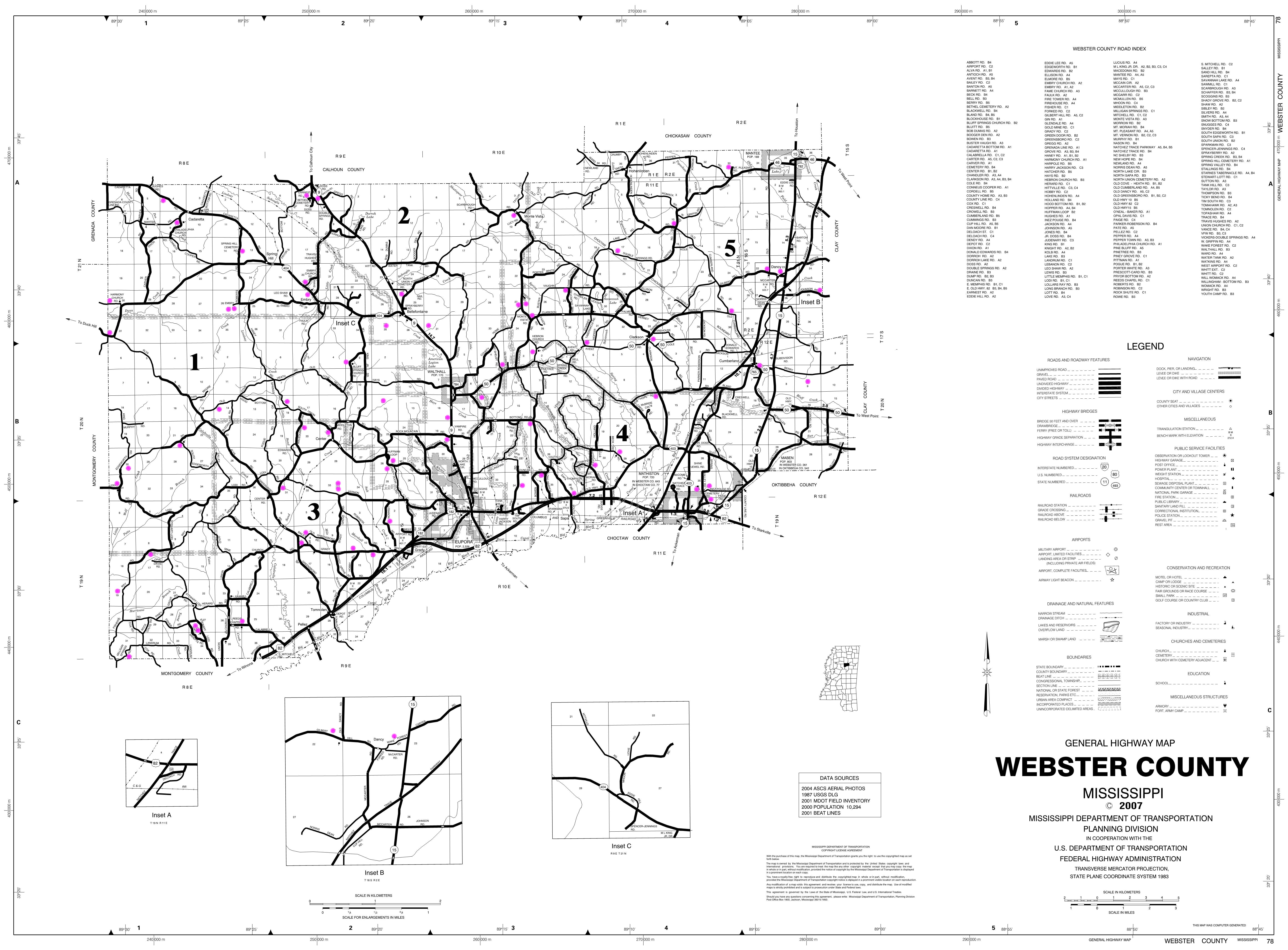
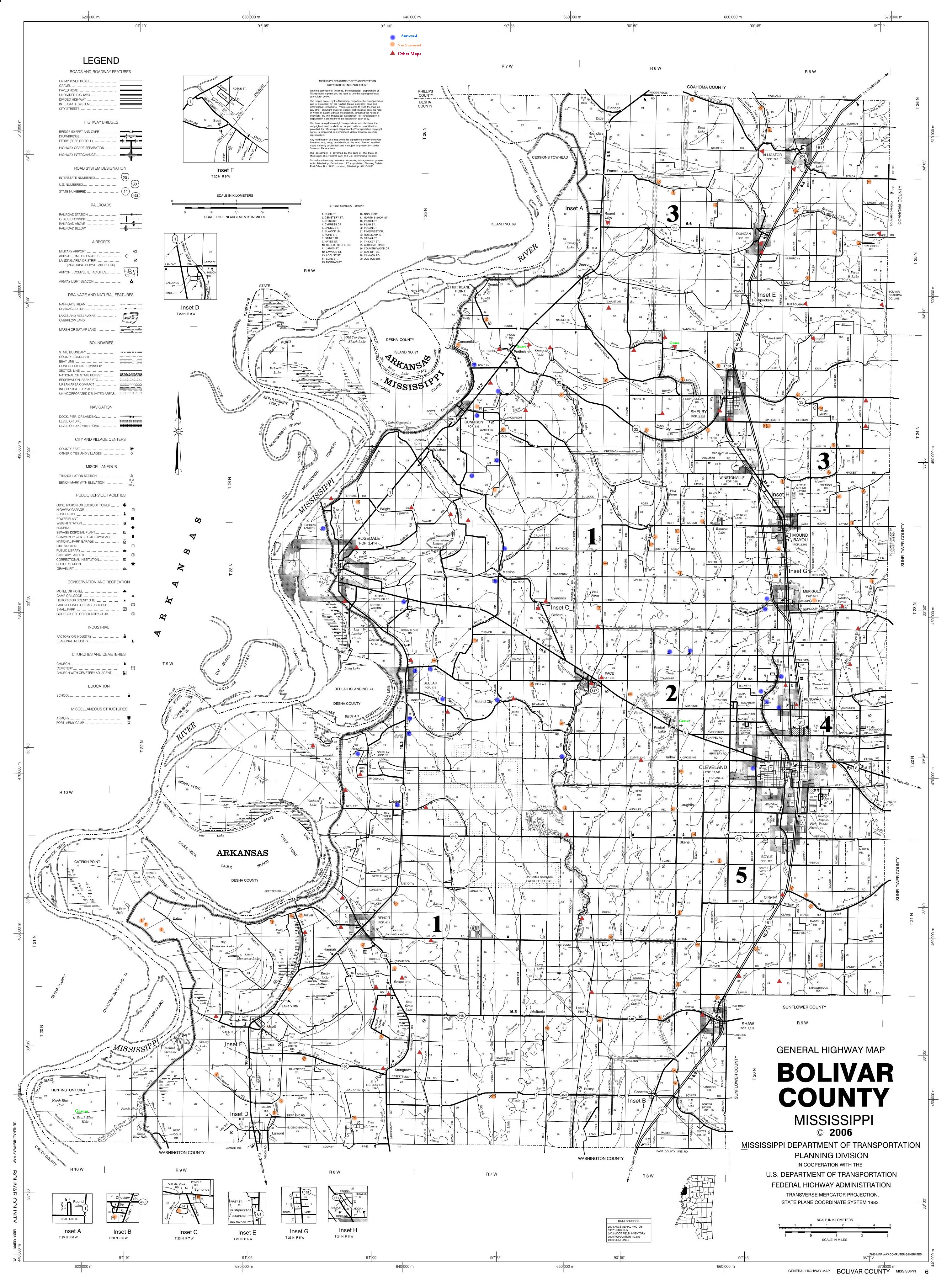
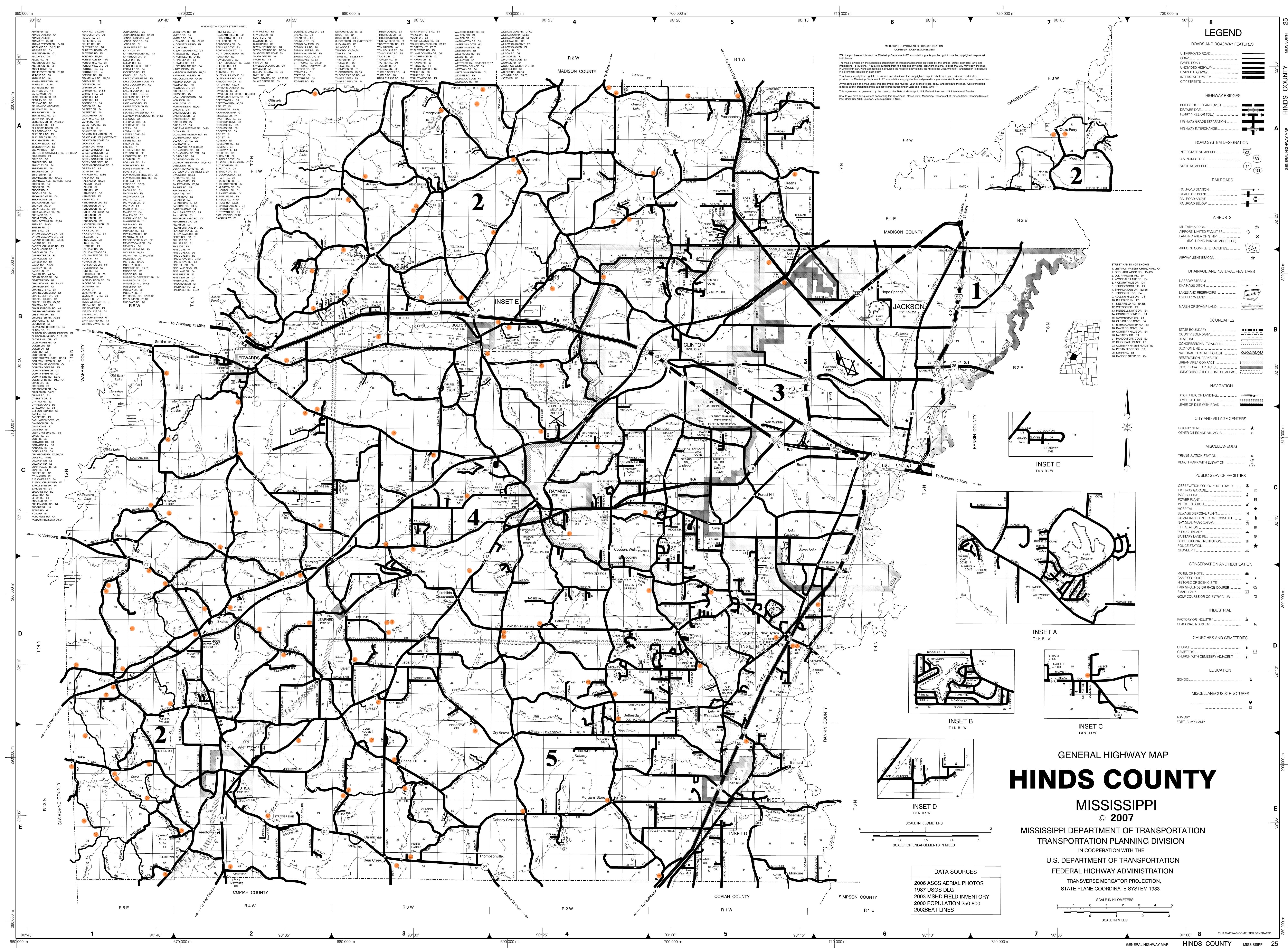
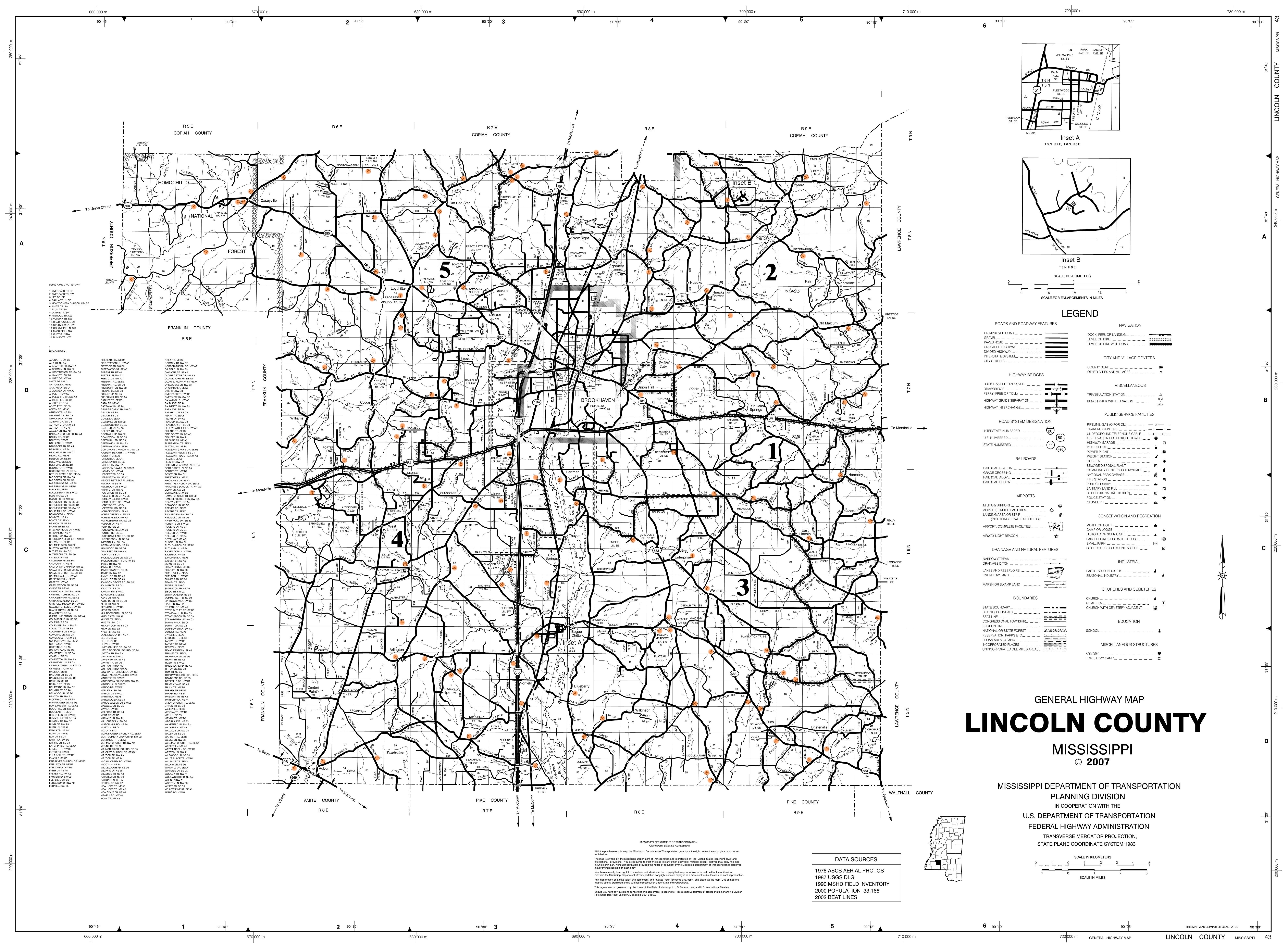
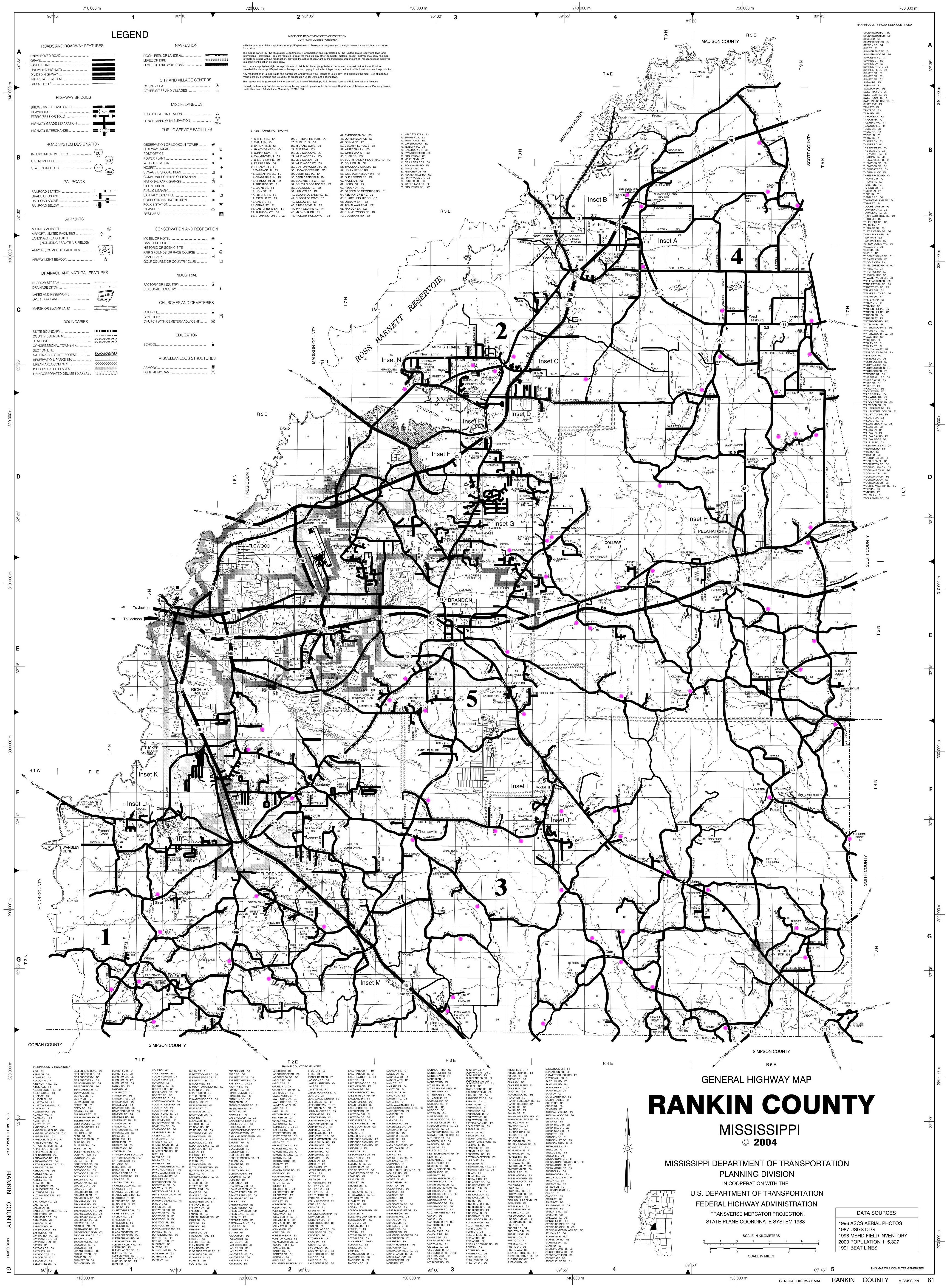
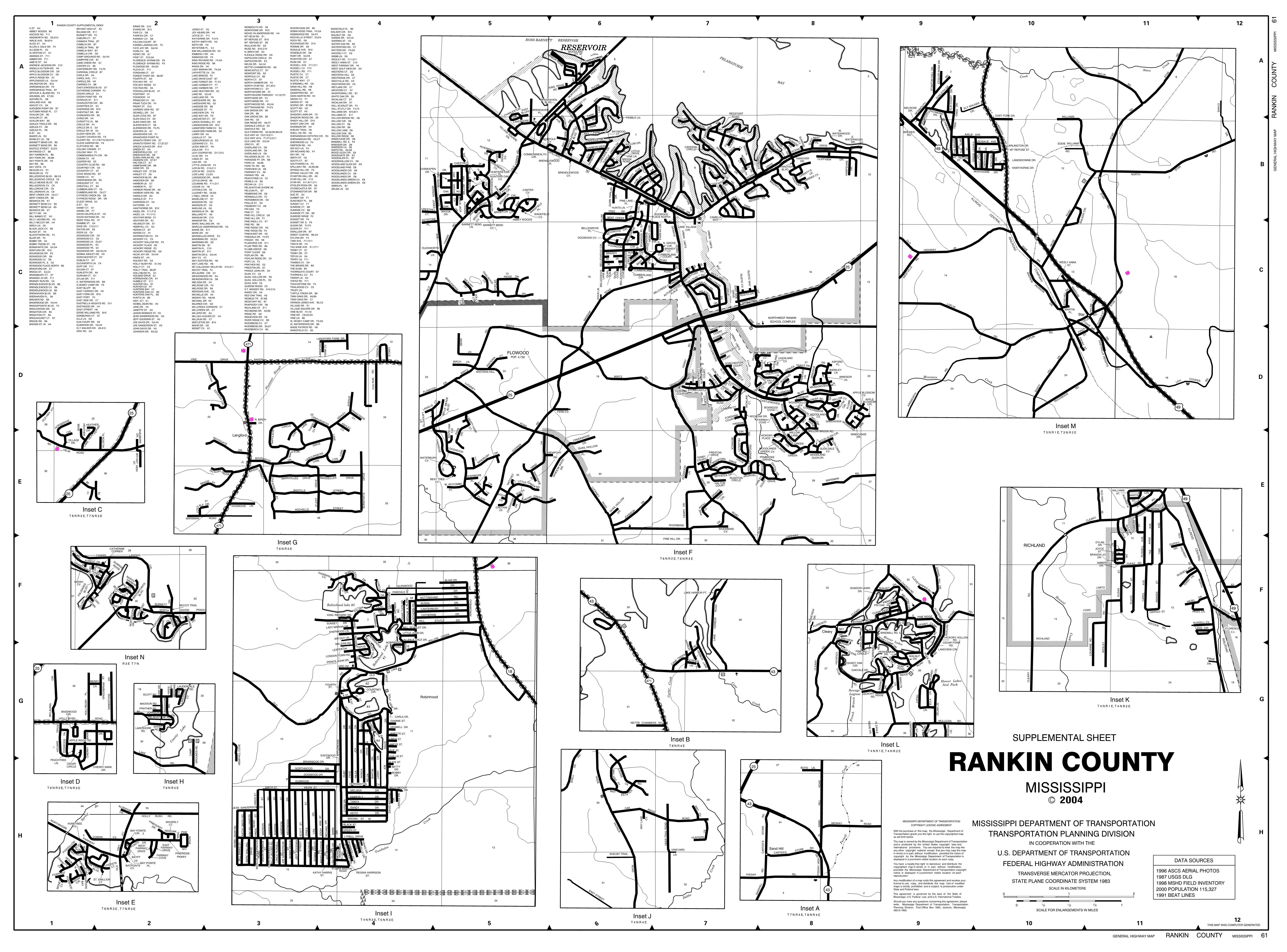
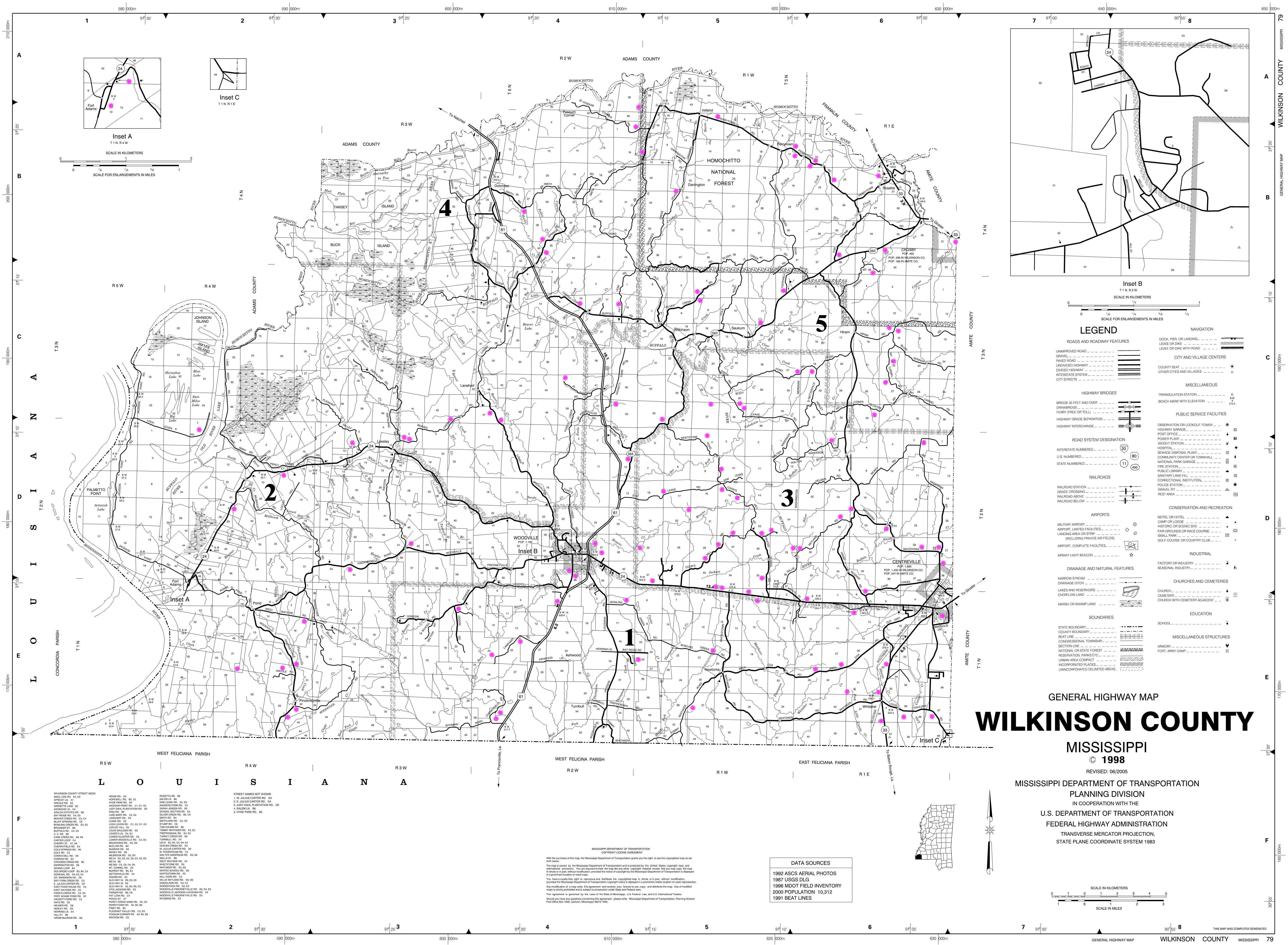
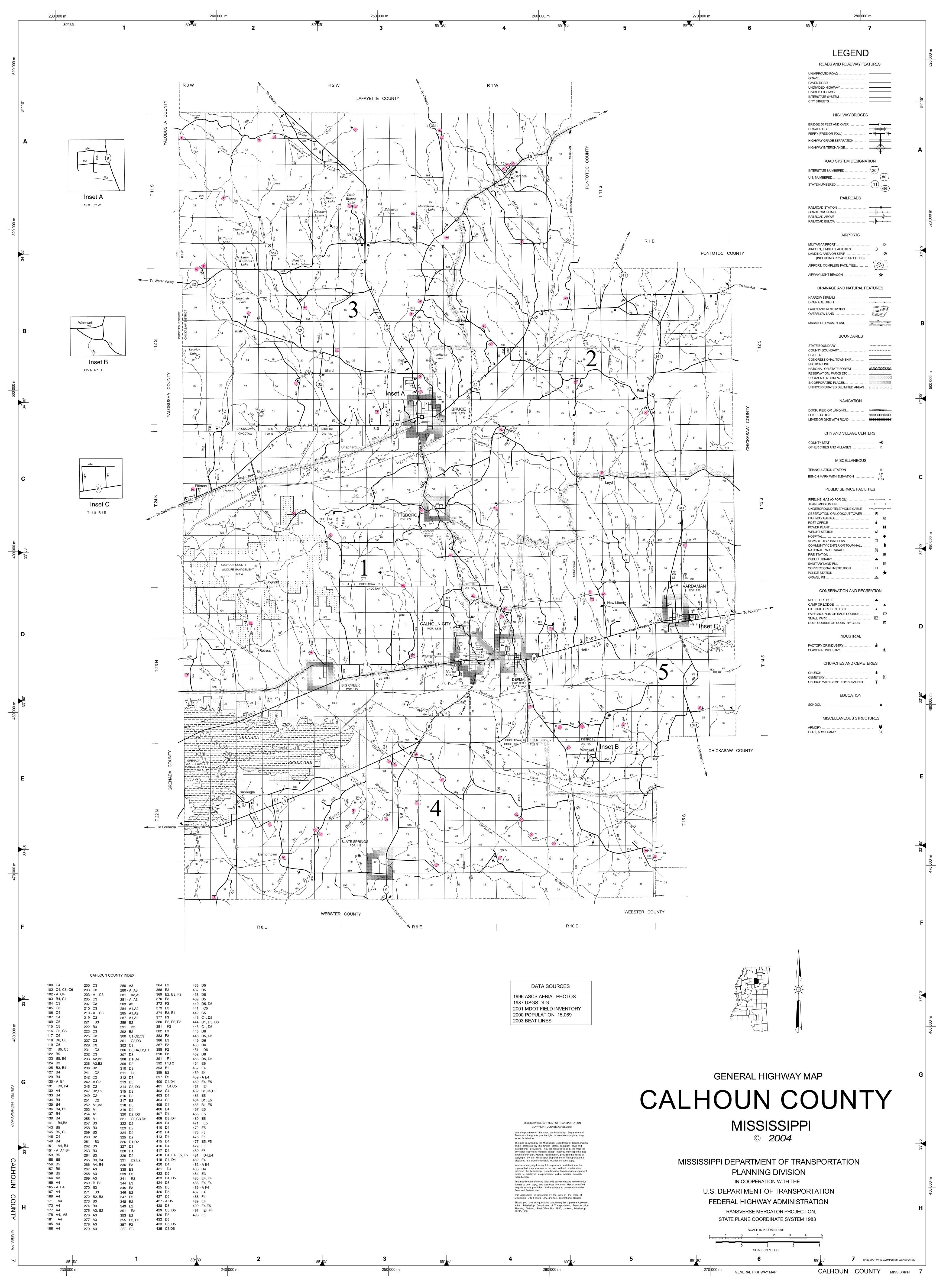
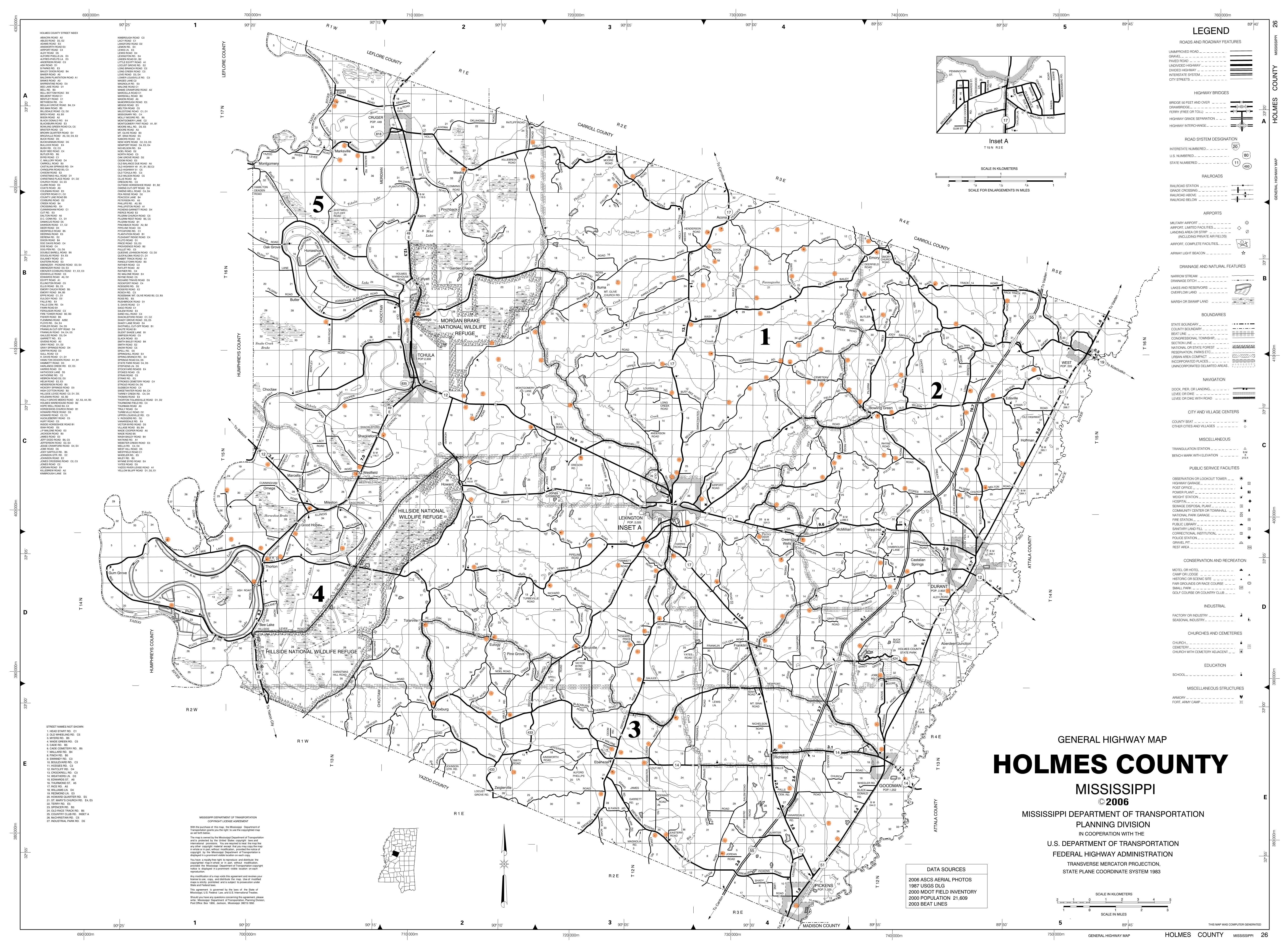
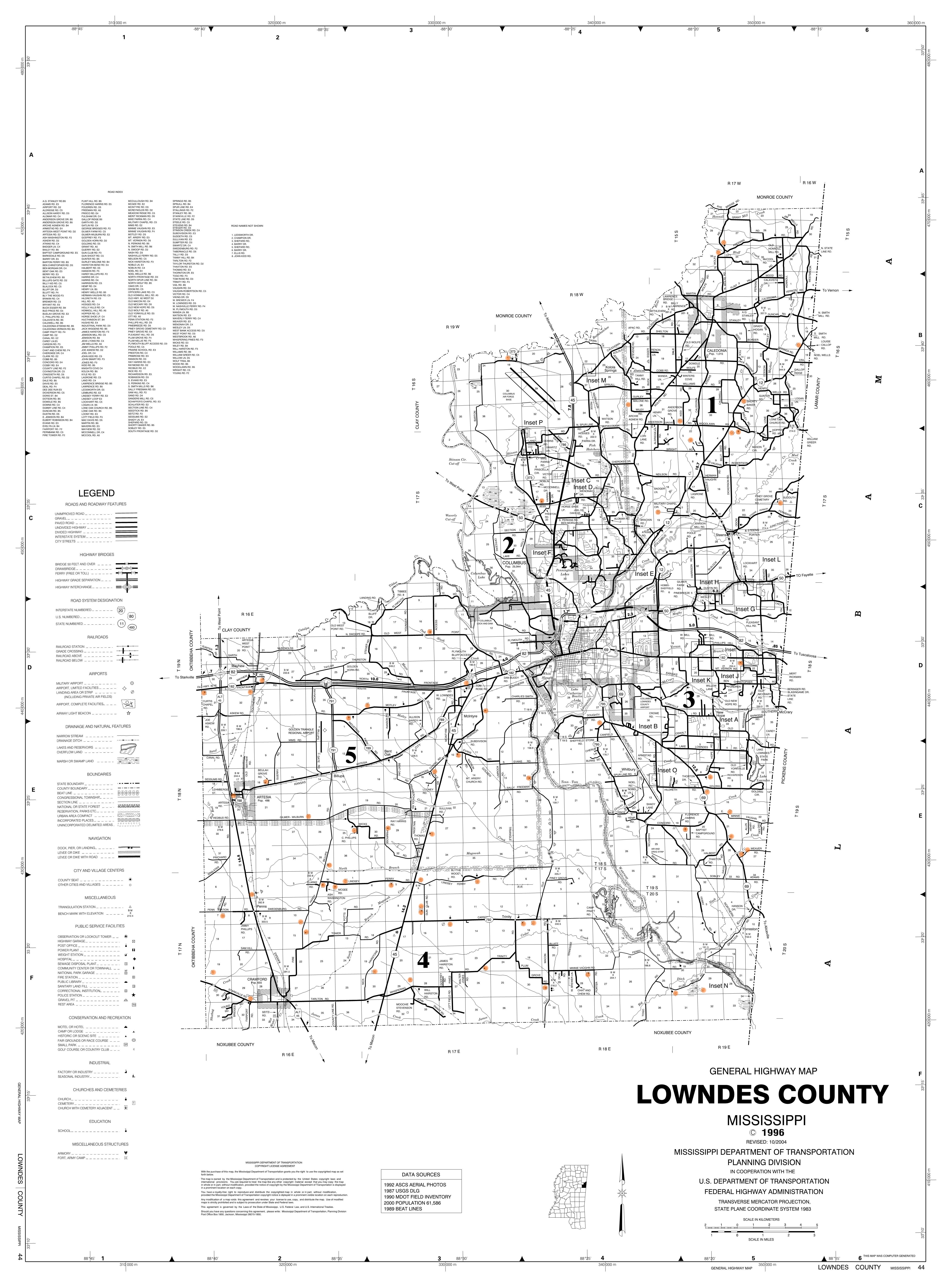
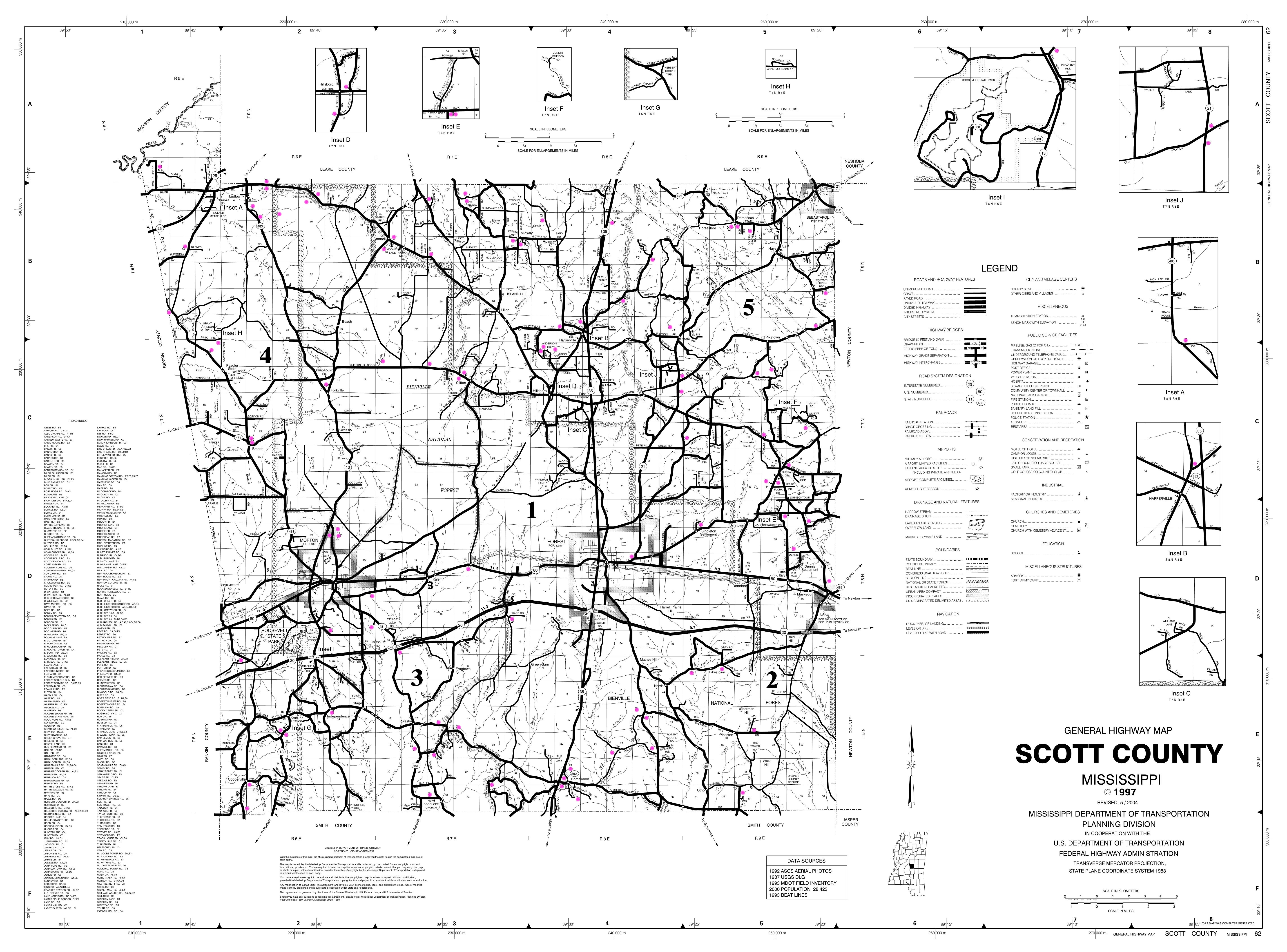
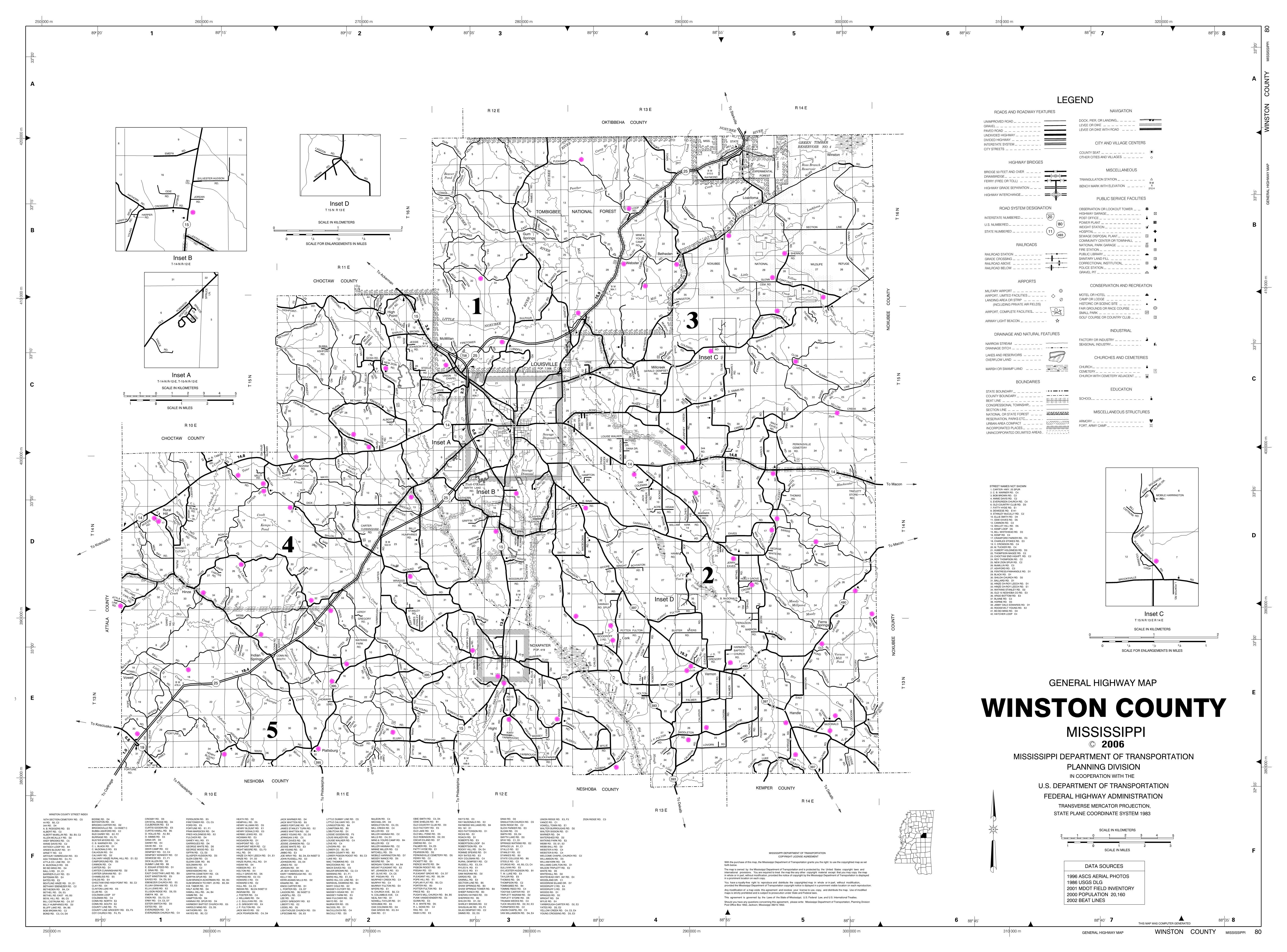
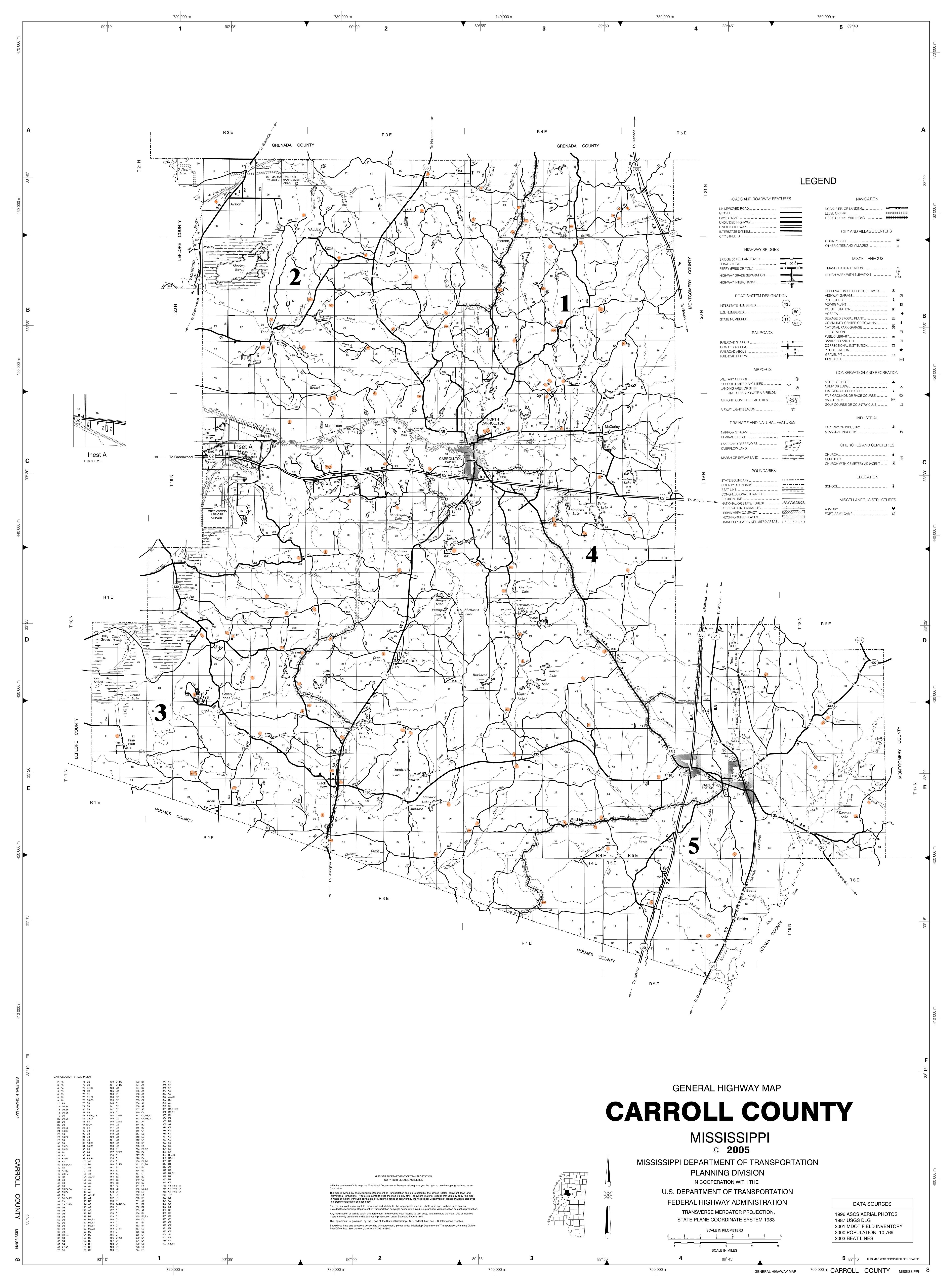
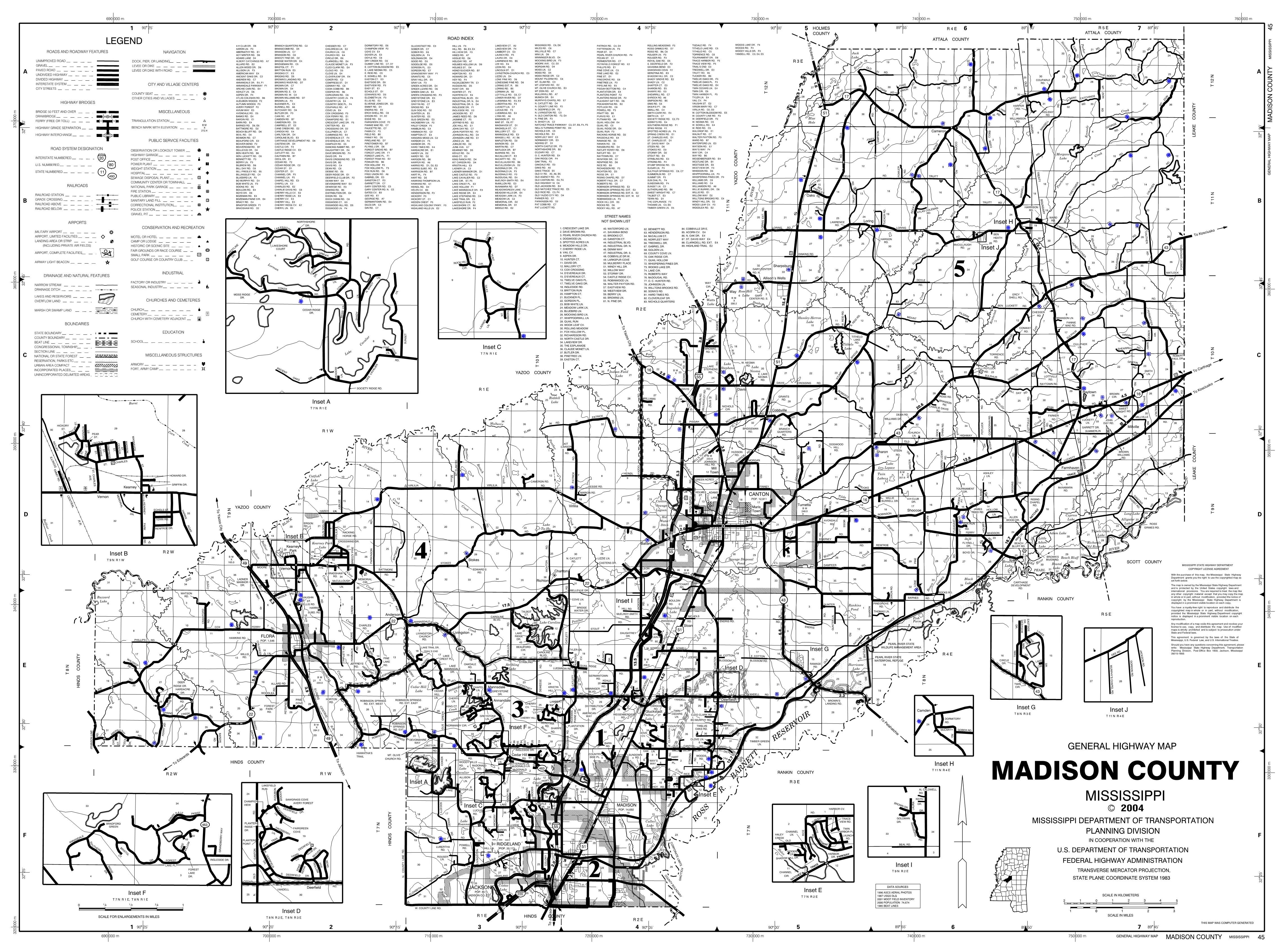
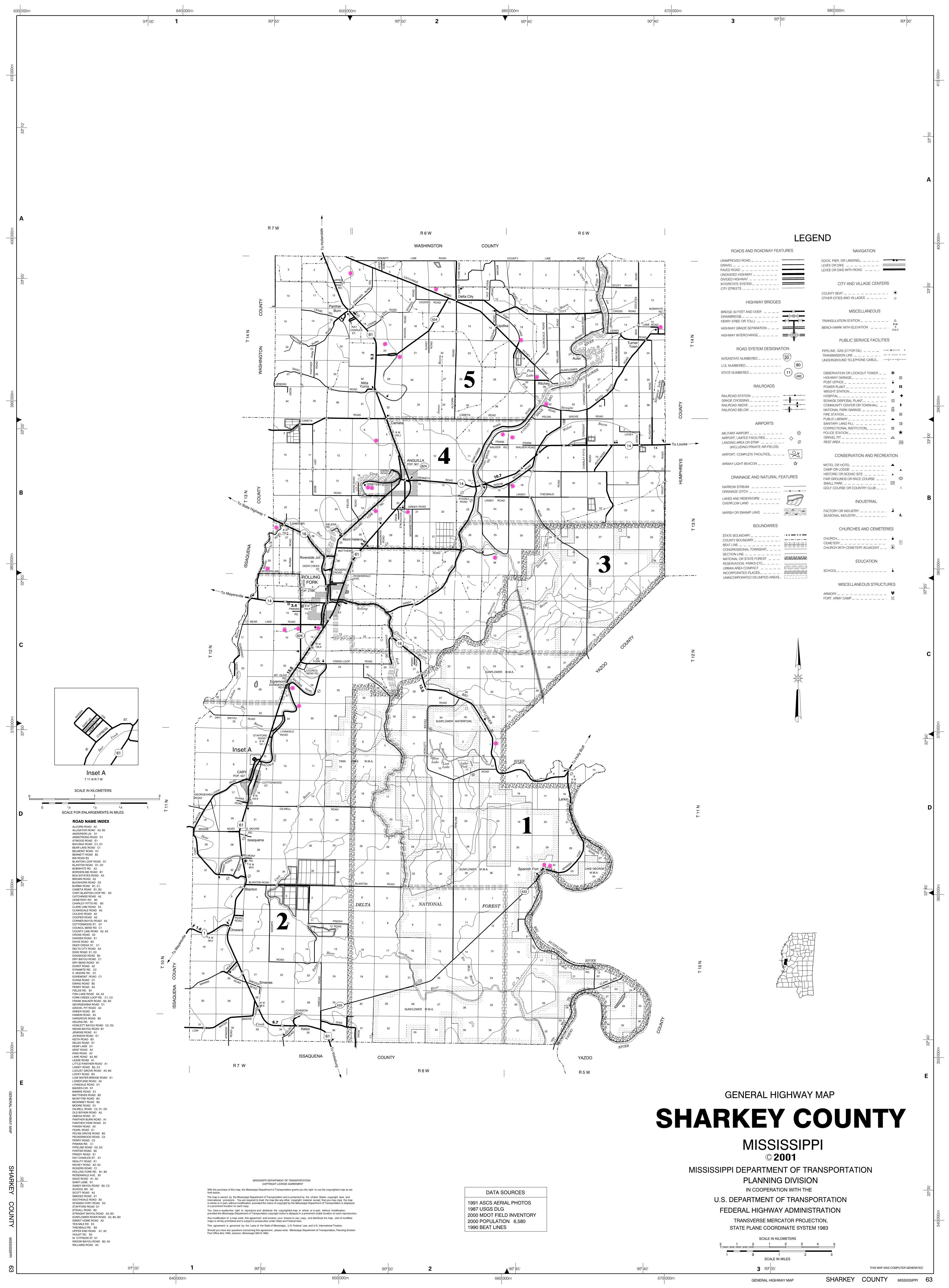
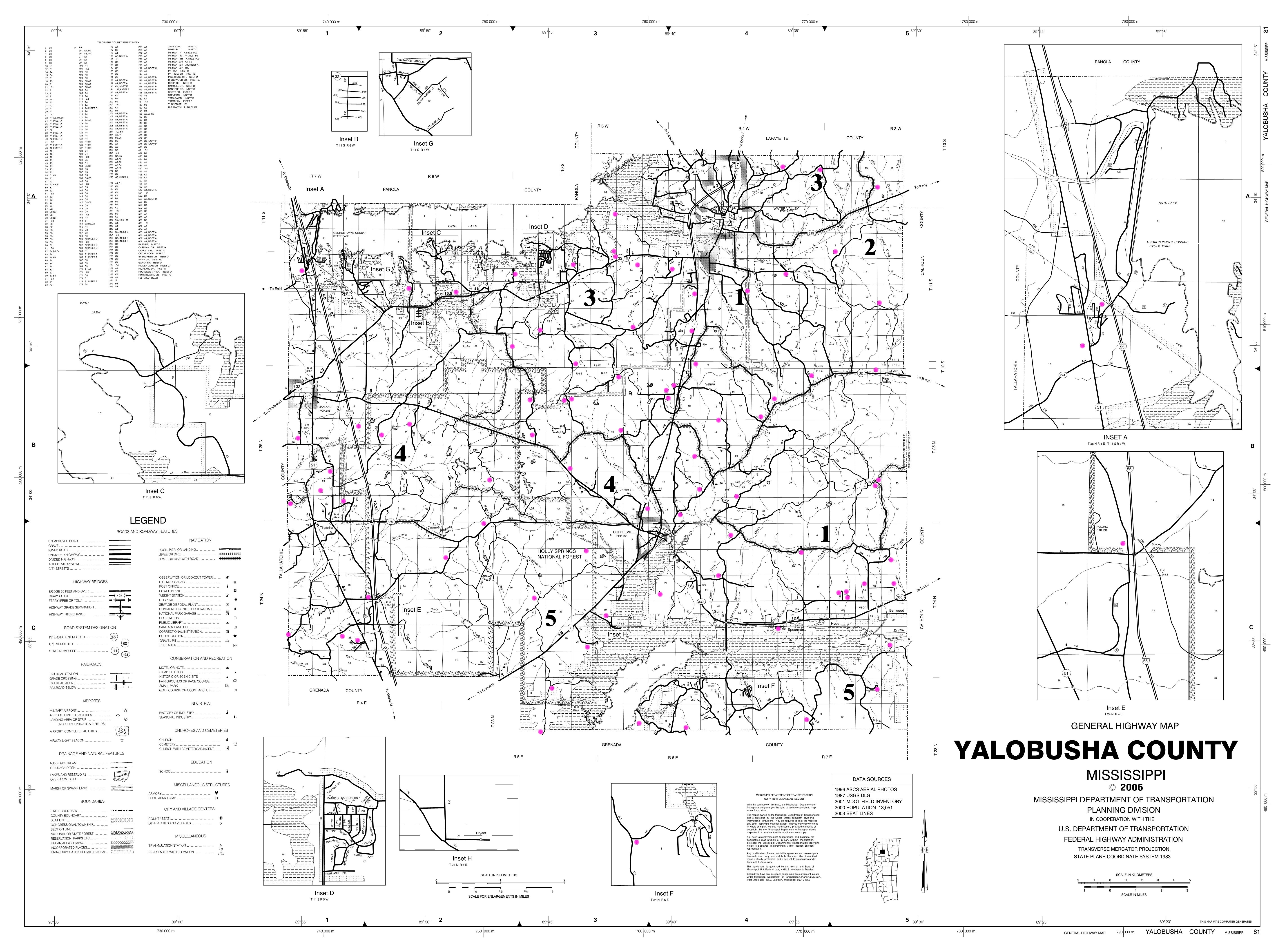
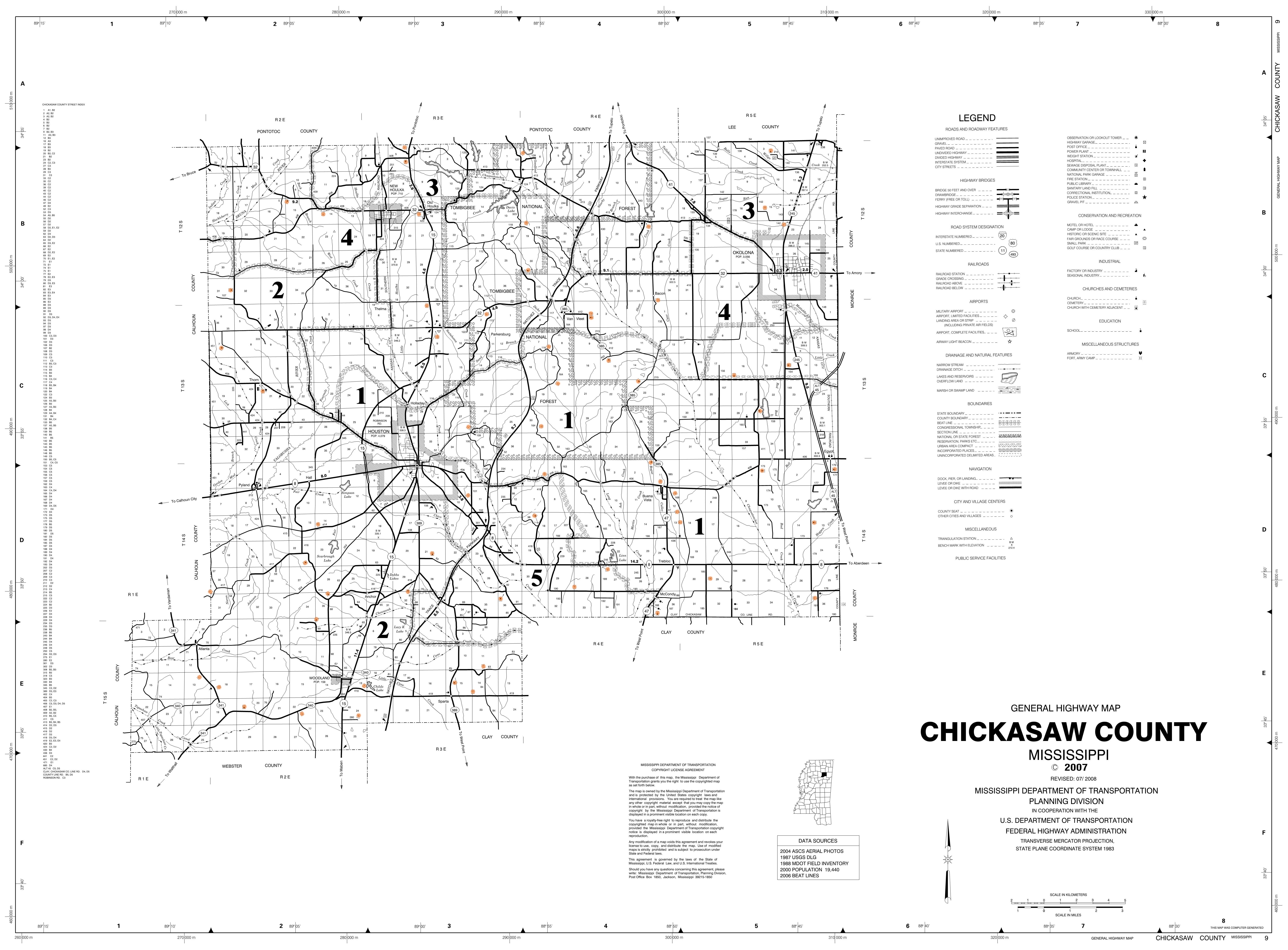
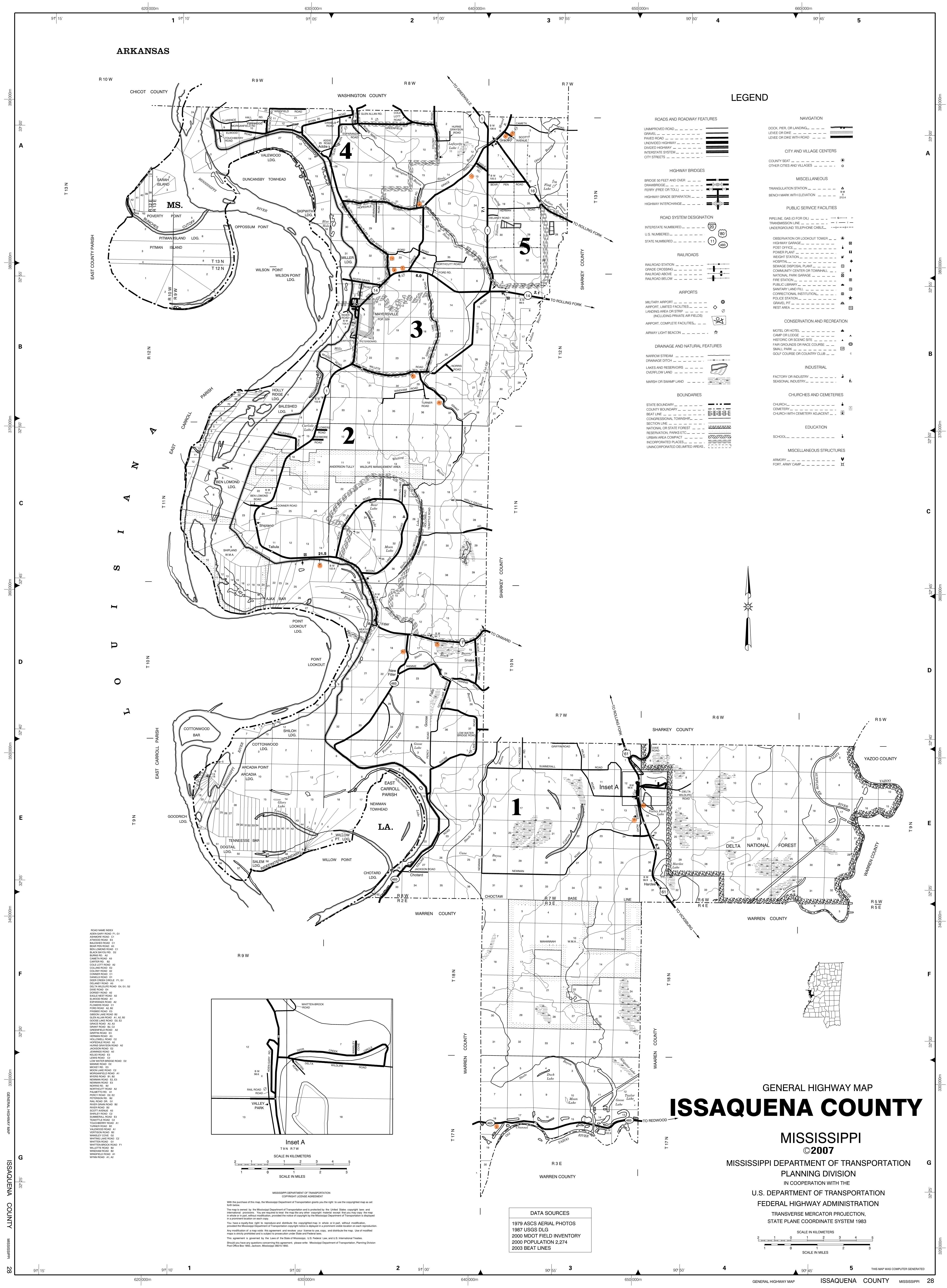
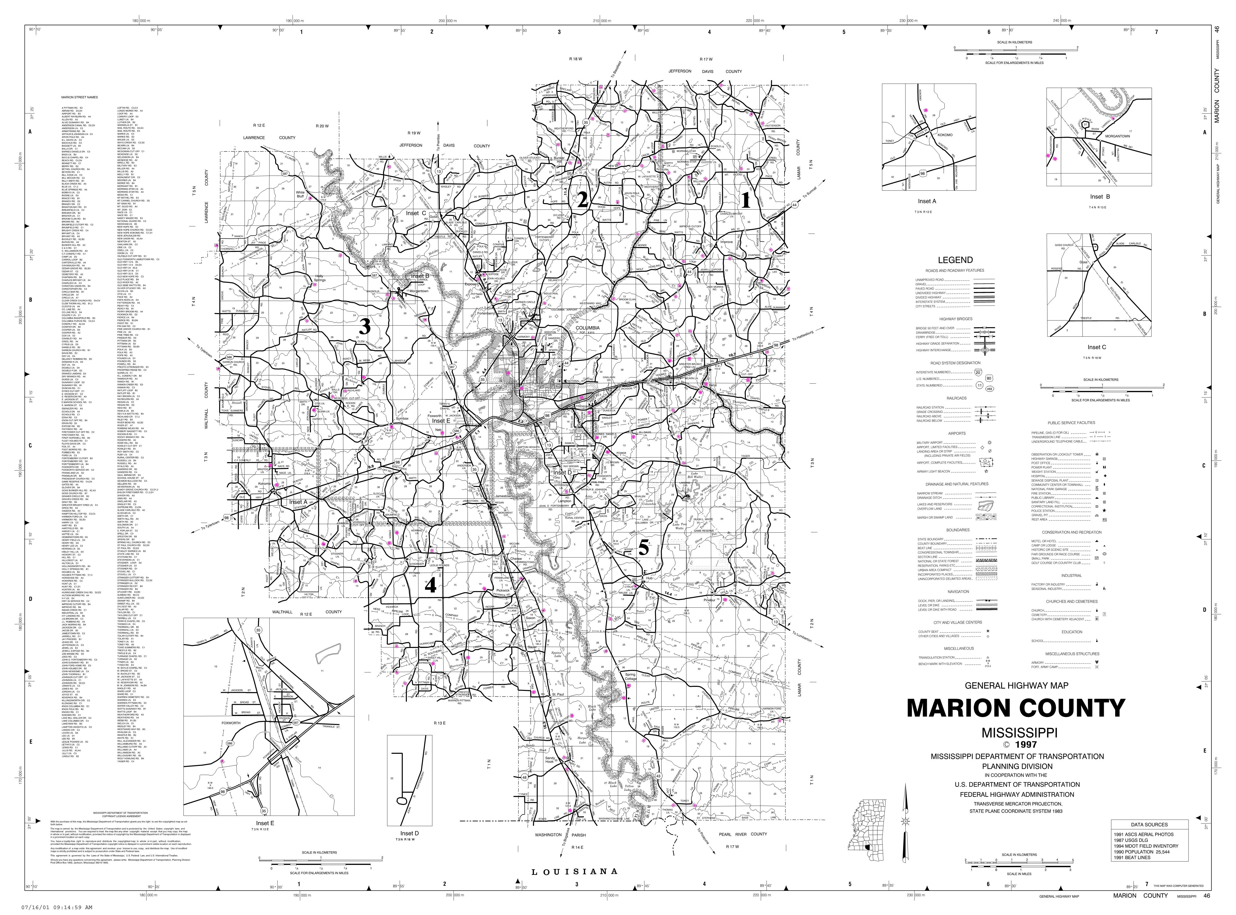
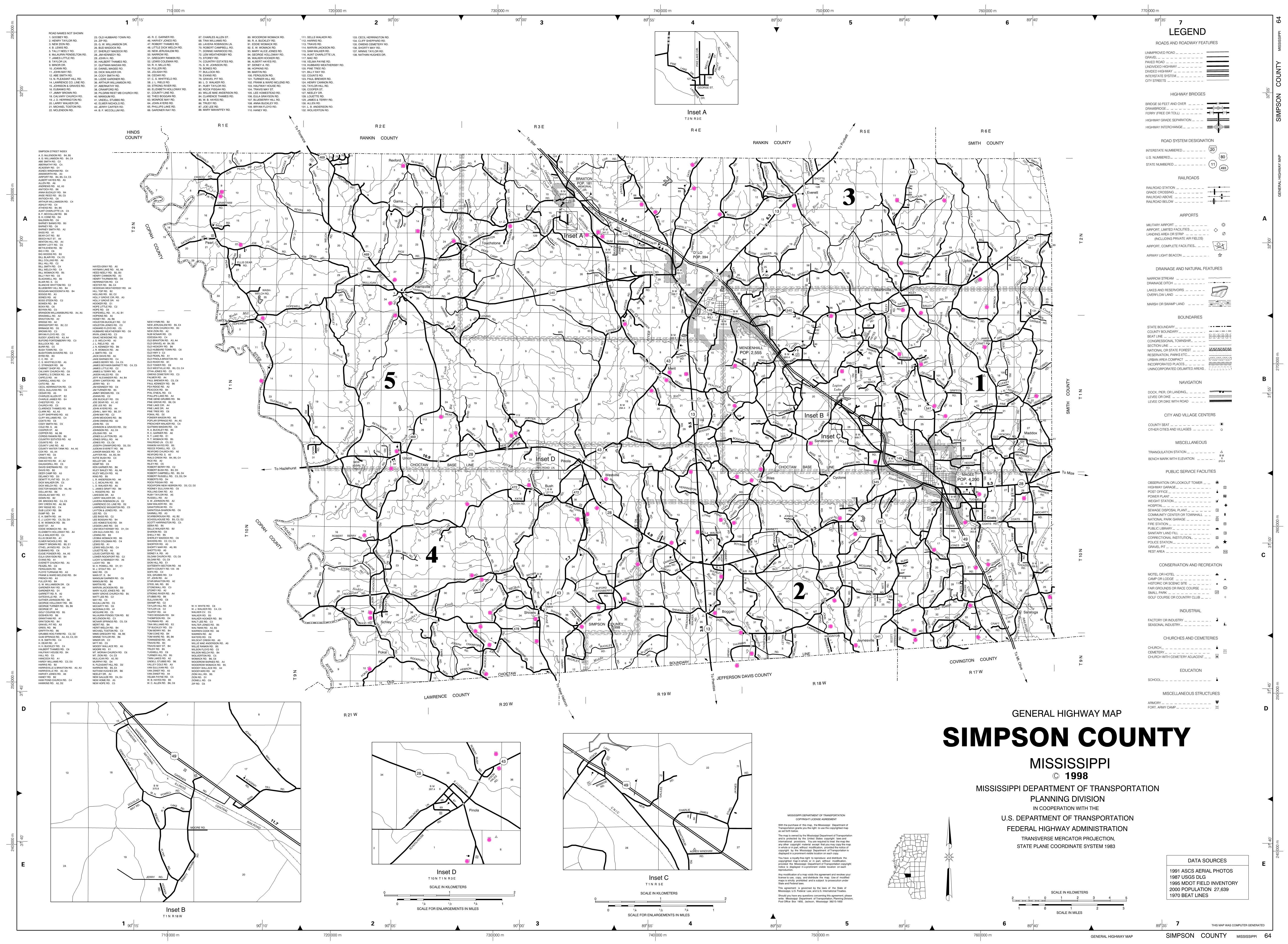
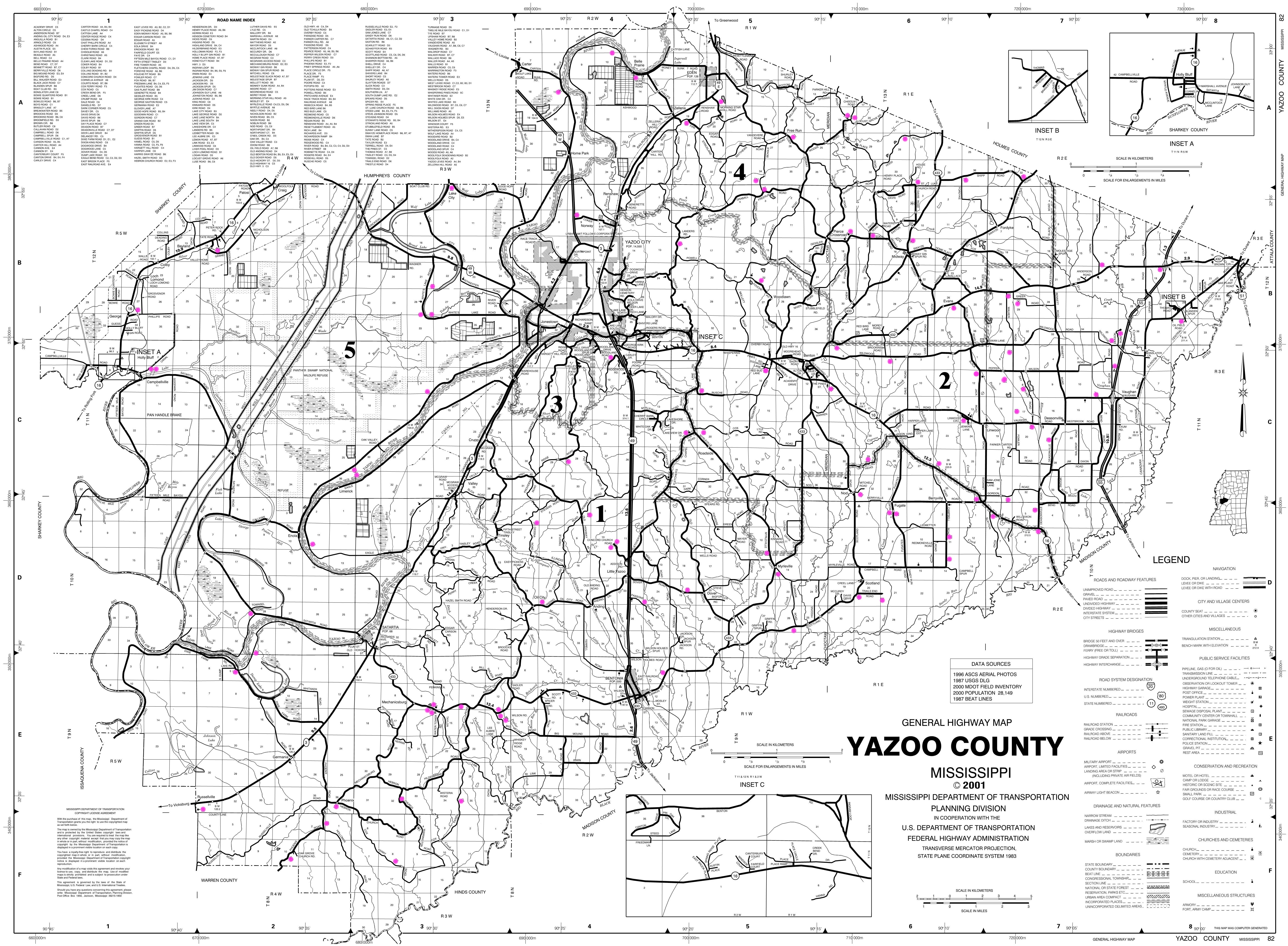
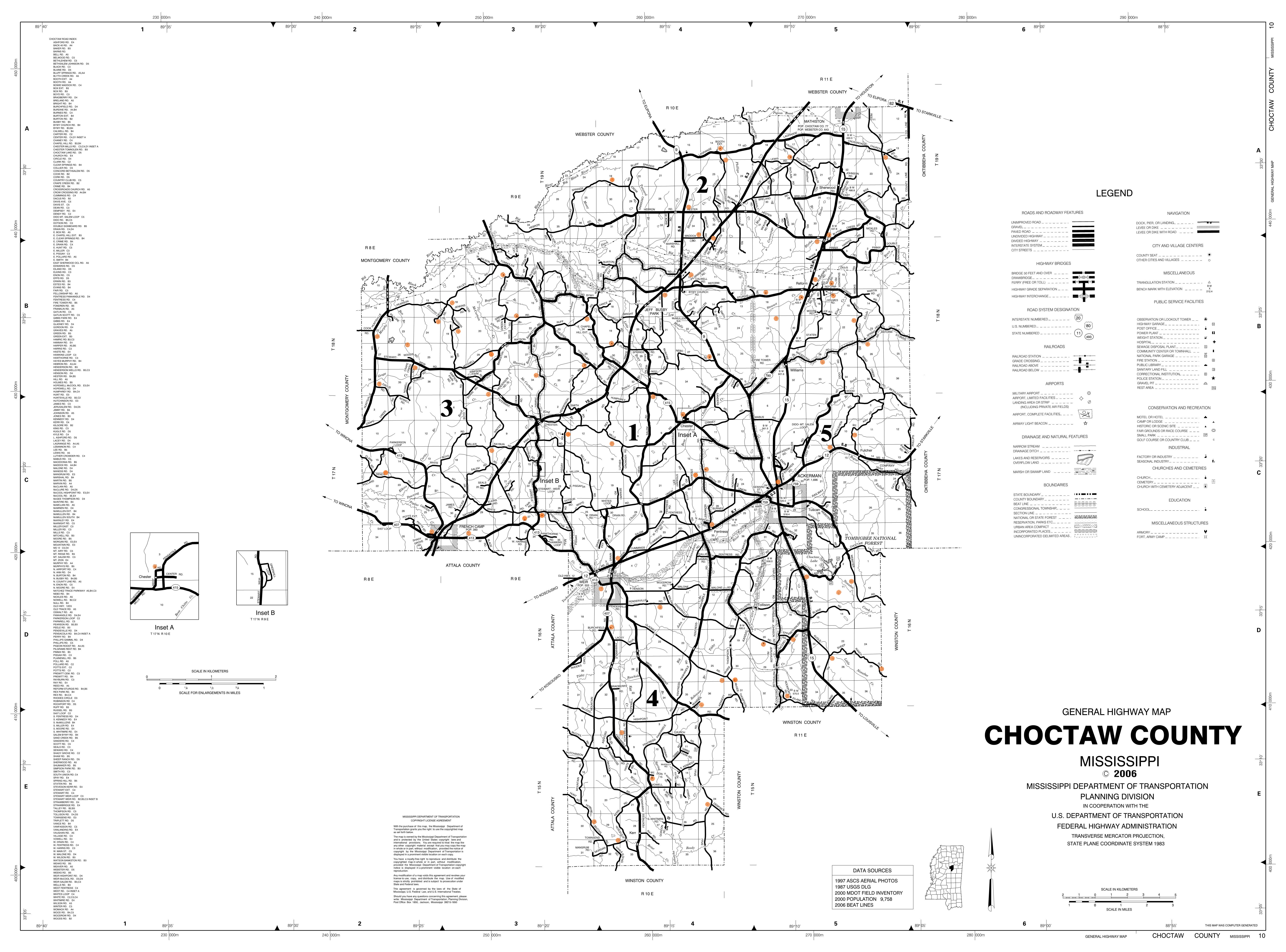
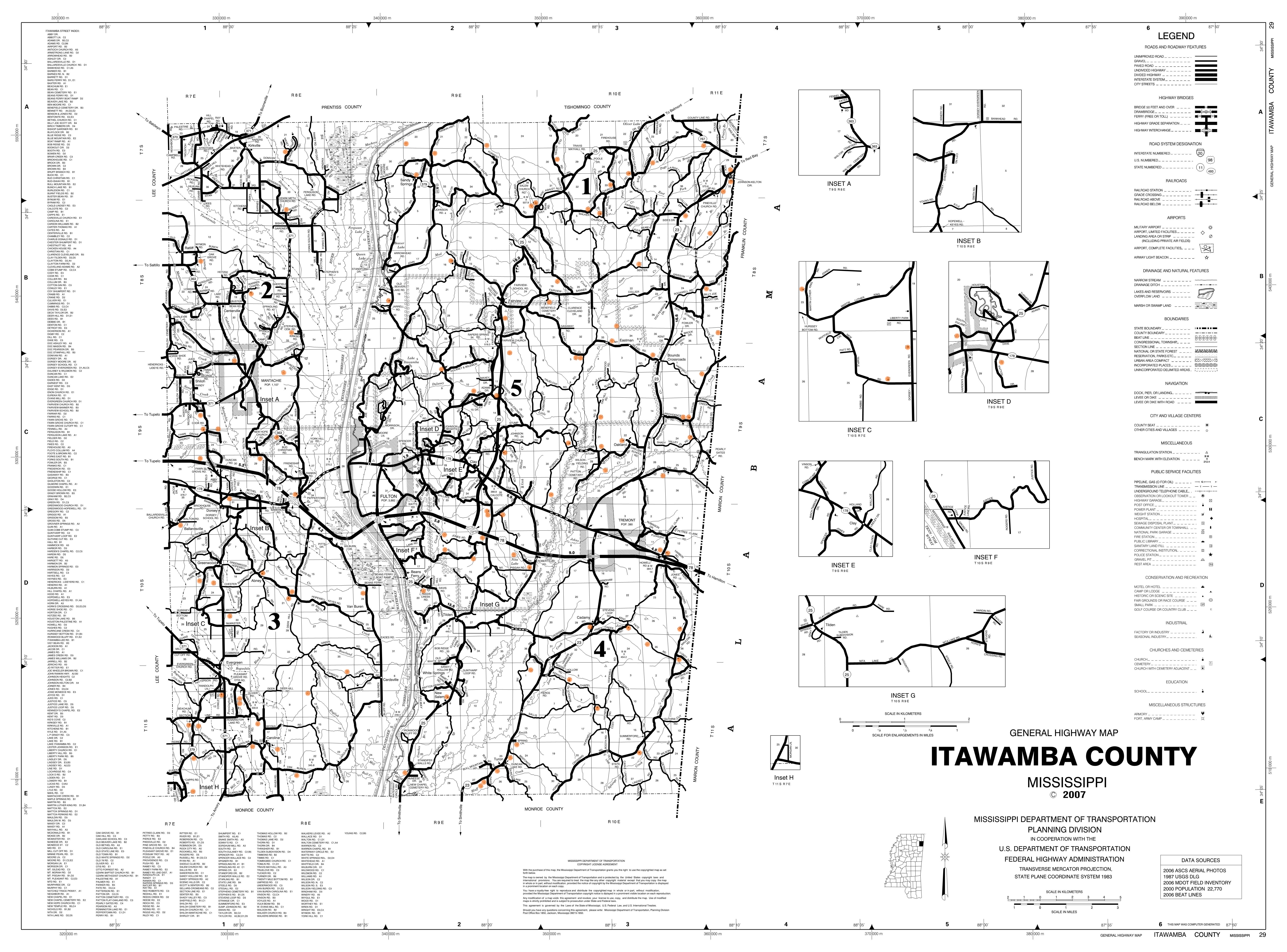
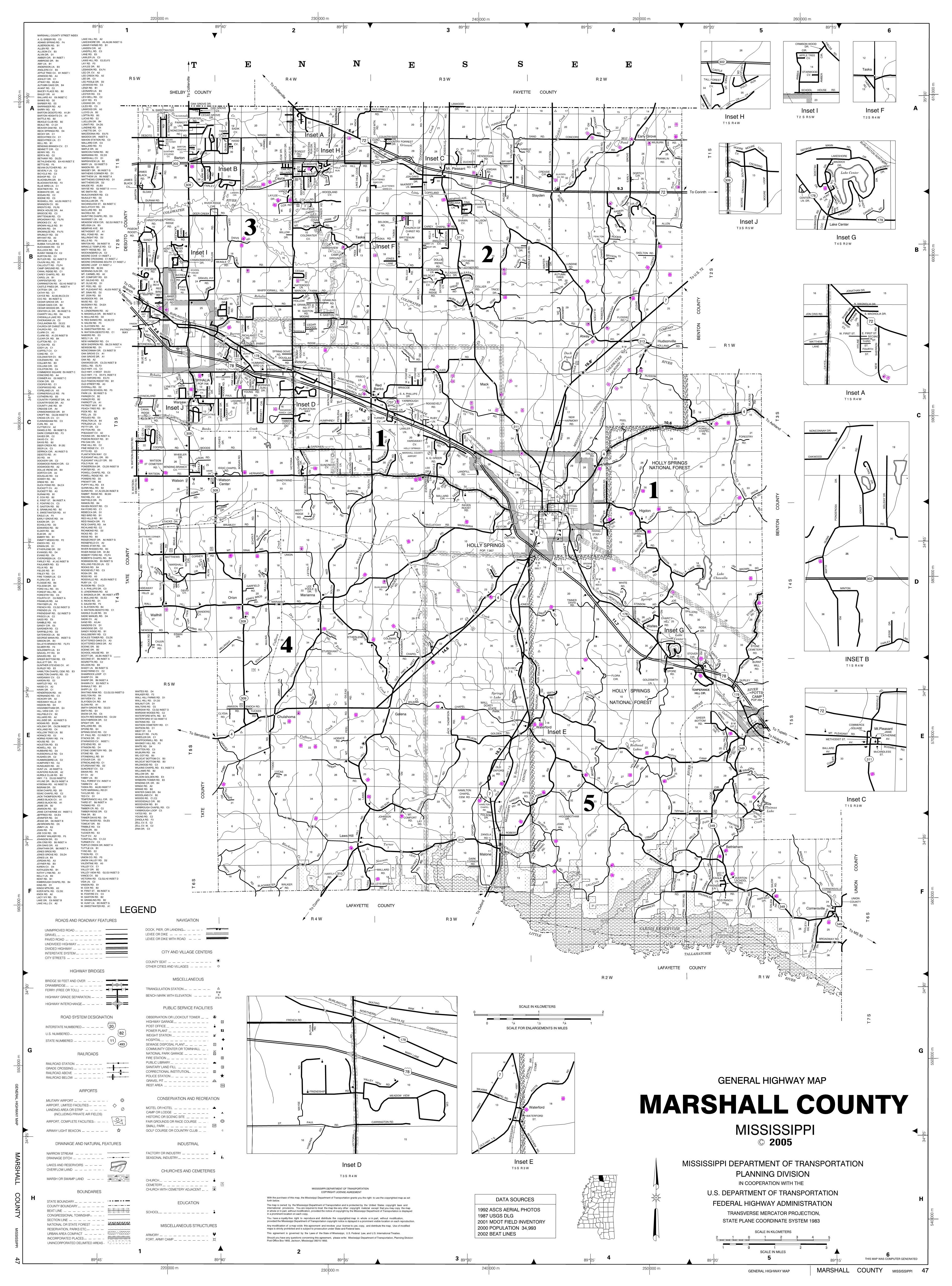
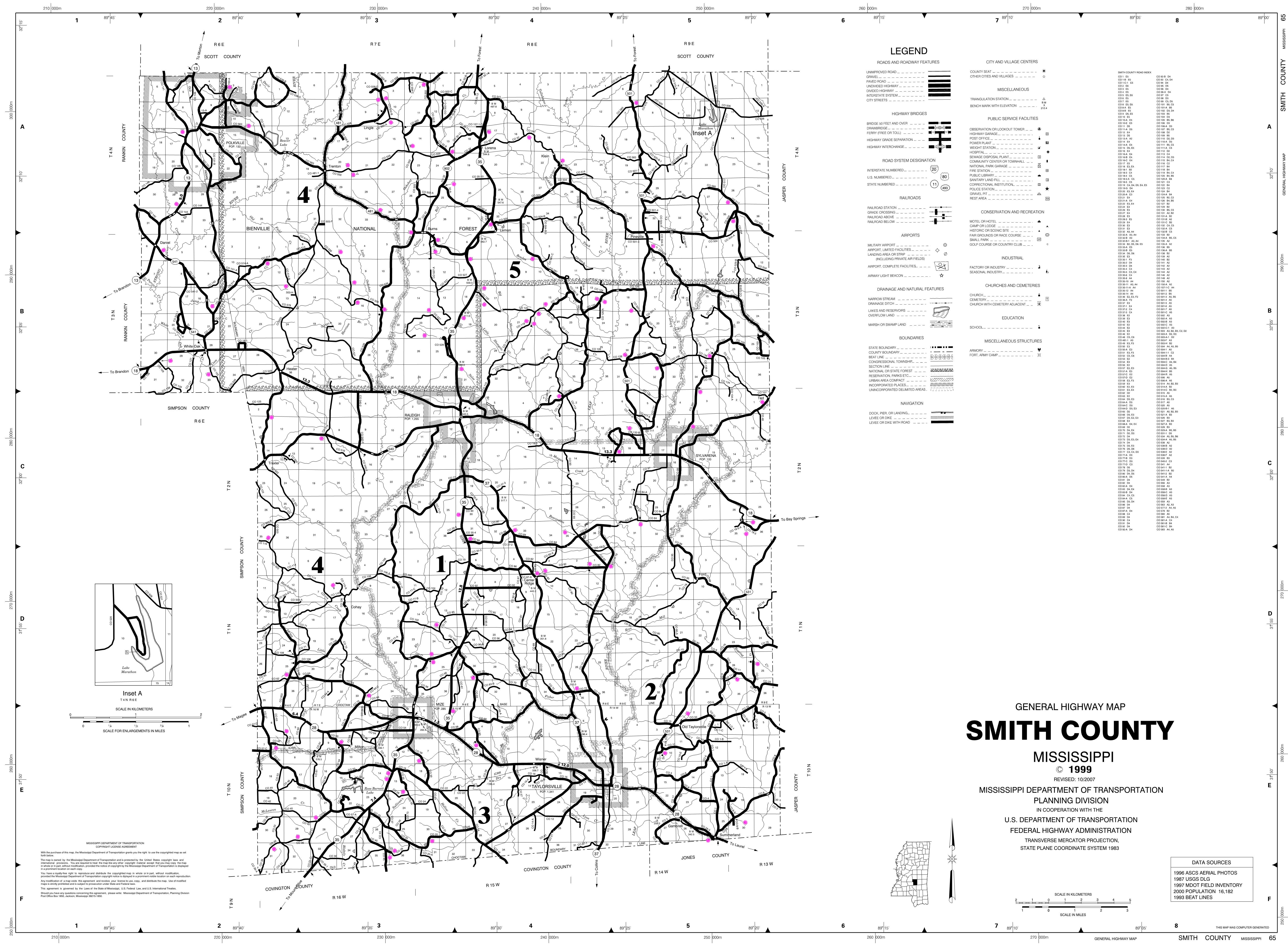
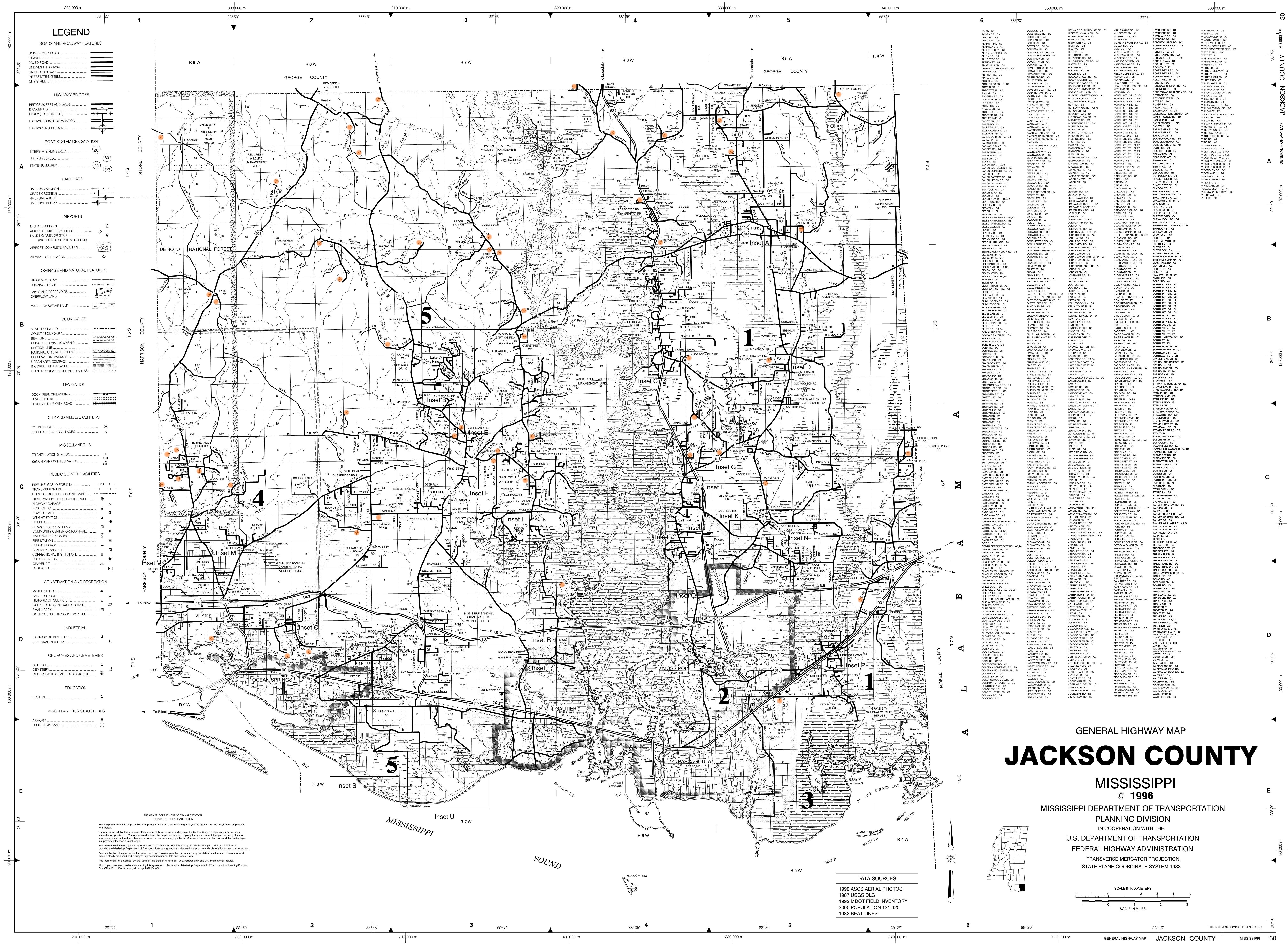
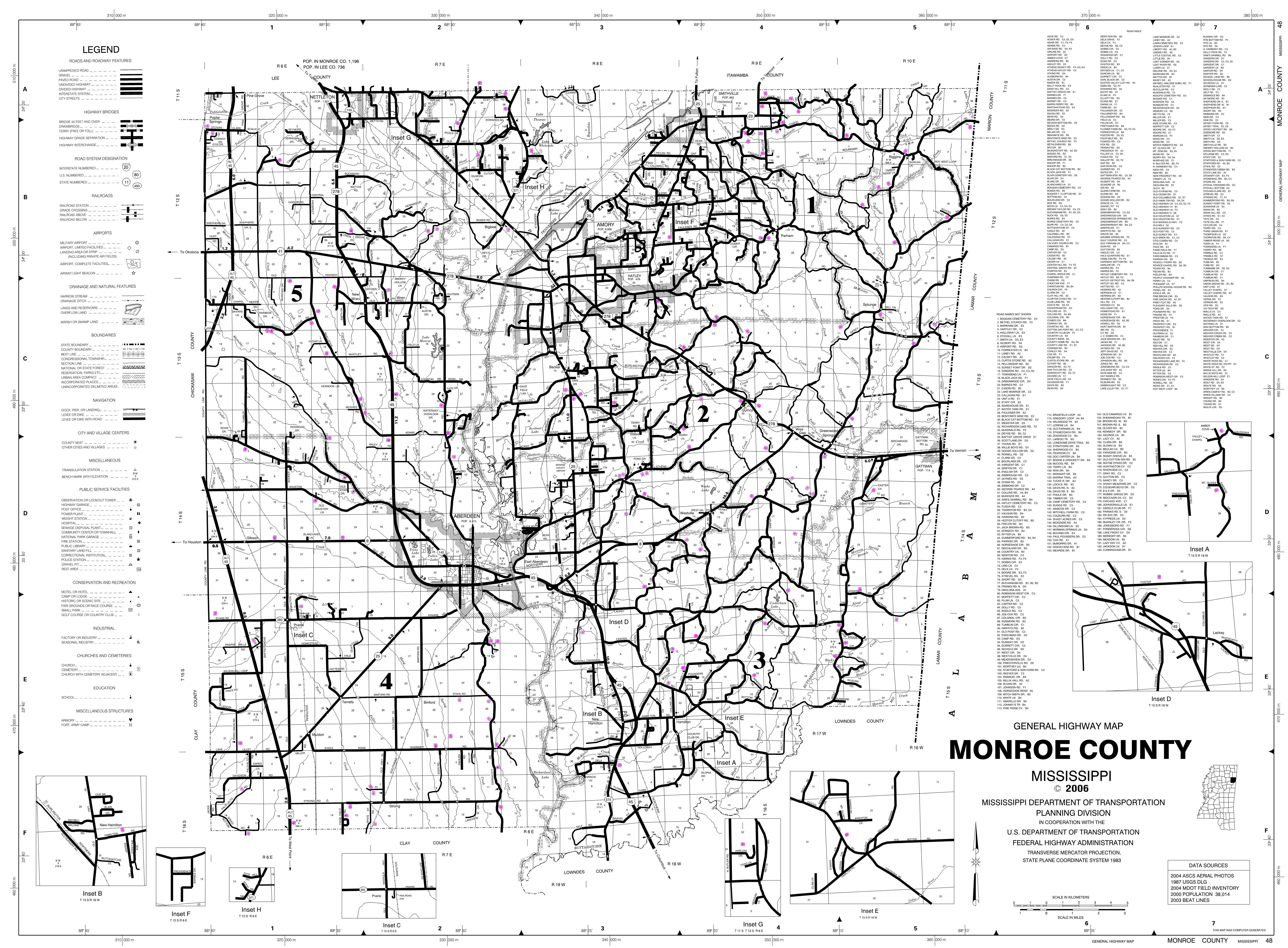
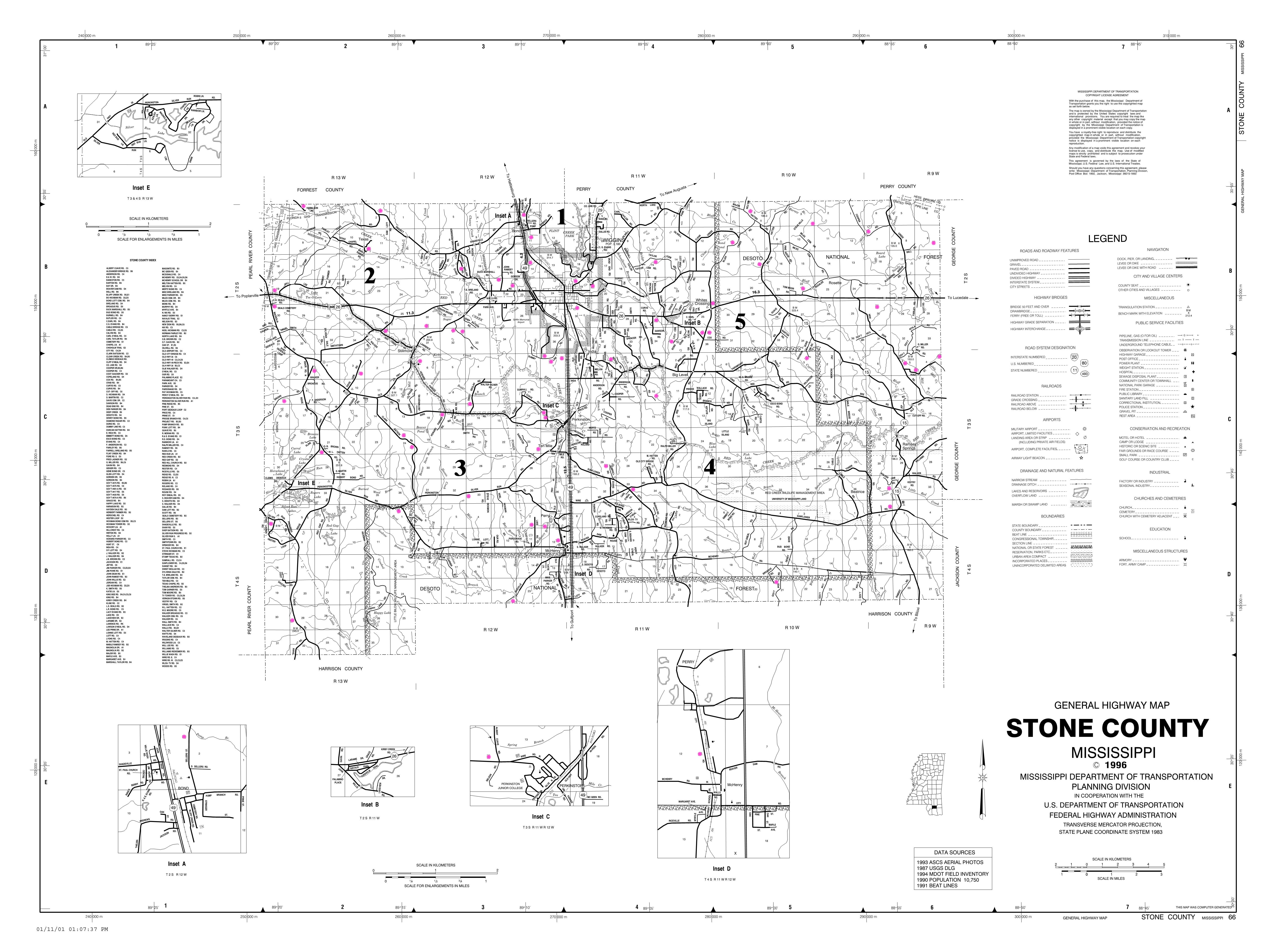
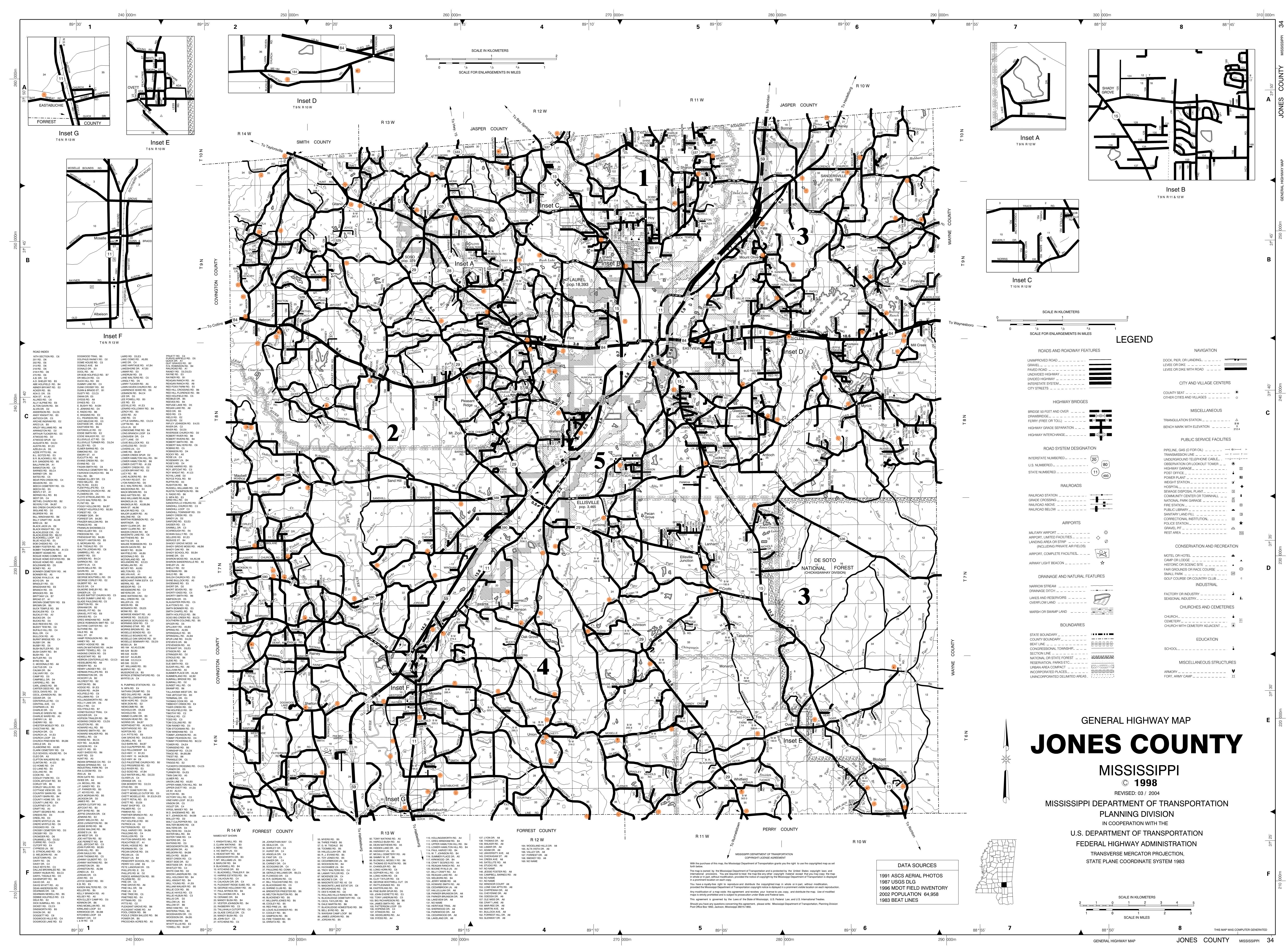
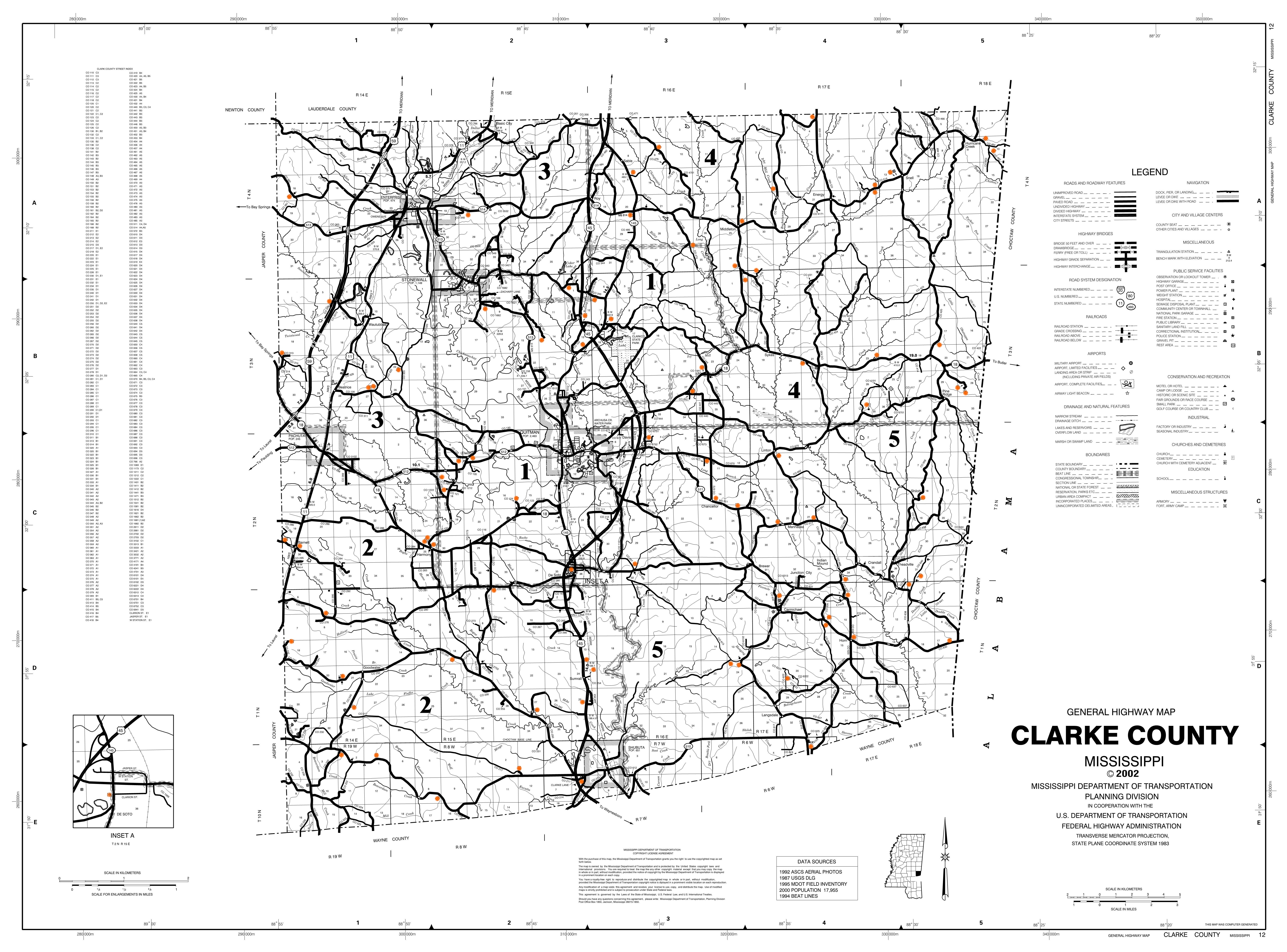
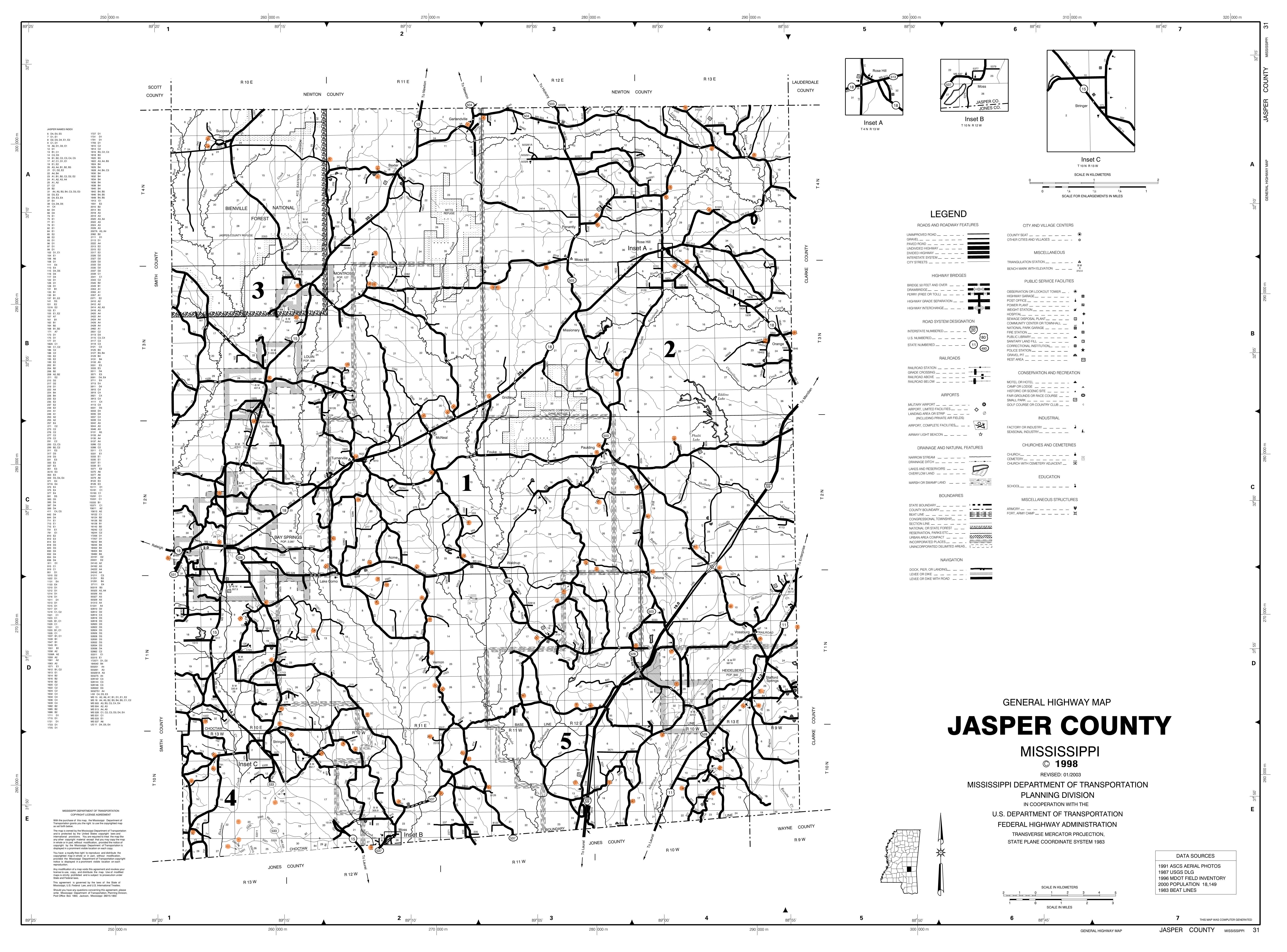
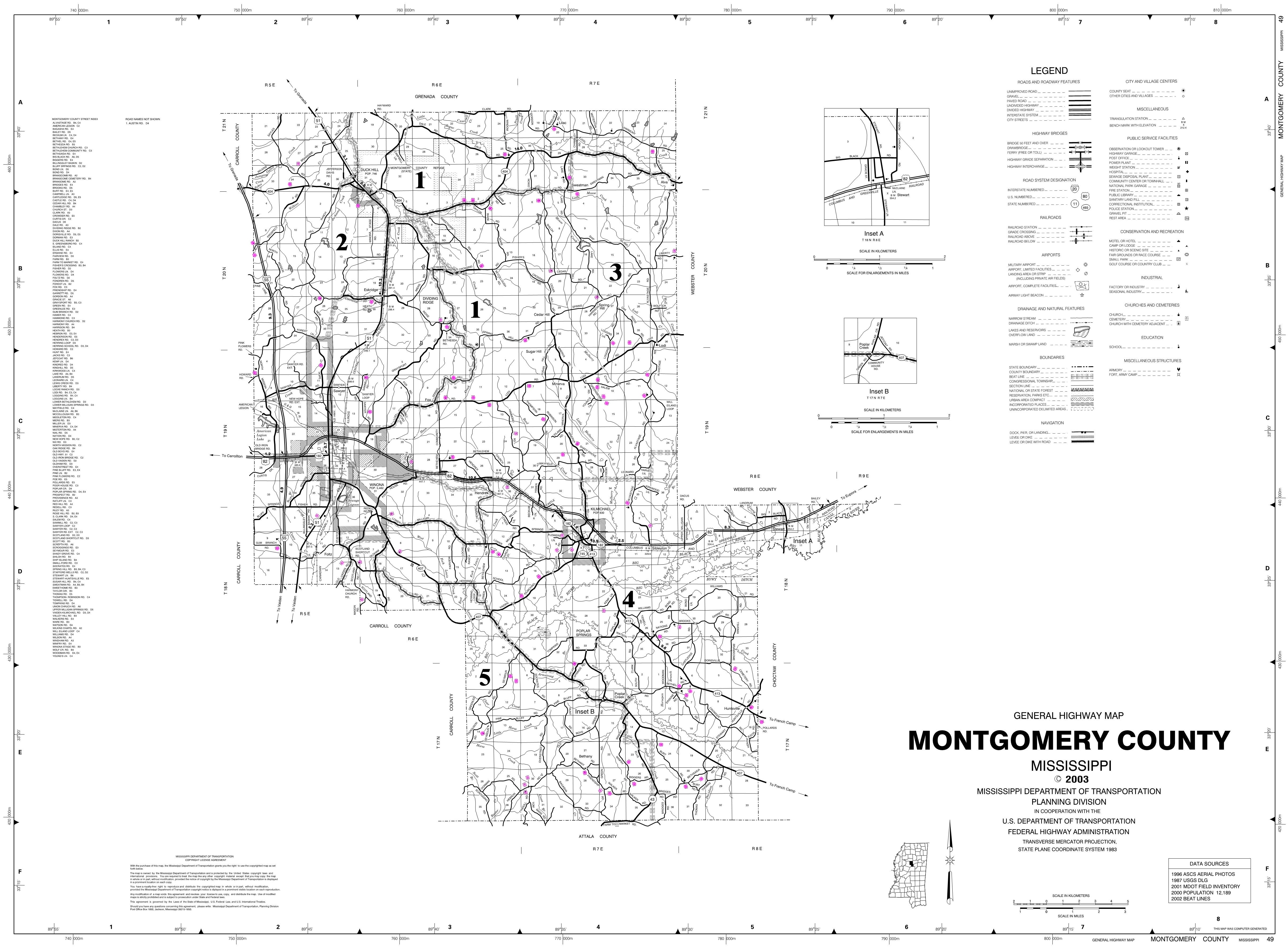
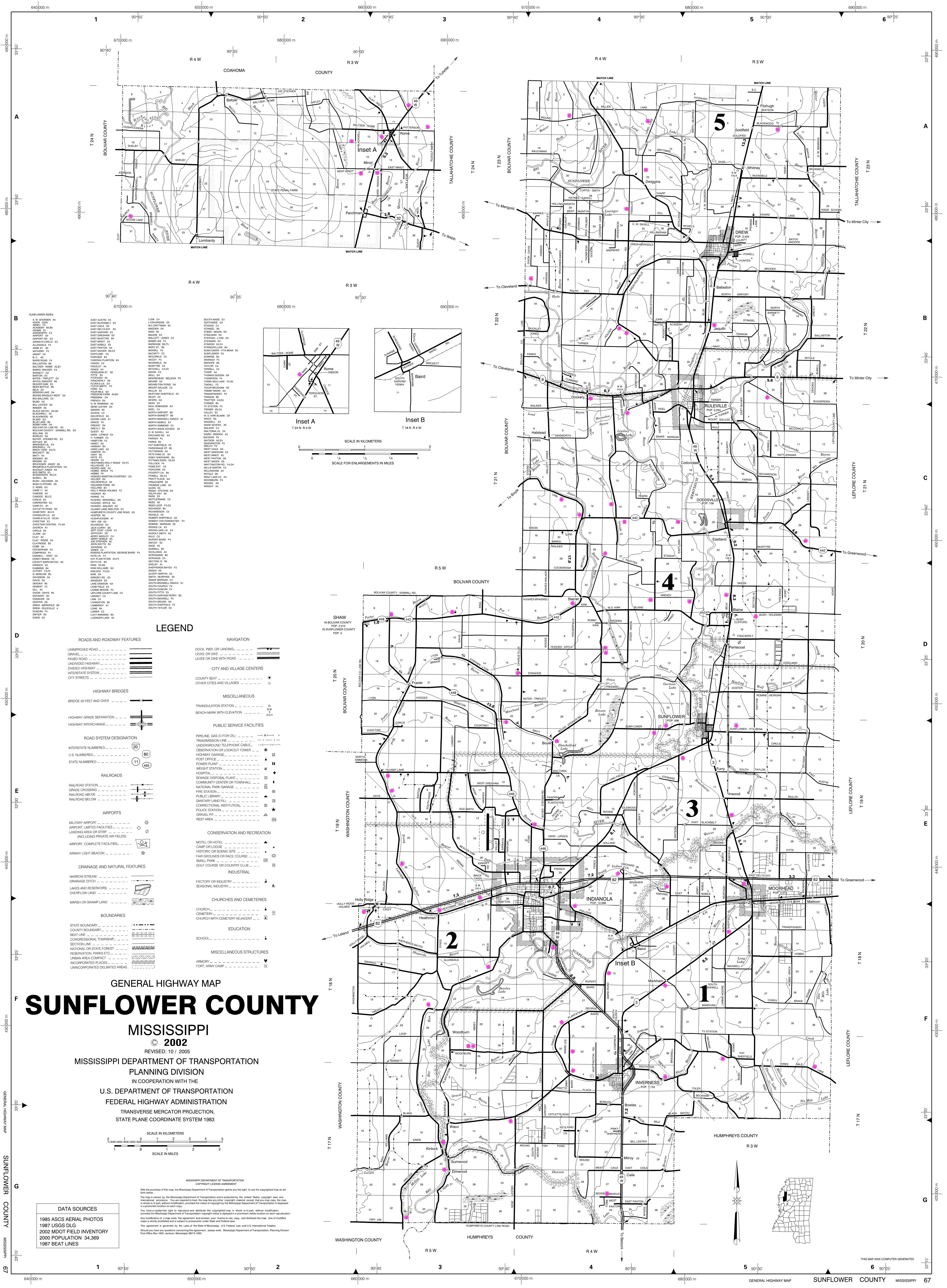
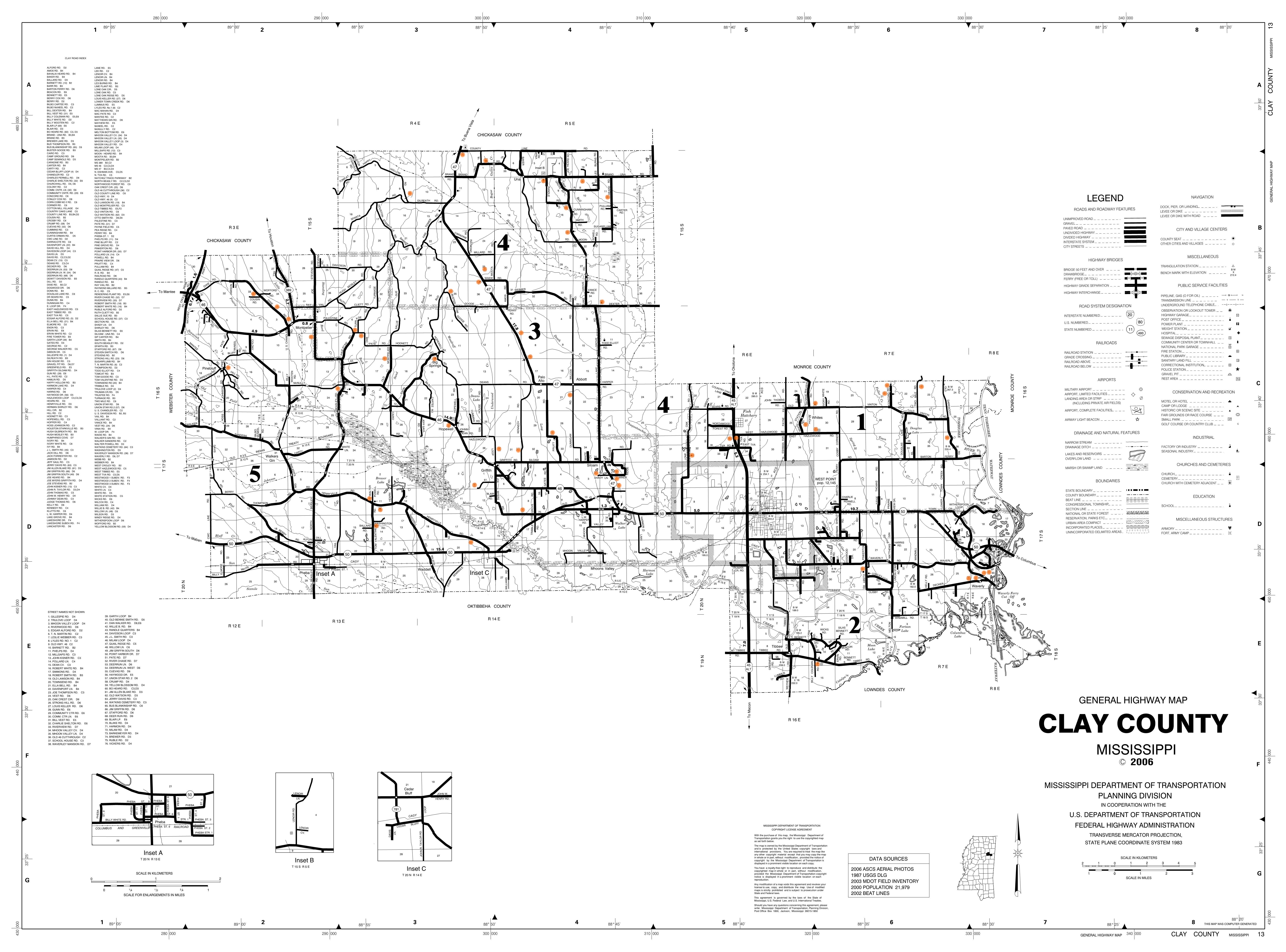
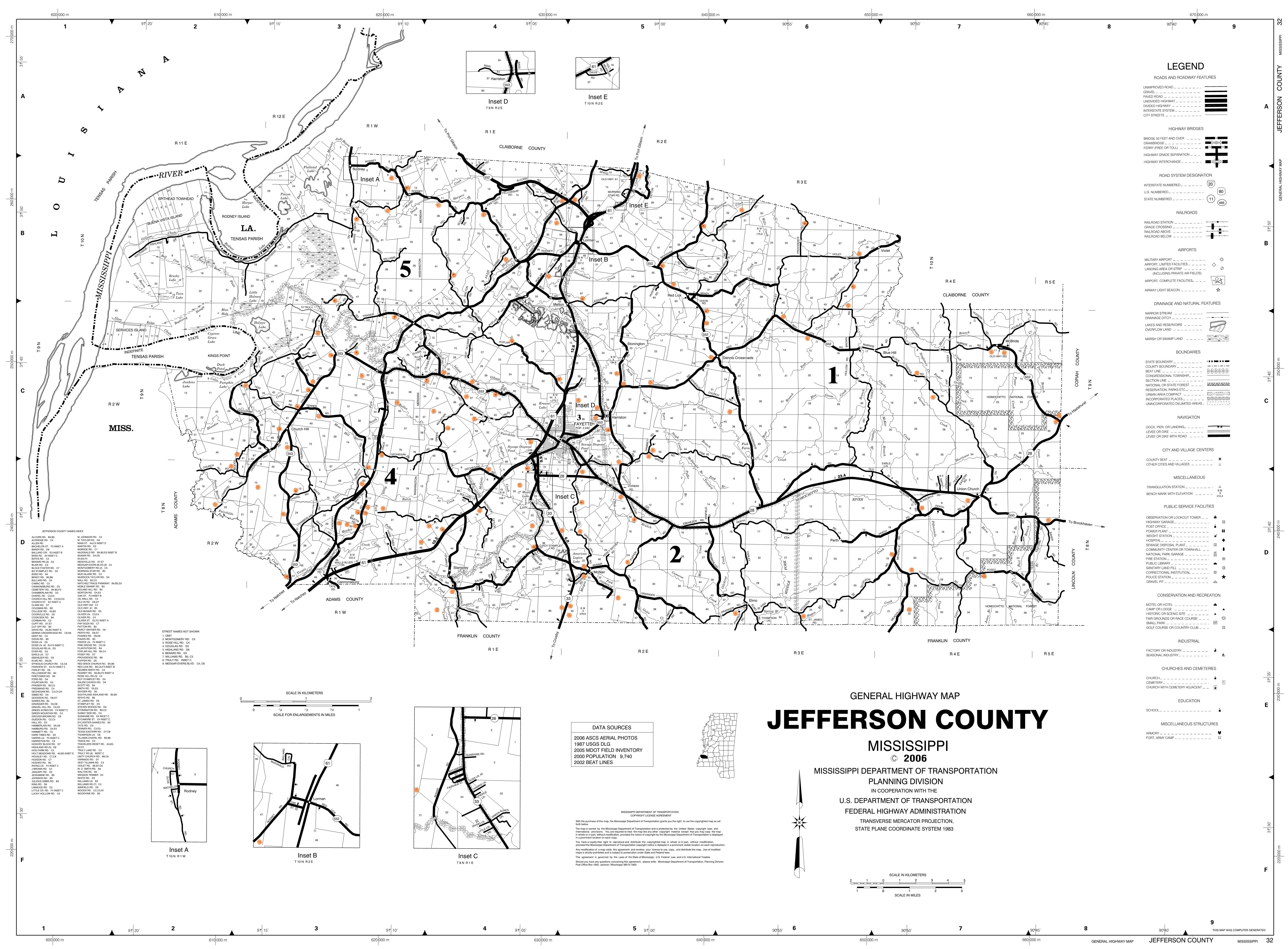
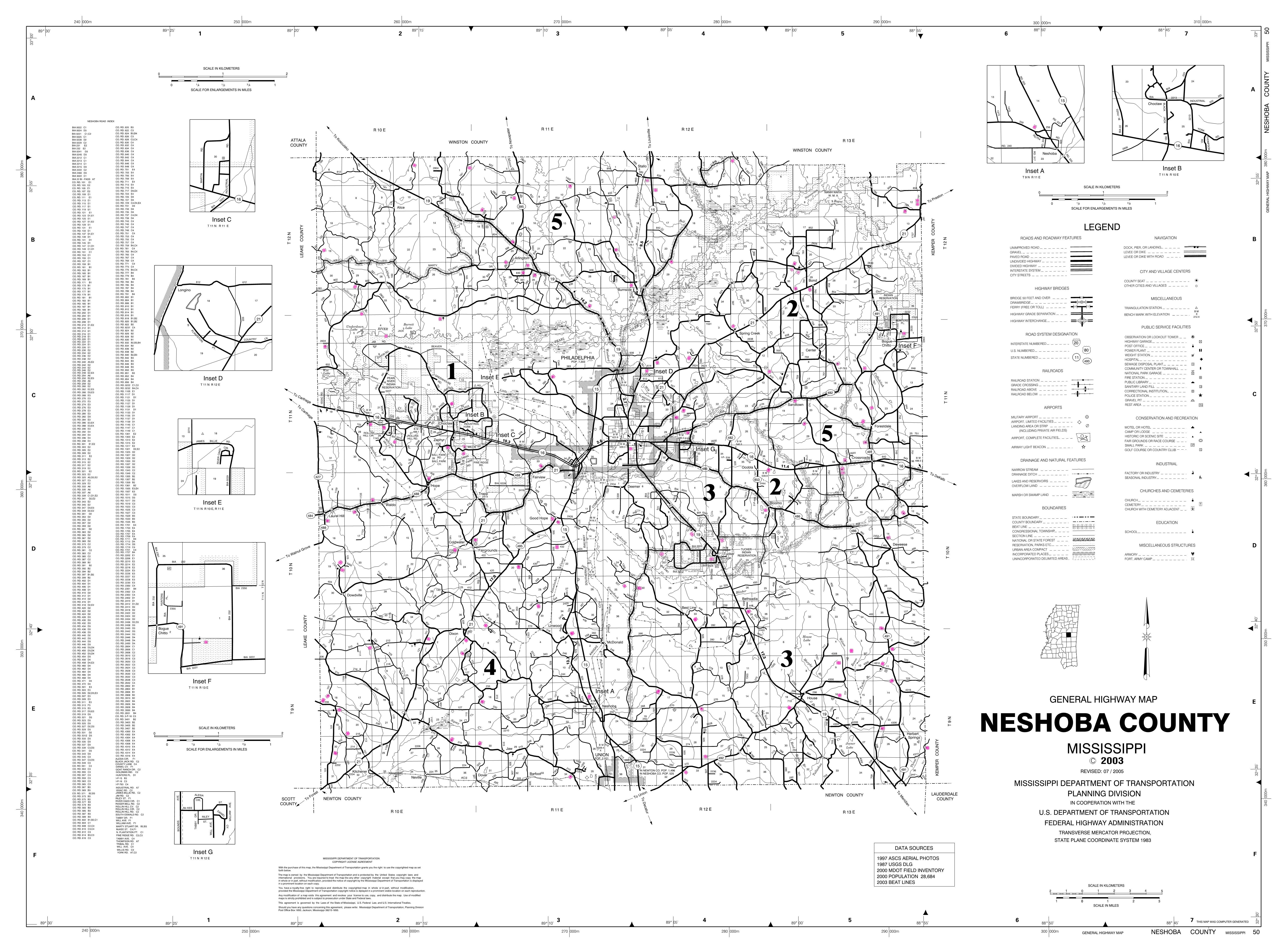
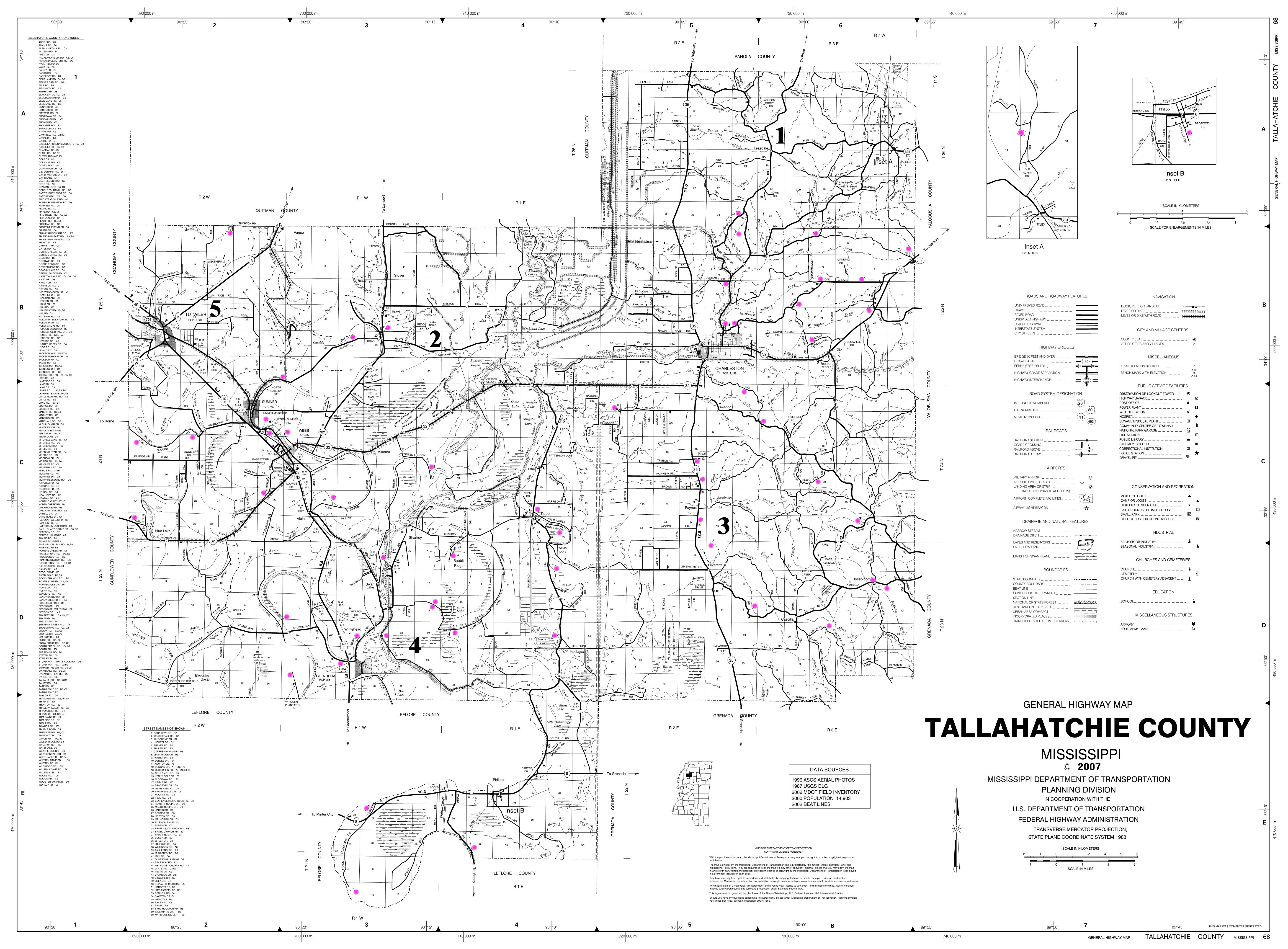
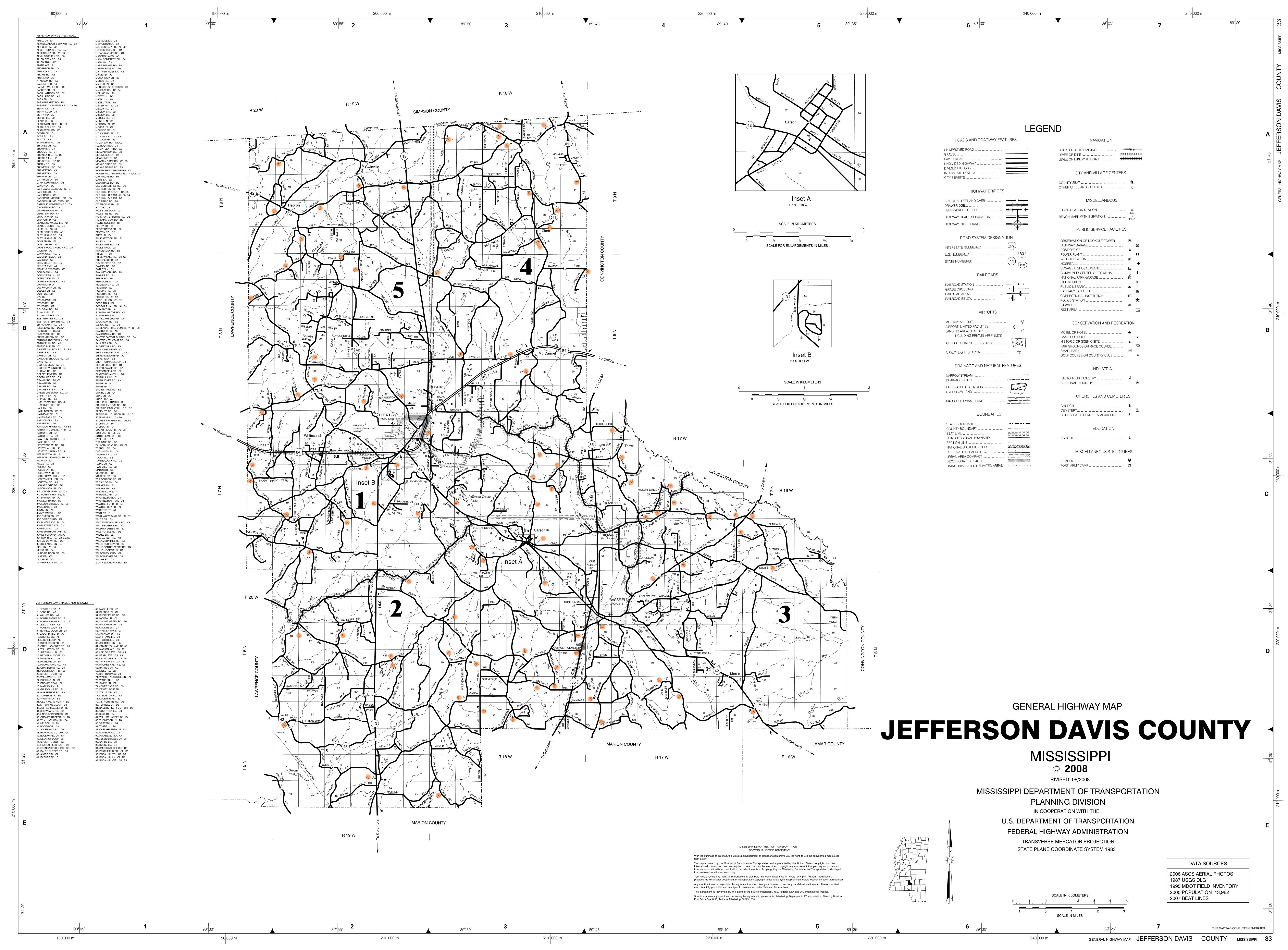
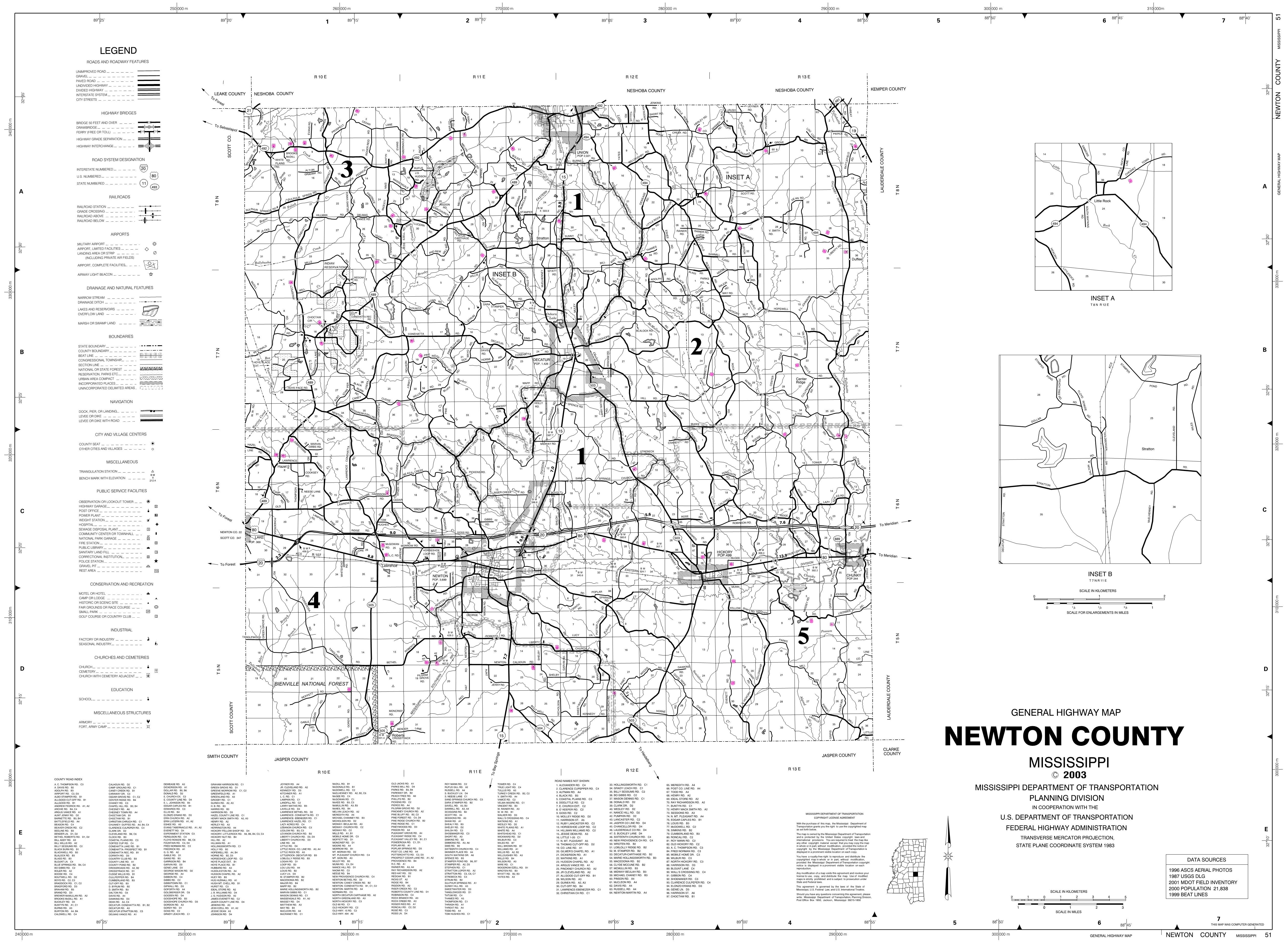
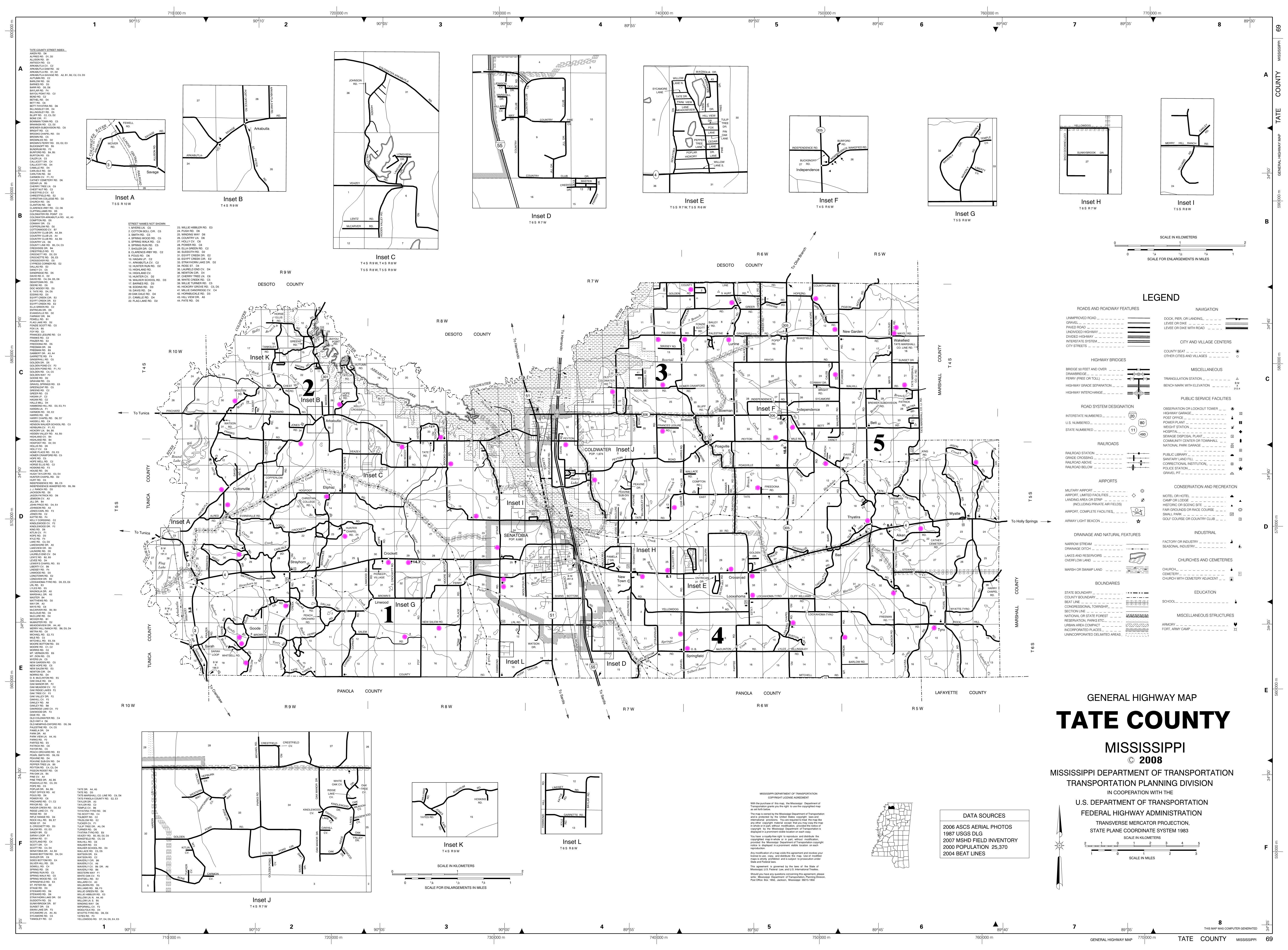
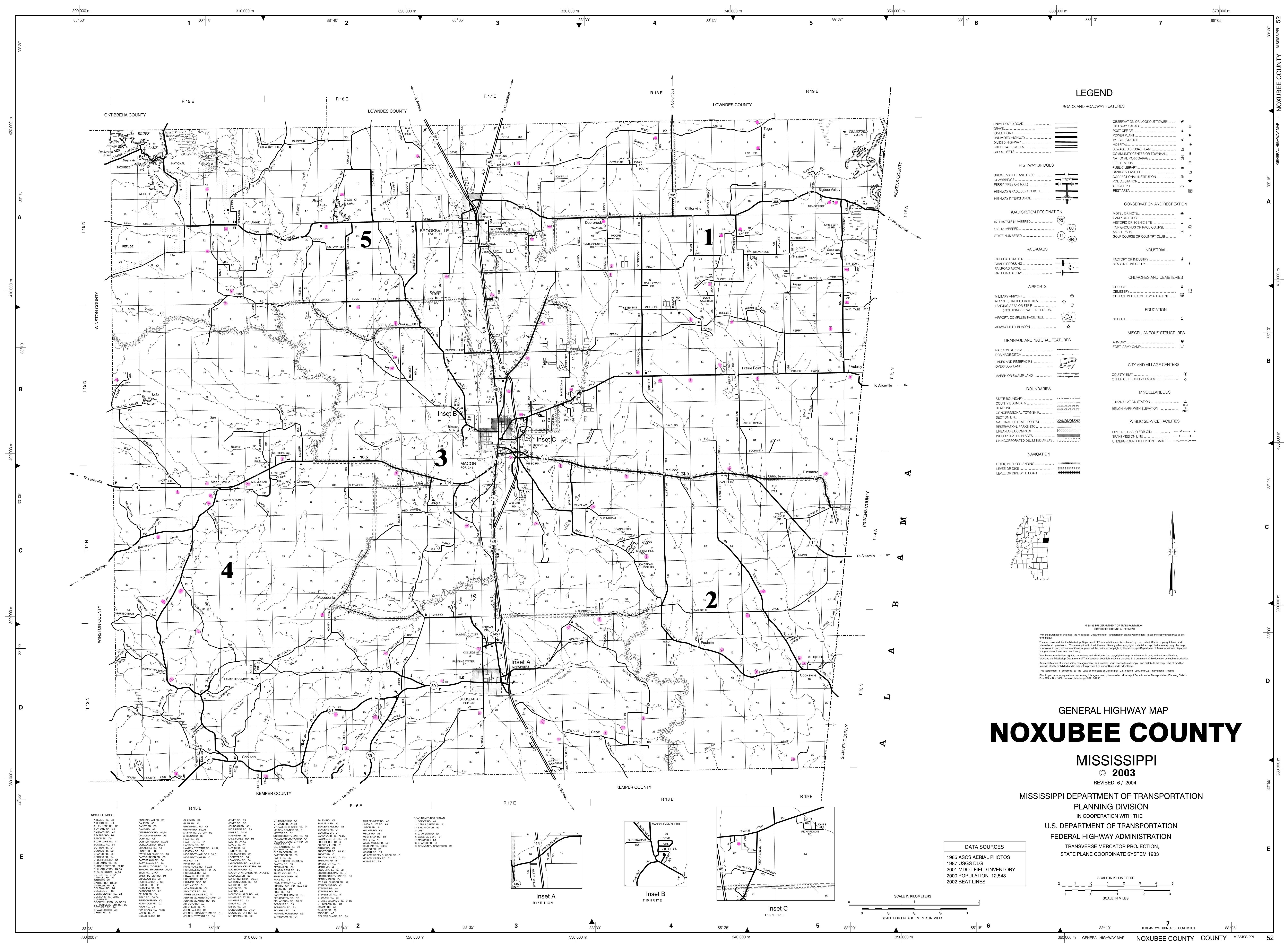
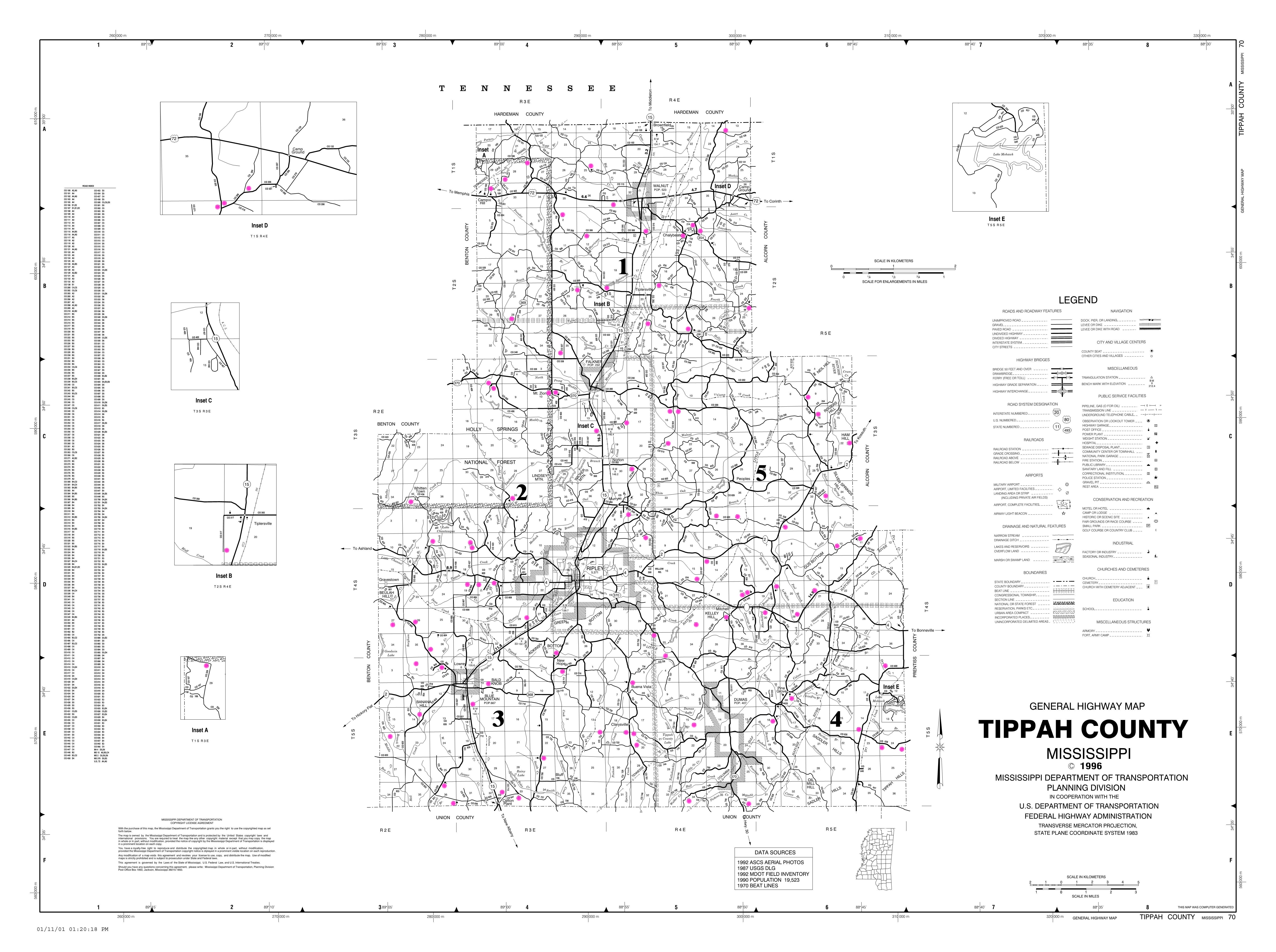
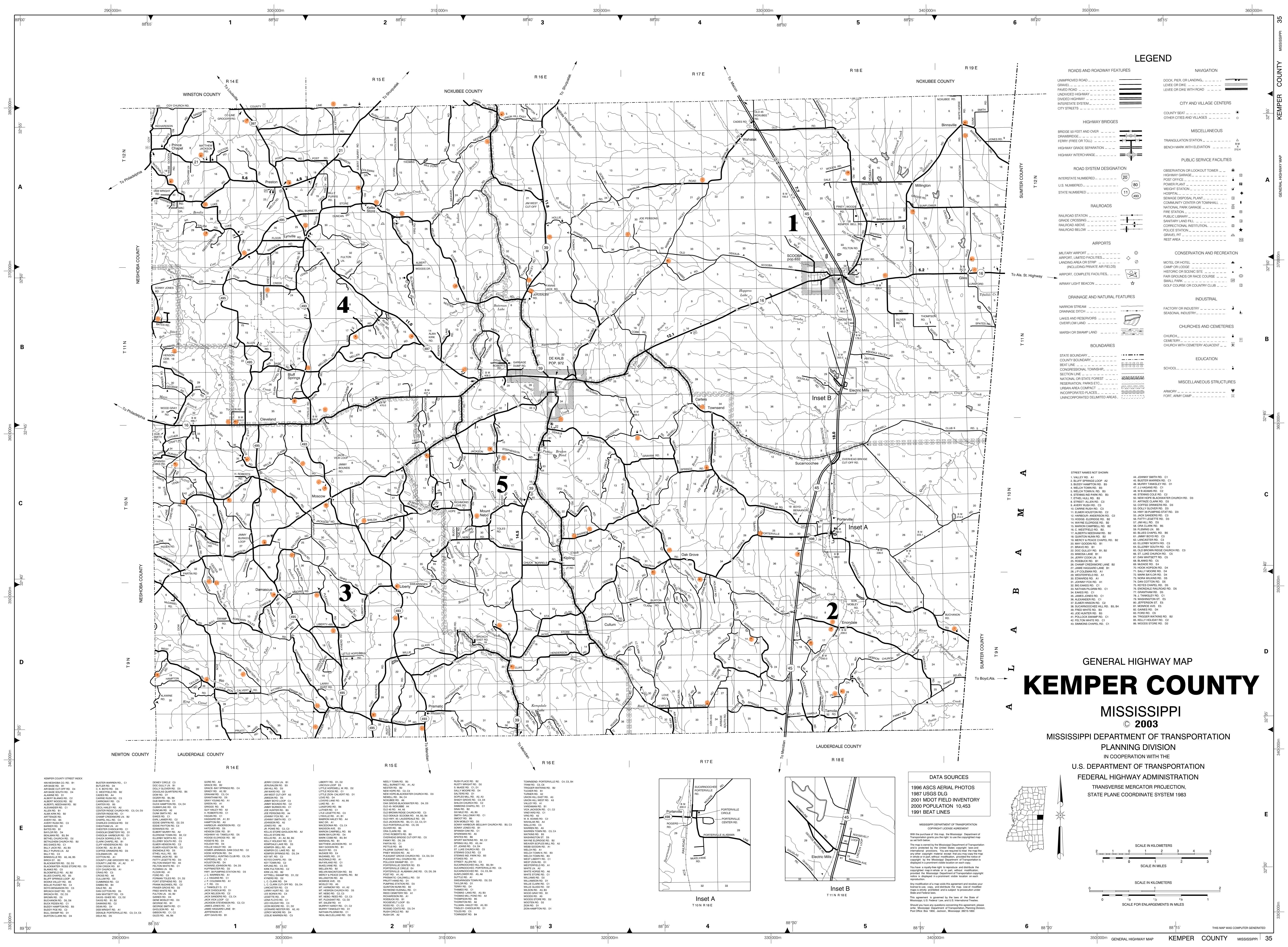
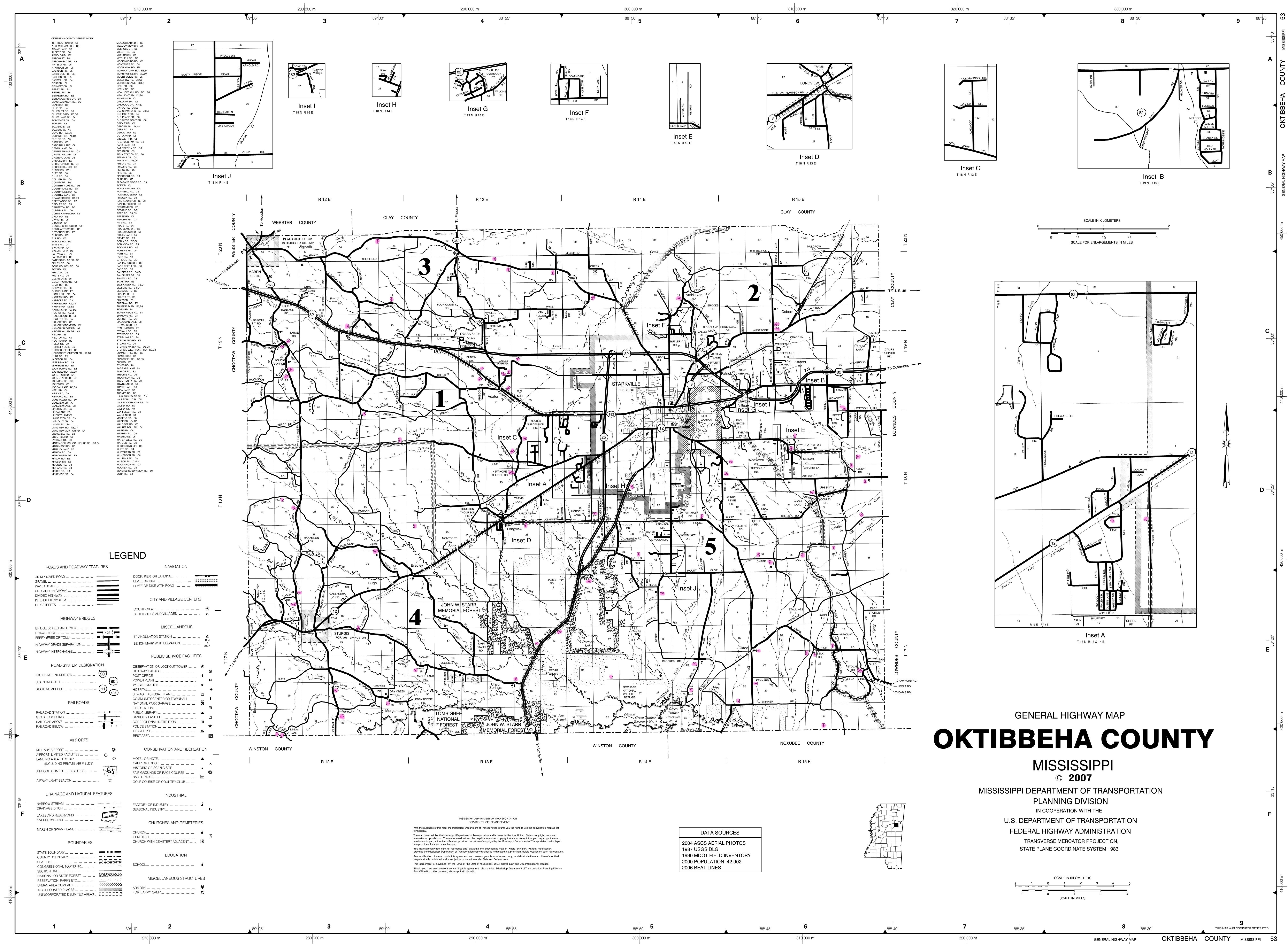
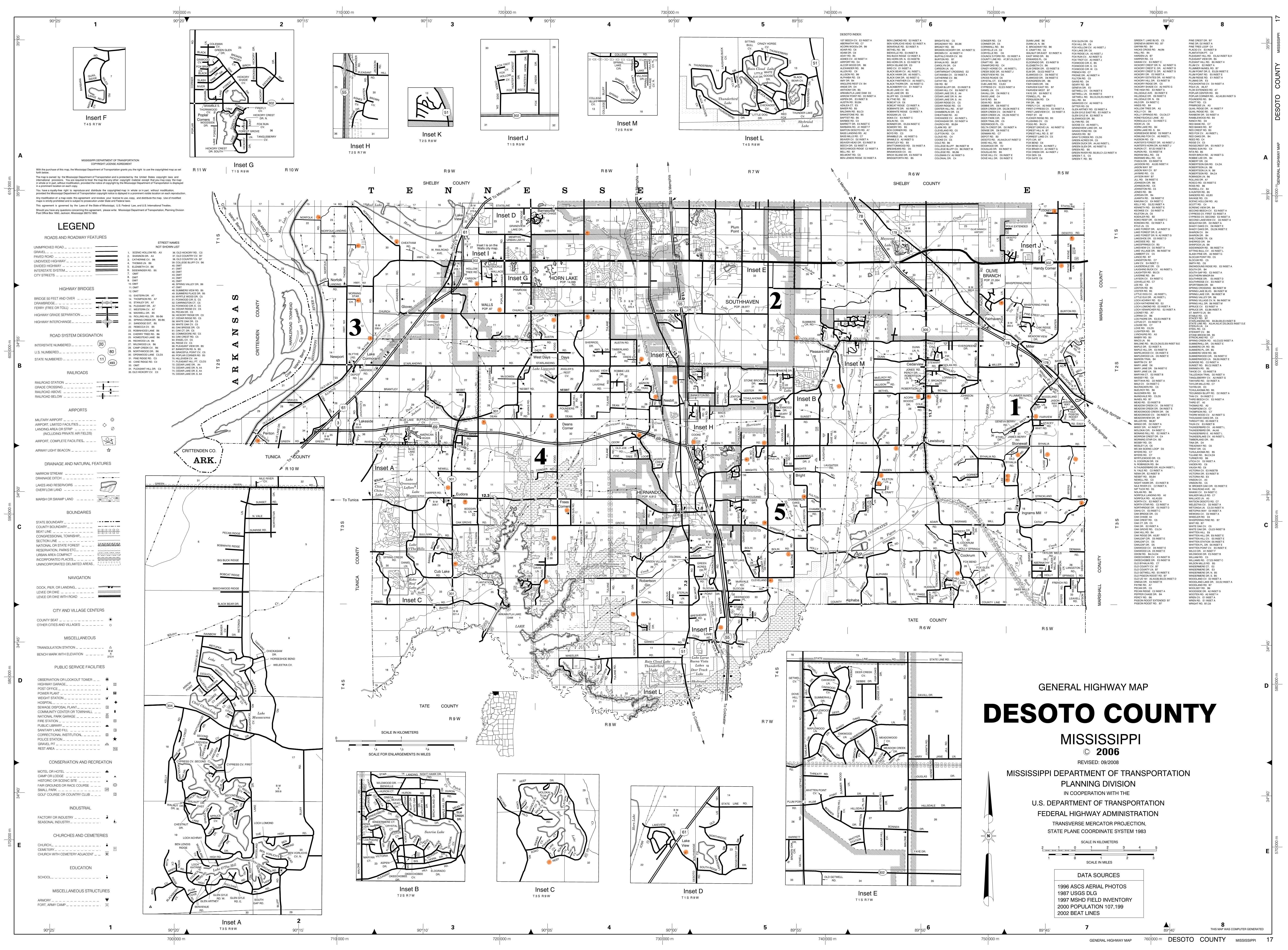
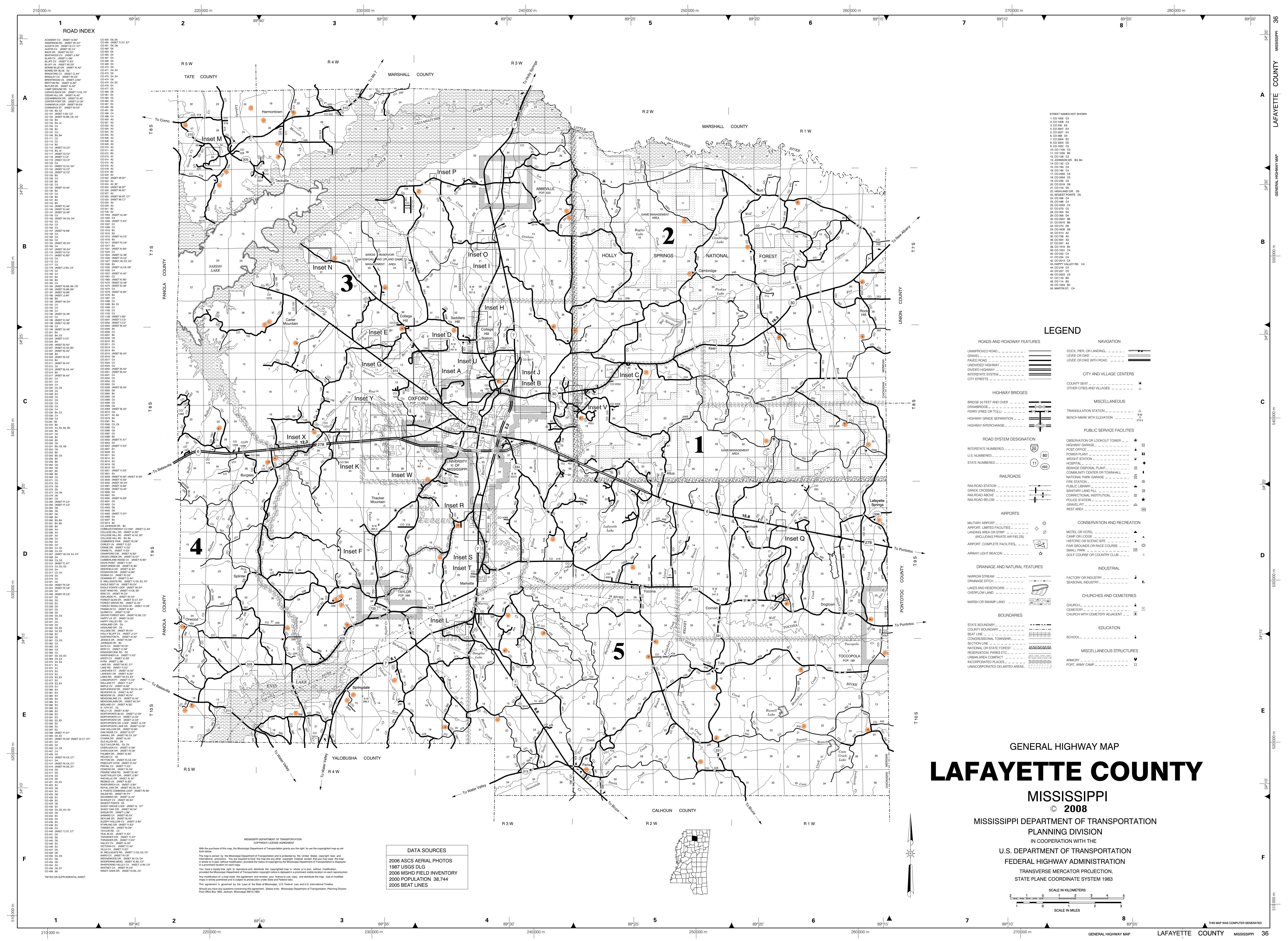
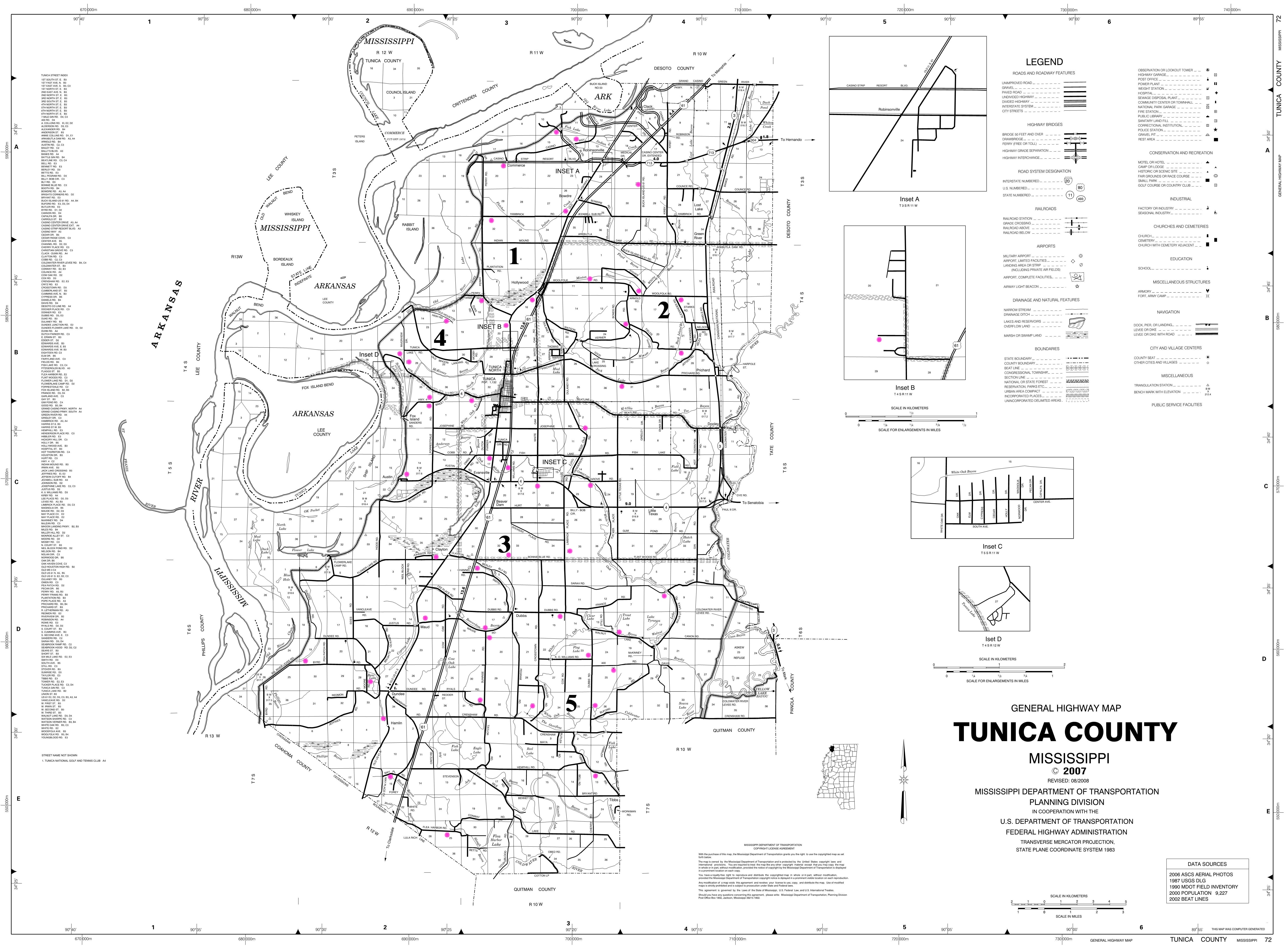
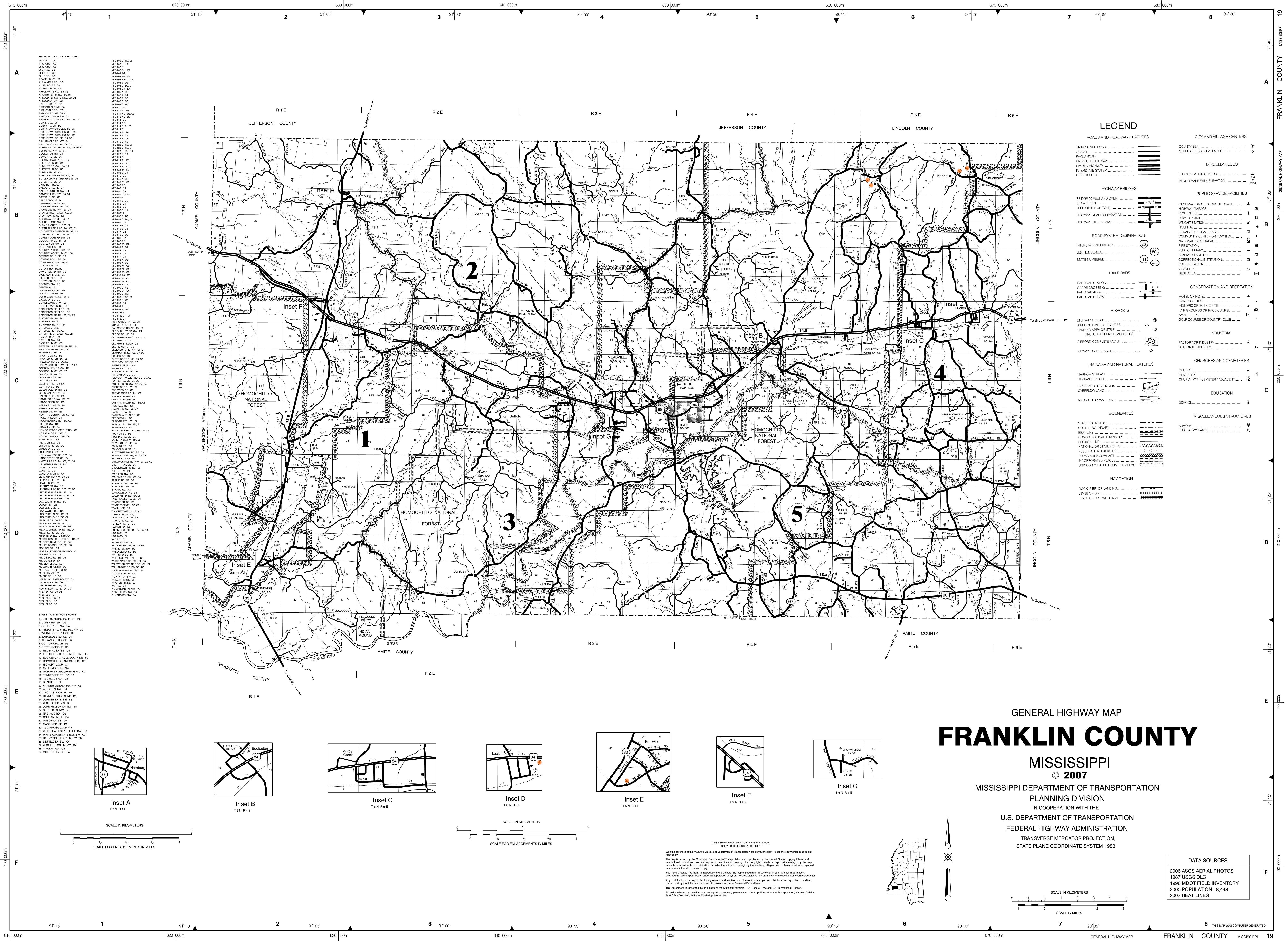
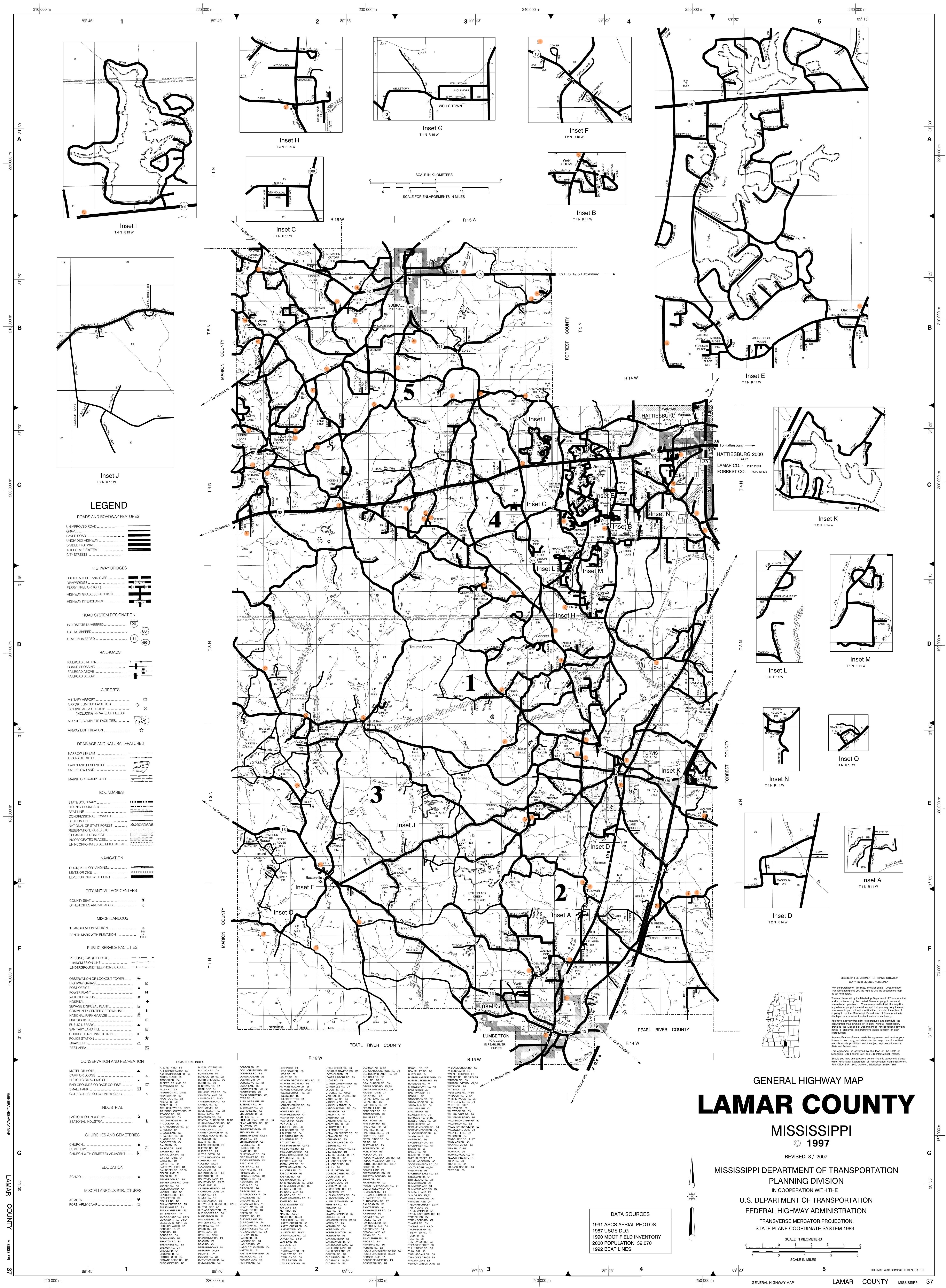
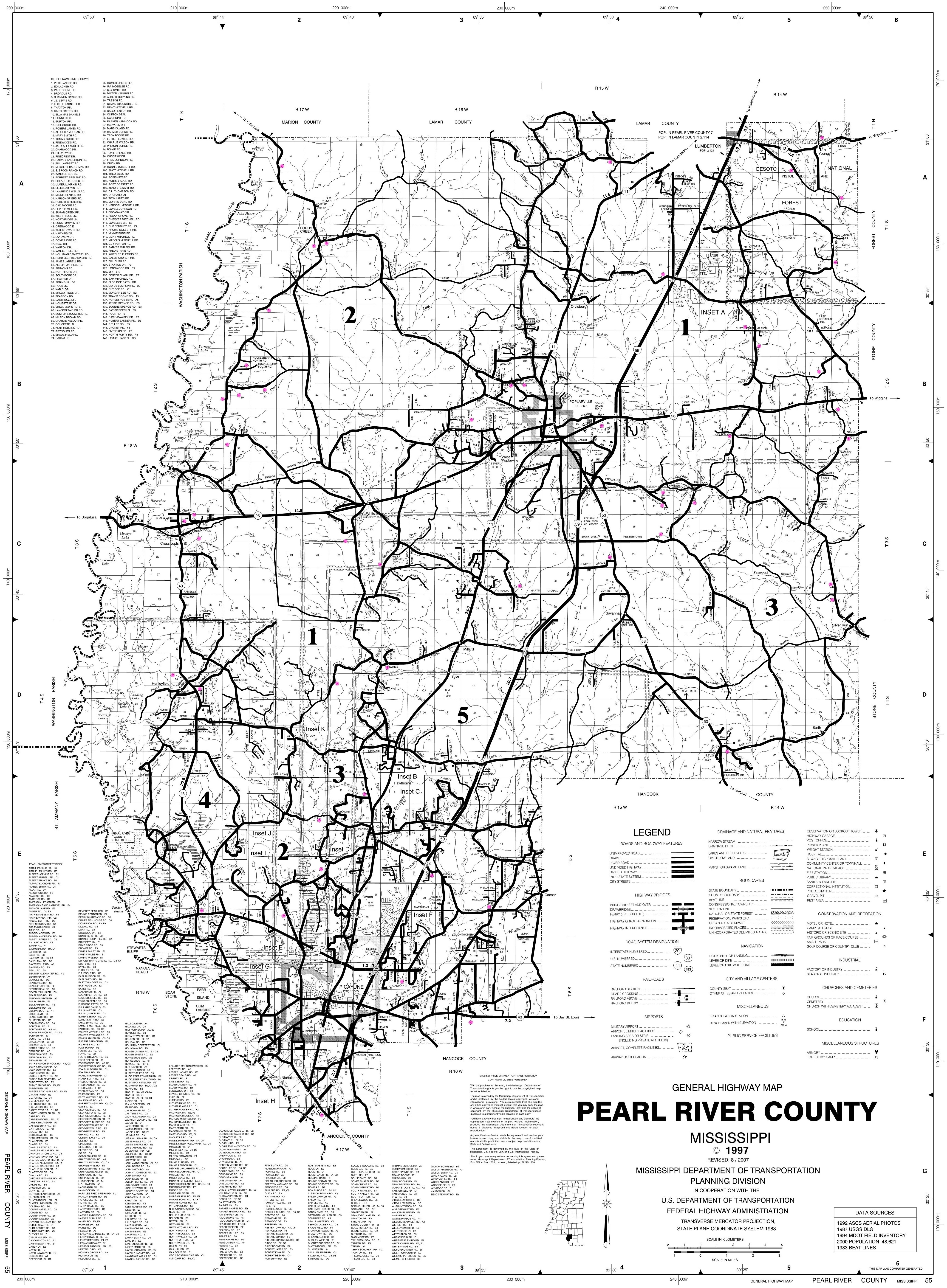
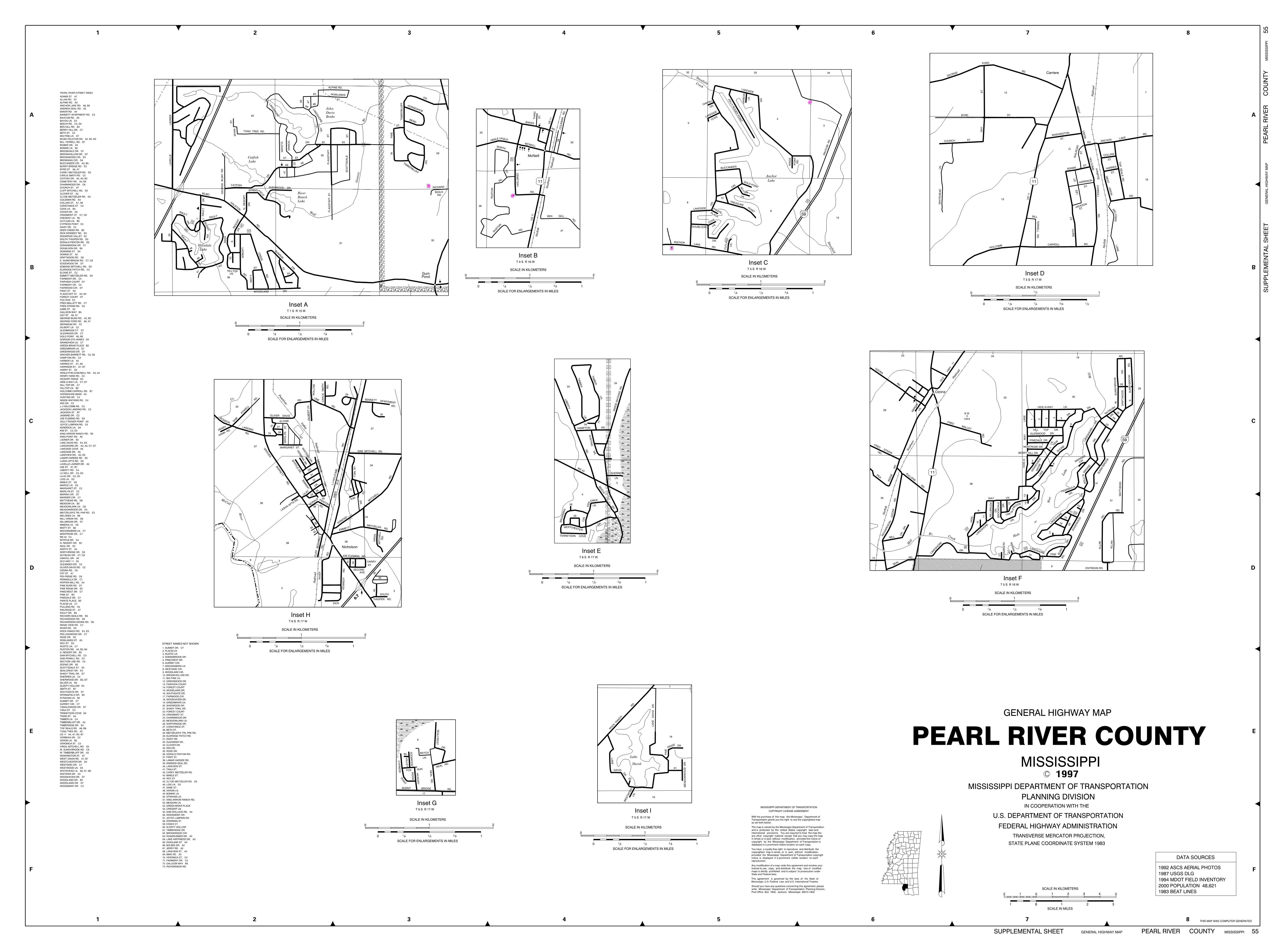
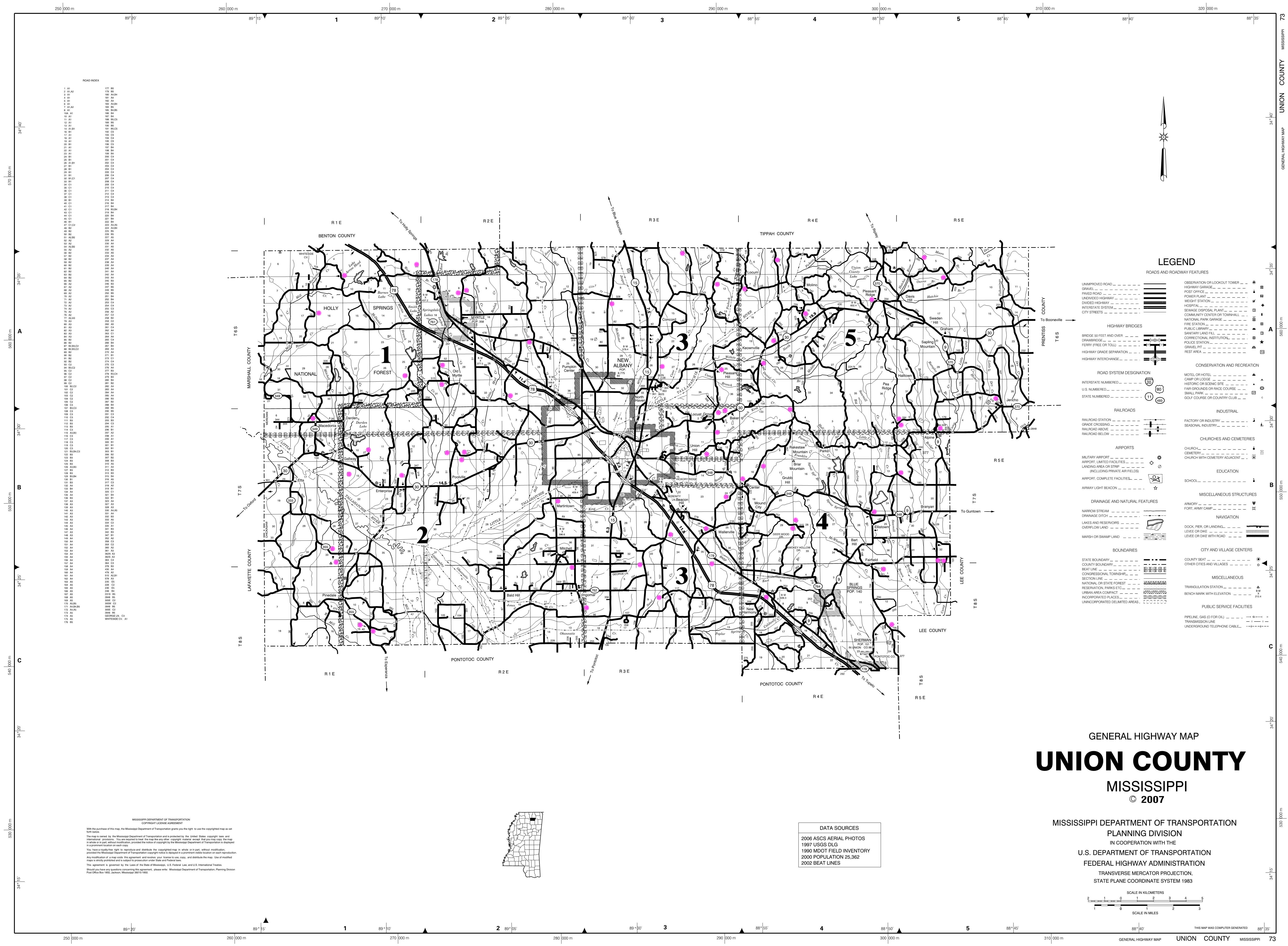
The Mississippi Department of Transportation provides maps for
each county in the state.
All roads, rivers, streams, lakes, etc. are noted on the
maps.
Along with other landmarks, cemeteries are also noted.
Each cemetery in each county has been highlighted.
The maps are large jpeg files and can be downloaded for printing.
You should save the maps to a file on your computer and view them
in your chosen size.
Full size prints are usually 3’ x 5’, available by your local
print shop.
Maps are linked to counties by name.
|
|
|
|
|
|
|
|
|
|
|
|
|
|
|
|
|
|
|
|
|
|
|
|
|
|
|
|
|
|
|
|
|
|
|
|
|
|
|
|
|
|
|
|
|
|
|
|
|
|
|
|
|
|
|
|
|
|
|
|
|
|
|
|
|
|
|
|
|
|
|
|
|
|
|
|
|
|
|
|
|
|
|
|
|
|
|
|
|
|
|
|
|
|
|
|
|
|
|
|
|
|
|
|
|
|
|