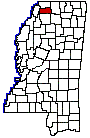
TATE COUNTY
Chapter XLVIII, pages 834-835
Tate County was established December 23,
1873, and was named for a prominent family of the region, of which the
Hon. T.S. Tate was a member. The county has a land surface of 400 square
miles. It is situated in the northwestern part of the State and was formed
chiefly from the southern part of the older county of De Soto, though Tunica
and Marshall counties contributed each a small portion of its area. It
was a part of the Chickasaw Indian cession of 1832. For the early history
of the region composing Tate, see the three counties mentioned. The Governor
was empowered to appoint the county officers, pending a general election
for that purpose, and the county assumed its share of the debts of the
parent counties and received its proper share of school and county funds.
Gov. R.C. Powers appointed the following county officers: Josiah Daily,
Sheriff; O.F. West, Clerk of the Chancery and Circuit Courts; W.J. Pace,
Treasurer; J.R. Jackson, Assessor and Collector; E.J. Litsey, County Supt.
of Schools; J.E. Matthews, Surveyor; T.S. Tate, J.V. Walker, J.P. Pickle,
Eli Bobo, D.T. Neighbors, Members of the Board of Supervisors. The county
was first represented in the Legislature by T.S. Tate and T.B. Garrett,
as Representatives, and J.H. Holloway and M. Campbell as Senators. It is
one of the smaller counties, but has an abundance of natural resources.
It is bounded on the north by the county of De Soto, Coldwater river forming
part of the dividing line; on the east by Marshall County, on the south
by Panola County and on the west by the Coldwater River which divides it
from Tunica County.
The county seat is Senatobia, a town of
1,100 inhabitants, in the south central part of the county, on the line
of the Memphis division of the Illinois Central railroad. It is a shipping
point for large quantities of cotton, corn, fruits and vegetables from
the rich country surrounding it, and enjoys the advantage of a close local
market at Memphis, only 37 miles distant. Its name is a Choctaw Indian
word meaning white sycamore. In the northern part of the county, also
on the railroad, is the town of Coldwater, with a population of 850. The
villages of Strayhorn, Arkabutla, Independence and Tyro are the largest
settlements away from the railroad. The Memphis division of the Illinois
Central railway runs north and south through the center of the county,
and the Yazoo & Mississippi Valley railway, cuts across the extreme
southwestern corner, affording it good shipping facilities.
The county is watered by the Coldwater
River on its northern and western boundary, and the tributary creeks, Senatobia,
Arkabutla, Hickahala, Jim Wolf, Bear Tail and Strayhorn. In the extreme
western part of the county an extension of the bluff formation crosses
the county north and south, the rest of the county is undulating, level
on the river and creek bottoms. The soil is rich and fertile for the most
part and produces excellent crops of cotton, the cereals, and all the vegetables
and fruits common to the latitude. Of late years, considerable attention
has been given to the live stock industry, for which the region is well
adapted, and fruits and vegetables are now grown for market as well as
home consumption.
Various items extracted from the census
reports of 1920, covering the year 1919, are enlightening as to the condition
of Tate County in the farming and live stock world. The value of all its
farm property was estimated at $10,664,000, of which the live stock was
figured at $1,618,000. All its crops were valued at $4,308,000. In the
latter computation, the raising of cotton played a leading role, as 41,000
acres were devoted to this branch of the agricultural industry and a crop
produced, which, when prepared for the market, amounted to 14,000 bales.
The population of Tate County has varied little since its establishment,
having been 18,721 in 1880, and 19,636 in 1920.