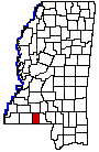
PIKE COUNTY
Chapter XLIV, pages 811-811
The county of Pike was created by act of
February 9, 1815, out of a part of the county of Marion, and its name perpetuates
the memory of Gen. Zebulon M. Pike, the explorer. Its limits were defined
as follows: Beginning on the line of demarcation at the southeast corner
of Amite County, running from thence east along said line thirty miles;
thence a line to run due north to its intersection with the summit of the
dividing ridge between the waters of Bogue Chitto and Pearl River, after
the same shall cross the waters of McGees Creek, thence along the said
ridge until it intersects the southern boundary of Lawrence County; and
all that tract of territory lying west and north of the lines thus described,
shall form a new county by the name of Pike. The southern and western
lines have not been changed, but a strip from the northern tier of townships
has been added to the counties of Lawrence and Lincoln. Some of its eastern
townships went to form the new county of Walthall in 1914, reducing its
area to 407 square miles. Pike County is located on the southern frontier
of the State adjoining the Louisiana border, and is bounded on the north
by Lincoln County, on the east by Walthall County, on the south by Louisiana
and on the west by Amite County.
Before the county was organized, a few
permanent settlers were to be found along its rivers and creeks, chiefly
in the valley of the Bogue Chitto River. The following is a list of the
civil officers of the county for the year 1818: James Y. McNabb, Richardson
Bowman, Peter Quinn, Jr., Benjamin Bagley, Nathan Morris, Justices of the
Quorum; Ralph Stovall, James Baggett, Wm. Carter, Mathew McCune, Nathaniel
Wells, Nathan Sims, Thos. Arthur, Benj. Morris, Henry Quinn, Nathan Morris,
Justices of the Peace; Laban Bascot, Assessor and Collector; Wyley P. Harris,
Ranger; Jas. C. Dickson, Surveyor and Notary Public; Peter Quinn, Treasurer;
other county officers, 1819-1827 were Peter Felder, Sr., Mathew McEwen,
Eleazer Bell, Justices of the Quorum; Leonard Varnade, John Wilson, Richard
Quinn, Benj. Thomas, Sr., David Cleveland, Thos. Rule, Jesse King, Nelson
Higginbotham, Daniel Felder, Jas. Roberts, Leroy Tatum, James Hope, David
Bullock, Jacob Coon, Michael Prescott, John Felder, Davis Barren, Stephen
Ellis, Jas. Chamberlain, Justices of the Peace; Vincent Gamen, Barnabas
Allen, Wm. Wilson, Wm. Dickson, Associate Justices; David Cleveland, Robert
Love, Judges of Probate; Felix Allen, A.M. Perryman, Treasurers; Laban
Bascot, Sheriff, Assessor and Collector; Gordon D. Boyd, Wm. W. Pearson,
Surveyors.
County courts were first held at the residence
of Gabriel Allen, on the Bogue Chitto, and finally in 1816, a commission
was appointed, consisting of Benjamin Bagley, Peter Felder, Sr., Obed Kirkland,
William Bullock, and David McGraw, Sr., to locate a permanent seat of justice
within three miles of the center of the county. They selected a site in
the valley of the Bogue Chitto, at the foot of a high range of hills, and
called it by the name of Holmesville in honor of Maj. Andrew Hunter Holmes,
a brother of Gov. David Holmes. The following were some of the prominent
citizens of this old town: David Quinn, the first settler at the place,
James Y. McNabb, clerk of the Superior court and delegate to the constitutional
convention of 1817; David Cleveland, Probate Judge, Sheriff and member
of the legislature; Laban Bascot, Sheriff 1819-1826; Henry Quinn, Clerk
of the courts; Anthony Perryman, the first merchant; John Black, William
Gage, Buckner, Harris, Dillingham, Hagan and Wm. A. Stone, lawyers. When
the Illinois Central railroad from New Orleans went through the county
in 1857, Holmesville was left to the east of it about nine miles and soon
began to decline in competition with the new towns which sprang up along
the line, such as Osyka, Summit and Magnolia. Not long after this, the
courts and county records were by vote removed to Magnolia, the present
county seat, and the past glory of the old town could not prevent its decay.
Magnolia is now a thriving place of about 2,000 people. A few miles north
of Magnolia on the railroad is McComb, the largest town in the county,
having over 7,700 inhabitants, extensive manufacturing and shipping interests,
and the largest and most complete railroad shops in the State. A little
farther north on the railroad is Summit, so called because of its altitude,
420 feet above tide water. It is an incorporated town of 1,200 people.
The Illinois Central railroad affords an
outlet for the products of the county and has been a potent agency in developing
its resources. The Bogue Chitto River flows through the county from northwest
to southeast, and with its numerous tributary creeks, supplies the region
with its water and affords power for its numerous mills. There is a considerable
growth of long leaf pine in this region and some large tracts of hardwood
timber. The soil varies considerably; it is a rich loam on the river and
creek bottoms, not so good on the hammock and higher lands. It has a clay
subsoil which will retain fertilizers, large quantities of which are used
annually. The crops are the usual staples of the region and the yield is
fairly good. Large quantities of early fruits and vegetables are also grown,
especially along the line of the railway, and are shipped to New Orleans
and the northern markets. Many have also gone into the business of stock
raising and have prospered.
According to the census of 1920, the population
of Pike County was 28,725, which are the latest accessible figures. In
1850, it was 7,360. As not a few tracts of hard wood still remain as a
source of lumber and timber supply, the county has a number of flourishing
establishments devoted to the development of those industries. Altogether
the census agents listed 32 in 1919, employing more than 2,400 wage earners,
to whom was distributed $2,600,000 in the year named. The products of these
establishments were valued at $5,500,000. When to such sources of wealth
are added the agricultural outcome from the soil of the county, it is evident
that Pike County has a substantial backing. In 1919, its farm property
had an assessed valuation of $6,840,000 and its crops of more than $3,000,000.
It is one of the cotton producing counties, although not in the richest
belt of the State. Still, over 29,000 acres of its area embrace cotton
fields which produced 7,600 bales in 1919. The total value of all its crops
was $3,000,000. Corn and other cereals were raised to the value of $695,000,
and vegetables were produced to such good advantage as to represent $395,000.
Dairy cattle, horses and mules constituted the bulk of the value of the
live stock, $1,313,000.