PANOLA COUNTY
Chapter XLIV, pages 806-808
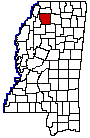
Panola County, in the northwestern part
of Mississippi, was established February 9, 1836, and is one of the twelve
large northern counties created in that year out of the Chickasaw cession
of 1832. The original act defined its limits as follows: Beginning at
the point where the line between ranges 9 and 10 strikes the center of
section 6, and running thence south with the said range line, and from
its termination in a direct line to the northern boundary of Tallahatchie
County, and thence along the northern boundary of Tallahatchie and Yalobusha
counties, to the center of range 5 west; thence north through the center
of range 5 west, according to the sectional lines, to the center of township
six; thence west through the center of township six, according to the sectional
lines, to the beginning. February 1, 1877, when Quitman County was created,
Panola surrendered a small fraction of its southwestern area to assist
in forming that county, which reduced Panola from an area of 756 square
miles to its present land surface of 6.6 square miles. It had a population
of 27,845, in 1920. Its inhabitants gradually increased in numbers from
1850 to 1910, from 11,444 to 31,274.
The name Panola is an Indian name signifying
cotton, and the fertile sunny valleys of the county have enabled the region
to live up to its name. There are only seven counties in the State, according
to the census figures of 1920, which exceed Panola as a producer of cotton;
these are Bolivar, Coahoma, Washington, Leflore, Tunica, Tallahatchie and
Quitman.
The county is bounded on the north by Tate
County, on the east by Lafayette County, on the south by Yalobusha and
Tallahatchie counties and on the west by Quitman County. The old boundary
line between the Choctaw and Chickasaw cessions cuts the southwestern corner.
It is a healthful, fertile, well watered and prosperous region and has
attracted a large number of settlers from other states.
Two of the oldest settlements in the county
were at Belmont and Panola, a few miles apart, and on opposite sides of
the Tallahatchie River. For several years there was a spirited contest
between these two towns over the location of the courthouse of Panola County.
With the advent of the Mississippi and Tennessee (now the Illinois Central
railroad) Belmont was absorbed by Sardis, and Panola was absorbed by Batesville.
One result of the above contest is found in the two judicial districts
of the county, Sardis being the seat of justice for the first judicial
district, and Batesville for the second judicial district into which the
county is divided.
Sardis is a thriving town of 1,300 people
on the Illinois Central line, possesses several small manufactories and
is the center of a good trade from the rich agricultural section surrounding
it. Batesville, a few miles south on the same railroad, has a population
of about 1,000 and is also a flourishing market town. Como, in the northern
part of the county, is a growing town of 800 inhabitants. Besides, there
are minor settlements, such as Crenshaw, Pope, Tocowa, Courtland, and Crowder,
the last named lying partly in Panola and partly in Quitman County. In
addition to the Illinois Central railroad which runs north and south through
the center of the county, there are two western spurs, or branches, running
from Sardis and Batesville to facilitate both travel and traffic to the
two county seats.
Panolas standing as a remarkable producer
of cotton has always maintained her lands at a high market value. The census
figures of 1920 gave the assessed value of her entire farm propertylands,
buildings, implements, livestock, etc.at $14,780,000, and the value of
her crops for 1919, at $7,623,000. Cotton is, of course, the countys great
source of prosperity. In the year named, nearly 69,000 acres were devoted
to the raising of the staple, and from that area was gathered a bumper
crop amounting to nearly 26,000 bales. Cereals and grains of all kinds
so flourished that nearly a fifth of the total value of all the crops was
covered by them; vegetables brought to the farmers $300,000, and hay and
forage for live stock and the market, $200,000 more. The live stock of
the county was valued at $2,100,000, mainly divided as follows: Mules,
$713,000; dairy cattle, $412,000; horses, $512,000. Considerable tracts
of timber remaining in Panola County give the section also an industrial
status. Simply stated, the census figures for 1920 show that the 15 manufacturing
establishments in the county pay out $672,000 in wages, and that their
output amounts to $2,145,000.