OKTIBBEHA COUNTY
Chapter XLIV, pages 803-806
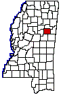
Situated in the northeastern part of the
State, Oktibbeha County was established December 23, 1833, as one of the
numerous counties formed at that time from the Choctaw cession of 1830.
Oktibbeha is an Indian word meaning ice there in creek, or, according
to another authority bloody water, because of the battles fought here
between the Chickasaws and Choctaws in an early day. The original act defined
its boundaries as follows: Beginning at the point at which the line between
ranges 15 and 16 east, leaves the line between townships 16 and 17, and
running from thence north with said line, between ranges 15 and 16 east,
to a point directly west of the junction of the Buttahatchy River, with
the Tombigbee River; from thence west to the line between ranges 11 and
12 east; from thence south, with said line between ranges 11 and 12 east,
to the line between townships 16 and 17, and from thence east, with said
line between townships 16 and 17, to the place of beginning. A part of
its northern area was taken in 1872 to assist in forming the new county
of Clay and in 1874 another piece of its territory went to Sumner, afterward
Webster County. Webster and Clay counties lie to the north, Lowndes County
on the east, Winston and Noxubee counties on the south and Choctaw County
on the west. The old Robinson Road ran through the southern part of the
county and in the southeastern part was the old Choctaw Indian agency.
Numerous mounds and the many Indian names of streams and towns are constant
reminders of the old Choctaw occupancy. The county has a land surface of
457 square miles.
A list of the civil officials of the county
for 1838, soon after its organization, is as follows: David Ames, Judge
of the Probate court; Joseph Yates, Clerk of the Circuit court; Charles
Debrells, Clerk of the Probate court; John Moore, Sheriff; Richard S. Graves,
Surveyor; John Wiseman, Assessor and Collector; Thomas A. Forbut, Treasurer;
Richard Drummond, Coroner; John R. Todd, Ranger; James Copeland, S. Clark,
Samuel Harper, John Quin, Nicholas H. Simmons, members of the Board of
Police.
The first Probate Judge was David Reese;
the first Sheriff was J.W. Eastland, the first County Treasurer was Robert
Bell, the first Clerks of the Circuit and Probate Courts were Yates and
Debrell above mentioned. R.A. Lampkin was the first postmaster and Horatio
Bardwell, a Presbyterian divine, was probably the first minister to hold
services in the county, about 1835. The Starkville Whig, established in
1847 by Dr. J.T. Freeman, was the first paper published. This became the
Broad Ax a little later and continued under that name down to the time
of the War.
Starkville has been the county seat from
the first and is a place of 2,600 people, at the junction of the Illinois
Central and Mobile & Ohio railroads. The country adjoining is an excellent
stock country and the city has a thriving local and shipping trade, has
several factories, and possesses exceptional social and educational advantages.
The State Agricultural and Mechanical College and United States Experiment
Station are situated one mile east of Starkville on the Mobile & Ohio
line. Other towns in the county worthy of note are Sturgis, Maben, Webster,
Longview and Bradley.
The Illinois Central railroad crosses the
county from east to west, a branch of the Mobile & Ohio railroad runs
from Columbus to Starkville, and the Southern railroad crosses the northwestern
corner of the county. The Noxubee River runs through the southern part
of the county, and with its tributaries, Chincahoma, Talking Warrior, Sand
and Wolf creeks water this section. In the east and north are Red Bull,
Trim Cane, Self, Biba Wila, Line and many other creeks.
The eastern part of the county is for the
most part rich prairie soil with a fair timber growth. A few miles west
of Starkville is a four to ten mile strip of the Flatwoods belt, having
a stiff clay soil and a timber growth of white and post oak. West of the
Flatwoods are the Sandy Hills, extending to Webster County and having a
timber growth of oak, hickory, pine, blackjack, and chestnut.
From 1850 to 1900, the population of Oktibbeba
County gradually increased from 9,000 to 20,000. Since then there has been
a decrease, the census figures for 1920 indicating a population of 16,872.
On the other hand there has been a decided increase in the value of its
farm property within the past two decades. In 1900, it was assessed at
$2,700,000; in 1910, at $4,600,000 and in 1920, at $7,100,000. In 1919
the value of its crops was $2,100,000, of which the cereals, hay and forage
and vegetables constituted more than one-half. The fine grasses which are
typical of the northeastern prairie region of Mississippi are luxuriant
in Oktibbeha, and, with its good supply of water, make the section well
adapted to the raising of live stock. Fine cattle, especially of the dairy
breed, have been raised for many years. In 1919, they were valued at nearly
a third of the entire worth of the live stock of the county, $1,450,000.
Dairy products realized more than $220,000. The mules were valued at $420,000,
and the horses at $232,000. Oktibbeha County also draws upon a considerable
belt of timber lands west of Starkville, and, is in the industrial, as
well as the agricultural class. The last census figures indicate that there
are more than a score of establishments in the county, chiefly engaged
in the timber and lumber industries; that more than $143,000 was distributed
to the workmen for wages, in 1919, and that all the products of its manufactories
amounted to $965,000.