MONROE COUNTY
Chapter XLIV, pages 792-795
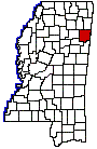
Monroe, which is a northeastern county
bordering on Alabama, was originally embraced within the Chickasaw Indian
territory, and by the treaty of Chickasaw Council House concluded September
20, 1816, that nation ceded to the United States 408,000 acres on their
eastern or Creek frontier. This large tract lay upon the eastern tributaries
of the upper Tombigbee River and comprised the original county of Monroe.
The Creek claims to these lands were surrendered by the treaty of Fort
Jackson. It was attached to the State of Alabama until the winter of 1820,
when the boundary was determined by actual survey, and on February 9, 1821,
the legislature of Mississippi recognized it as within the limits of the
State and approved a law entitled, An act to form a county east of the
Tombigbee River, and for other purposes, which defined its limits as follows:
All the tract of country lying on the east side of the Tombigbee River
. . . beginning on the east side of said river, where the eastern boundary
line of the State crosses the same; thence northwardly with said boundary
line, to the Chickasaw boundary; thence with said boundary line westwardly
to the Tombigbee River; thence with the meanders of said river to the beginning.
The act of February 9, 1836, which organized the Chickasaw cession of 1832
into counties, extended the limits of Monroe and defined them as follows:
Beginning at the point one mile due north of the point where the line
between townships 11 and 12 intersects the eastern boundary line of the
State, and running thence due west to the line between ranges 5 and 6 east;
thence south with the said range line, to the northern boundary of Oktibbeha
County; and thence due east to the mouth of the Buttahatchy River; thence
according to the present boundaries between the said county of Monroe and
the county of Lowndes, to the eastern boundary line of the State, and thence
along the said eastern boundary line to the beginning.
Since that time Monroe County has formed
part of the State of Mississippi, though it was long separated from the
older counties in the southern part, and from the counties in the western
part, erected out of the New Purchase, by the remaining territory of
the Choctaws. It was connected with them by a public road through the Chickasaw
and Choctaw nations long known as the Natchez Trace. Lowndes County and
a part of Clay County were embraced within the old county of Monroe.
A list of the civil officers of the county
for 1821, the year of its organization, discloses the names of the following
pioneers: Gideon Lincecum, Chief Justice of the Quorum, and Wiley Harbin,
Ezekiel Nash, Stephen Harman, Frederick Weaver, Associate Justices; Bartlett
Sims, Sheriff; Silas Brown, Assessor and Collector; Hezekiah Lincecum,
Coroner; John G. Faulks, Treasurer and Ranger; Nathaniel Morgan, George
Dilworth, Silas McBee, Thos. Sampson, Andrew Haynes, John H. Morris, David
Shannon, John Halbot, Robert Earington, Jacob Laughridge, Justices of the
Peace; James Draper, Robert Pickens, James Dillingham, Isaac Dyche, John
Bibb, John H. Hayes, John Brighton, Benj. Morgan, William M. Kincaid, Constables;
William S. Moon, Surveyor; S. Hawkins, Judge of Probate; Nathaniel Harbin,
Clerk. Additional county officers for the years 1822-1827 inclusive, and
excluding the names of officers given for the year 1821, are Robert I.
Haden, Thomas Sampson, William Dowsing, George Higgason, Judges of Probate;
John Kirk, Nathaniel L. Morgan, Associate Justices; John Dexter, Assessor
and Collector; James T. Burdine, Abram P. Gideon, Samuel B. Morgan, Constables;
Samuel Ragsdale, Sheriff; Matthew Anderson, Geo. Dilworth, Coroners; Matthew
Sims, Ranger; Willis A. Farris, Notary Public; William Downing, Ovid P.
Brown, John H. Hand, Presidents of Columbus; William Standifer, James White,
Collin McKinney, John Mullin, Alanson Nash, Wm. Coates, Wm. Cook, John
Price, John Thompson, Eli Runnels, James Gray, Benjamin Land, Matthew Gibbs,
Jeremiah Riggin, John McKinny, Richard Dilworth, Wm. Dowsing, Stephen Harman,
Richard Halley, Jacob Bruton, Peter R. McClanahan, J.S. Cravens, Jesse
McKenny, Edmond J. Bailey, George Good, Reuben Menifee, Stewart Pipkins,
Robert D. Haden, John Fisher, William E. Willis, Robert B. Pickens, John
P. Neal, Justices of the Peace.
The last contribution of Monroe County
from its territory was in 1872, when it relinquished some of its southwestern
sections to the new county of Clay. It now has an area of 770 square miles.
It received its name from President James Monroe, and, as now constituted,
is bounded on the north by Lee and Itawamba counties, on the east by Lamar
County, Alabama, on the south by Clay and Lowndes counties and on the west
by Clay and Chickasaw counties.
Its early county seat was at Hamilton,
in the southern part of the county, one mile east of the Tombigbee River.
The present town of Hamilton lies three miles to the northeast. Later,
in 1830, the seat was moved to Athens, a little north of Aberdeen on the
eastern side of the Tombigbee, where it remained until 1849. Cotton Gin
Port was another old settlement on the Tombigbee about thirteen miles north
of Aberdeen.
The present county seat is the attractive
and pleasant city of Aberdeen, which has long been a center of culture,
and has given to the State many men and women noted for special accomplishments
in many fields of effort. It has been said of Aberdeen in the past that
it was one place in which money alone could not purchase a place in society.
Among its first settlers were the Rowlands and Sykes who settled in the
village when it was still close to the river. Colonel Rowland later removed
to a plantation close bythe two families pioneered together from Virginia
to the State of Mississippi. Aberdeen contains about 4,000 inhabitants
and is a manufacturing and trading center of considerable importance. It
is on the Tombigbee River and has three tributary railroads, the Mobile
& Ohio, the Kansas City, Memphis & Birmingham, and the Illinois
Central. It is adjacent to the iron and coal of Alabama, has a fine water
power and is surrounded with forests of valuable wood and should continue
to develop in many lines. Armory is a growing city of 2,800 (census of
1920) people in the northern part of the county, on the line of the K.
C. M. & B. railroad, and, next to Aberdeen, is the most important town.
Some of the smaller settlements besides those previously mentioned, are
Gattman, Smithville, Prairie, Quincy and Sykes. The three railroads above
mentioned give the region excellent transportation facilities in all directions.
The attractions of this favored region of the State were early recognized,
and a strong tide of emigration set in, composed for the most part of pioneers
of the best stock from the older states. It has long been regarded as one
of the wealthiest and most inviting sections of the Commonwealth, noted
for its fertile farms and thriving manufactures. The principal streams
in the county are the Tombigbee River and its numerous tributaries, the
most important of which is the Buttahatchie River on the southeastern border.
The region is partly level and partly undulating with rich black prairie,
and fine black sand soils, and a clay subsoil.
An exhibit of the diverse wealth upon which
Monroe County depends for its continued support and development is found
in the census reports of 1920. The figures there contained show that its
farm property has substantially doubled in value within the decadal periods
since 1900. In the year named, the Federal Census Bureau gave it at $4,985,000;
in 1910, at $9,813,000; in 1920, at $18,212,000. The crops of the county
were valued at $5,739,000 in 1919, of which the sum from the cereals was
given as $1,558,000, from hay and forage at $775,000 and from vegetables
at $469,000. More than 49,000 acres of the area represented the cotton
fields, which produced in the year named 12,600 bales. Altogether the value
of the live stock is placed at $2,263,000, of which mules, horses, swine
and dairy cattle are the chief contributors. The dairy cattle were valued
at $482,000 and the dairy products at $296,000. As a fruit country, Monroe
County is represented by 28,000 trees bearing goodly harvests of (chiefly)
peaches and apples.