KEMPER COUNTY
CHAPTER XLVI, pages 758 - 760
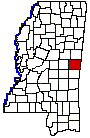
This county is situated near the center
of the Alabama border, and received its name from Reuben Kemper, an American
soldier in the Florida, Mexican and 1812 wars. He was of a somewhat reckless
and fiery disposition, but intensely patriotic and won distinction in the
service of his country.
Kemper County was one of the sixteen counties
formed in 1833 from the territory acquired from the Choctaws by the treaty
of Dancing Rabbit, and the act of December 23, 1833, thus defined its boundaries:
"The territory within townships nine, ten, eleven and twelve, of ranges
fourteen, fifteen, sixteen, seventeen, eighteen, and nineteen." It is bounded
on the north by Winston and Noxubee counties, on the east by Alabama, on
the south by Lauderdale County, and on the west by Neshoba County, and
has an area of 752 square miles.
The following is a list of its county officers
for the year 1838, taken from Besancons Annual Register: Lawrence W. Pennington,
Sheriff; Lewis Stovall, Clerk of the Circuit Court; Benjamin C. Oppelt,
Judge of Probate; William G. Gill, Clerk of Probate Court; C.R. McKaskill,
Assessor and Collector; Silas Manor, Ranger; Mathew Newton, Coroner; William
B. Jay, County Treasurer; David Henderson, Surveyor; Board of Police, John
Rhodes, Mathew Jackson, John F. Aulds, Washington McDaniel, Solomon Lanham;
Justices of the Peace, James W. Jones, Rivers, Daniel Ship, Presley Floyd,
Alsa Pace, Spears, Benjamin C. Oppelt, Washington A. Cook; Constables,
Andrew Jester, Hezekiah Chepman, William Killin.
The interests of the county are almost
exclusively agricultural, and while it possesses a considerable population,
19,619 in 1920, there are no towns of any size within its borders. The
county seat is DeKalb, a place of 550 people, near the center of the county
and connected by a short eastern spur with the Mobile & Ohio railroad.
Numerous other small towns are scattered over its area, among which are
Sucarnoochee, Electric Mills, Porterville, Scooba, Enondale, and Wahalak
on the railroad. The principal market for the region is Meridian, a few
miles to the south.
The streams that water the county are tributaries
of the Tombigbee River for the most part and flow to the southeast into
Alabama. The more important ones are Sucarnoochee, Scooba, Blackwater,
Bodea and Pawticfaw creeks. The Mobile & Ohio railroad runs through
the eastern part of the county from north to south and gives it access
to the market of Meridian. Much of the county is timbered with long and
short leaf pine. In the eastern part the lands are prairie, in the middle
and western parts the soil is a sandy loam with clay soil, easily worked
and productive. Good crops of cotton, corn, oats, wheat, sugar cane, sorghum,
field peas, potatoes, fruits and vegetables are raised. Pasturage of native
grasses, switch cane, and Japan clover is excellent and considerable attention
is paid to stock raising and dairying.
Kemper County has a land area of 752 square
miles. It is bounded north by Winston and Noxubee counties, east by Alabama
State, south by Lauderdale County and west by Neshoba. The Federal census
figures published since 1850 do not indicate a rapid nor by any means steady
increase in population. In the year named it was 12,517. The county reached
its greatest population in 1900, when the enumeration showed 20,492 inhabitants
- that for 1920, 19,619, indicates a slight decrease.
The figures of the last census also show
in a general way where Kemper stands agriculturally. They indicate a farm
valuation of $6,088,000; value of crops $2,567,000, to which the cereals
contributed $1,383,000, and the vegetab1es of the county $372,OQO; 32,000
acres cultivated to cotton, the crop of which was represented by 4,400
bales; and a valuation of all live stock amounting to $1,373,000.