DE SOTO COUNTY
Chapter XLV, pages 716-720
Established February 9, 1836, De Soto was
one of the twelve counties formed in that year from the territory originally
belonging to the Chickasaw nation and ceded by the Indians under the Pontotoc
treaty of 1832. The original act defined its boundaries as follows: "Beginning
at the point where the northern boundary line of the State intersects the
Mississippi River, and running thence down the said river, to the point
where the line between townships 2 and 3 intersects the same; thence with
the said township line, to the line between ranges 9 and 10 west; thence
south with the said range line to the center of township 6; thence east
through the center of township 6, according to the sectional lines, to
the center of range 5 west; thence north through the center of range 5
west, according to the sectional lines, to the northern boundary line of
the State; thence west with the said boundary line to the place of beginning."
Its original area was about 24 townships, or about 864 square miles. December
23, 1873, it contributed to form the new county of Tate, and now has a
land area of 475 square miles. It was organized during the first administration
of Gov. Charles Lynch, and was named after Hernando De Soto, the discoverer
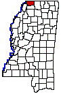
of the Mississippi. It is located in the extreme northwestern part of the
State, bounded on the north by the state line which divides Mississippi
from Tennessee and on the east by Marshall County; Tate County, whose history
is closely associated with that of De Soto County, adjoins it on the south,
the Coldwater River making part of the boundary between them; the Mississippi
River touches it for a few miles on the west and Tunica County completes
its western boundary. Its county seat is Hernando, just south of the center
of the county, a place of 800 inhabitants and one of the historic old towns
of the State. It was named in honor of Hernando De Soto. It was originally
called Jefferson and was organized in 1836 by a bill introduced by Senator
A.G. McNutt of Warren County. It became the home of many wealthy and prominent
families, whose glory before the war is told by the remains of their handsome
homes. It was the home of Col. Felix Labauve, who was one of its earliest
settlers and quite a remarkable character. A native of France, of distinguished
ancestry, and coming as a child to the new world, he was identified in
later years with the history of Mississippi. His bequest of $20,000 for
the education of poor youths of De Soto County, makes him deservingly remembered
as one of its wisest benefactors. Other towns in the county are Eudora,
Cockrum, Olive Branch, Nesbit, Pleasant Hill and Love. The main line of
the Illinois Central railway crosses De Soto County from north to south,
passing through Hernando. The Yazoo & Mississippi Valley railway, which
connects the Delta with Memphis also crosses the western part of the county,
and the Kansas City, Memphis & Birmingham passes through the northeast
portion. Most of the county belongs to the Yellow Loam section of the State
and its general surface is level and undulating. A small portion of the
county is hilly and the extreme western part is Mississippi bottom land,
alluvial and fertile.
De Soto County is rich as an agricultural
section of the State, and like the other river counties has a large body
of negroes to do the manual labor. The census enumeration gives 3,800 negroes
to 1,000 whites engaged in cultivating the rich lands of this portion of
Mississippi. The farm property of all kinds is valued at $18,275,000, as
compared with $8,464,000 in 1910, and the total value of the crops raised
in 1919 was $6,865,000. De Soto County has set aside 74,000 of its fertile
acres to the cultivation of cotton, which yielded 24,000 bales in the year
named. It is also largely engaged in fruit culture, its thirty thousand
peach and apple trees yielding good returns, although only about half of
them are of bearing age. The countys live stock is valued at $2,286,000,
the order of their importance from the assessors standpoint being mules,
dairy cattle and horses.