.
Claiborne
County
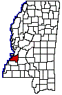
CLAIBORNE COUNTY
Chapter XLIV, pages 701-704
Claiborne is one of the old historic counties
on the Mississippi River in the southwestern part of the State. It constituted
a part of the Natchez District, which was settled by the French, Spaniards,
English and Americans during the eighteenth century. It was the fourth
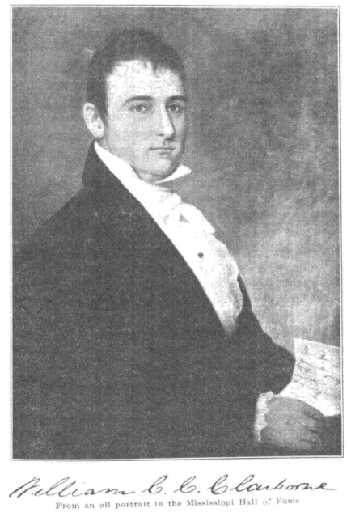
county erected while Mississippi was a Territory and was established January
27, 1802, during the administration of William C.C. Claiborne, Mississippis
second territorial governor. His name is perpetuated in that of the county.
The original act of the General Assembly recites that Jefferson County
shall be divided as follows:"Beginning on the river Mississippi at the
mouth of Petty Gulph Creek; thence running up the main branch of said creek
four miles, or to its source, should not exceed four miles; thence, by
a line to be drawn due east, to the eastern territorial line, and all that
tract of country, north of the above mentioned creek, an east line, south
of the northern boundary of said territory, and east of the Mississippi
River, shall compose a county, which shall be called Claiborne." The act
of June 29, 1822, defining the boundaries of the several counties of the
State, declared that the dividing line between the counties of Claiborne
and Jefferson should be as follows: "Beginning on the bank of the Mississippi
River, at the lower end of the Petit Gulf Hills, running thence a direct
course to the most northern part of the tract of land known by the name
of Robert Trimbles, on Tabors Creek of Bayou Pierre, continuing the same
course until it shall intersect the South Fork of Bayou Pierre, at Elijah
L. Clarkes wagon ford on said creek, thence up said creek to the township
line between townships 9 and 10, thence pursuing said line east to the
old Choctaw boundary line." The first civil officers of the county, commissioned
January 30, 1802, were William Downs, G.W. Humphreys, James Stansfield,
Ebenezer Smith and Daniel Bwinch, Justices of the Peace; Samuel Cobwin,
Sheriff, Mathew Teirney, Clerk; Samuel Gibson, Coroner.
The old towns of Grand Gulf, Brandywine
and Buckland were prosperous settlements in the early part of the last
century. Grand Gulf was the shipping point on the river for Port Gibson,
and as late as 1858 had 1,000 to 1,500 inhabitants. The course of the river
changed to the west and destroyed the town.
The county has a land surface of 489 square
miles. The beautiful old town of Port Gibson is the county seat and is
part of a tract of land once owned by a Mr. Gibson, who donated a town
site on Bayou Pierre, six miles from the Mississippi. It was the seat of
culture and wealth before the days of the War for Southern Independence
and about it clustered the homes of many families whose names are familiar
in the annals of the State. Here lived the Archers, Humphreys, Magruders,
Vertners, Van Dorns, Burnets, McCalebs and many others. "The Hill", the
famous old home of Judge P.A. Van Dorn, was built on a commanding eminence
overlooking the town. About seven miles southeast of the city is located
the old home of the unfortunate Harmon and Margaret Blennerhasset, called
"La Cache" to indicate the retirement from the world of Burrs misguided
associate. Only ruins remain today to serve as a memory.
During the War for Southern Independence,
Port Gibson was the scene of much hard fighting while Grant was forcing
his way to Vicksburg. The city of Port Gibson has now a population of some
1,700 people. Numerous small towns are sprinkled over the county among
which may be mentioned, Hermanville, Martin, Tillman, Carlisle, Rocky Springs,
Ingleside, St. Elmo, and Grand Gulf, the last named village above referred
to being an early rival of Port Gibson for the county seat, and at one
time the seat of a thriving river trade. The county is located in a rich
agricultural section of the State and is bounded on the north by Warren
County, on the east by Hinds and Copiah counties, on the south by Jefferson
County and on the west by the Mississippi River. The two main lines of
the Yazoo & Mississippi Valley railway traverse the county and yield
it excellent rail transportation privileges, while the Mississippi and
Big Black rivers, forming its western and northern boundaries, give it
exceptional water facilities. The central portions of the county are well
watered by the North and South Forks of the Bayou Pierre; a fine water
power exists at Scutcheloe Falls, and numerous springs of good water are,
to be found, so that it may fairly be termed one of the best watered counties
in the State. There is considerable timber in the county of the poplar,
walnut, magnolia, pine, gum, hickory, and oak species. The surface of the
land is broken and hilly in places, the balance is undulating and level.
The soil is quite fertile and produces cotton, corn, rice, oats, field
peas, potatoes, sorghum, sugar cane, melons and all kinds of fruits and
vegetables suitable to the latitude. The pasturage is especially good and
is well suited to stock raising.
Claiborne is one of the old-time river
counties, which has deteriorated some in population. It reached its peak
in that regard in 1900, when it had 20,787 people. In 1850, the national
census gave its population at 14,941, and in 1920, at 13,019. Its lands
are fertile, however, largely cultivated by negroes, and, albeit there
may not be marked progress, there is undoubtedly much contentment and substantial
pleasure in living. The lands of the county have greatly increased in value.
In 1920, they were valued at $7,770,000, as compared with $3,741,000 in
1910. The value of the crops was estimated at $2,426,000 and of live stock
at $1,835,000.
Return to
County History Index
MSGenWeb Home
Source:
Mississippi The Heart of the South - By Dunbar Rowland, LL.D - Director
of the Mississippi State Department of Archives and History. Vol.
II Illustrated. Chicago-Jackson; The S. J. Clarke Publishing
Company, 1925. Public Domain
Copyright Notice: All files
and photographs on this site are copyrighted by their creator and/or contributor,
unless otherwise noted. They may be linked to but may not be reproduced
on another site without specific permission from The MSGenWeb State Coordinator
or the Assistant State Coordinator, and/or their contributor. Although
public information is not in and of itself copyrightable, the format in
which they are presented, the notes and comments, etc., are. It is however,
quite permissible to print or save the files to a personal computer for
personal use ONLY.
  
|
