CALHOUN COUNTY
Chapter XLIV, pages 694-696
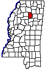
Calhoun County, which is located in the
north-central part of the State, was created on March 8, 1852, during the
gubernatorial administration of Henry S. Foote. Its land surface has an
area of 579 square miles. It was named for John C. Calhoun. Calhoun County
is bounded on the north by Lafayette and Pontotoc counties, on the east
by Pontotoc and Chickasaw, on the south by Webster, and on the west by
Grenada and Yalobusha. Its boundaries have not been changed since it was
established in 1852.
Porter A. Davis, W. H. Duberry, L. Brasher,
M. Murphree, C. Orr, John Hunter and James McCrory were appointed commissioners
to organize the county, and it was provided by the act that the Board of
Police select a seat of justice as near the geographical center as possible.
Pittsboro was thus chosen and was named in honor of one of the early settlers.
It is a small town of 250 inhabitants, located at the geographical center
of the county. Other towns in the county are Vardaman, Sarepta, Banner,
Denton, Ellzey, Wardwell and Slate Springs.
The principal streams are the Yalobusha
and Schoona rivers, which, with their tributaries, provide the county with
its water power. The surface of the county is undulating and in places
rugged and hilly; the valleys are level and fertile. All the timber trees
common to central Mississippi are found here in considerable quantity.
The soil is usually light colored and underlaid with either clay or sand.
Large upland tracts of land overgrown with hardwood timber are frequently
found and produce corn and other grain crops. The stock raising industry
has attained considerable proportions and many settlers have gone into
the horse raising business, breeding working stock. Good churches and schools
exist throughout the county and with the introduction of railroads and
better shipping facilities the county will grow in wealth and importance.
Among the names prominent in the early days of the county may be mentioned
Allen, McCrory, Burney, Duncan, Reasons, Guy, Woodward, Davis and Stephens,
all of whom represented their county in the State legislature prior to
the War for Southern Independence.
The population of Calhoun County is largely
white. Its farmers numbering 2,700; there are only 560 negroes engaged
in agricultural pursuits. The various censuses issued by the Federal government
show that there has been a gradual, although not rapid increase of population,
except within the past decade. In 1860, it was 9,518; 1880, 13,492; 1900,
16,512; 1910, 17,726; 1920, 16,823.
With the exception of a spur from the main
line of the Gulfs Mobile & Northern railroad, which runs from Houston,
Chickasaw County, west to Calhoun City, no railway has entered the county.
Return to County History
Index
MSGenWeb Home